

<< Our Photo Pages >> Lynford Middle Paleolithic Site - Not Known (by us) in England in Norfolk
Submitted by coldrum on Wednesday, 02 September 2020 Page Views: 441
Multi-periodSite Name: Lynford Middle Paleolithic SiteCountry: England
NOTE: This site is 1.628 km away from the location you searched for.
County: Norfolk Type: Not Known (by us)
Nearest Village: Lynford
Map Ref: TL82409484
Latitude: 52.520905N Longitude: 0.686994E
Condition:
| 5 | Perfect |
| 4 | Almost Perfect |
| 3 | Reasonable but with some damage |
| 2 | Ruined but still recognisable as an ancient site |
| 1 | Pretty much destroyed, possibly visible as crop marks |
| 0 | No data. |
| -1 | Completely destroyed |
| 5 | Superb |
| 4 | Good |
| 3 | Ordinary |
| 2 | Not Good |
| 1 | Awful |
| 0 | No data. |
| 5 | Can be driven to, probably with disabled access |
| 4 | Short walk on a footpath |
| 3 | Requiring a bit more of a walk |
| 2 | A long walk |
| 1 | In the middle of nowhere, a nightmare to find |
| 0 | No data. |
| 5 | co-ordinates taken by GPS or official recorded co-ordinates |
| 4 | co-ordinates scaled from a detailed map |
| 3 | co-ordinates scaled from a bad map |
| 2 | co-ordinates of the nearest village |
| 1 | co-ordinates of the nearest town |
| 0 | no data |
Internal Links:
External Links:
")
Paleolithic possible Neanderthal hunting site, discovered in a Quarry in 2002.
The remains of Mammoths were found, plus Lower middle paleolithic artifacts.
The Mousterian flint assemblages are associated with the final reoccupation of Britain by Neanderthals. The dates obtained from faunal remains was in excess of 50,000 years.
See Norfolk Heritage
You may be viewing yesterday's version of this page. To see the most up to date information please register for a free account.
")
Do not use the above information on other web sites or publications without permission of the contributor.
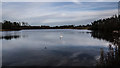
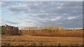
Nearby Images from Geograph Britain and Ireland:
©2015(licence)
©2018(licence)
©2018(licence)
©2019(licence)
©2018(licence)
The above images may not be of the site on this page, they are loaded from Geograph.
Please Submit an Image of this site or go out and take one for us!
Click here to see more info for this site
Nearby sites
Key: Red: member's photo, Blue: 3rd party photo, Yellow: other image, Green: no photo - please go there and take one, Grey: site destroyed
Download sites to:
KML (Google Earth)
GPX (GPS waypoints)
CSV (Garmin/Navman)
CSV (Excel)
To unlock full downloads you need to sign up as a Contributory Member. Otherwise downloads are limited to 50 sites.
Turn off the page maps and other distractions
Nearby sites listing. In the following links * = Image available
5.1km S 190° Grime's Graves Flint Mines* Ancient Mine, Quarry or other Industry (TL817898)
5.1km SSW 205° Grimes Graves Barrows* Round Barrow(s) (TL804901)
5.3km NE 47° Little Cressingham Barrow Cemetery* Barrow Cemetery (TL861986)
5.3km S 189° Grimes Puddingstone* Marker Stone (TL8172389589)
7.4km S 169° Blood Hill* Round Barrow(s) (TL84078765)
7.6km SSW 211° Pepper Hill* Round Barrow(s) (TL787882)
7.8km SE 143° Mickle Hill Tumulus* Round Barrow(s) (TL873888)
8.3km ENE 61° Merton Stone* Natural Stone / Erratic / Other Natural Feature (TL895991)
9.2km SSW 207° Brandon Heritage Museum Museum (TL785865)
9.7km NNW 345° St Mary’s Chapel, Cockley Cley* Ancient Temple (TF79550411)
9.7km N 349° Cockley Cley Iceni Village* Museum (TF802043)
11.1km SE 129° East Wretham Heath Earthwork* Misc. Earthwork (TL91278814)
11.2km SSW 210° White Hill, Suffolk* Round Barrow(s) (TL77168497)
12.5km NE 36° Devil's Dyke (Norfolk)* Misc. Earthwork (TF8934705200)
12.5km SSE 161° Thetford Puddingstones* Marker Stone (TL8684583181)
12.9km SSE 164° Thetford Barrow Round Barrow(s) (TL86358256)
13.1km SSE 159° Thetford Castle* Hillfort (TL875828)
13.4km SE 127° Peddars Way* Ancient Trackway (TL9341287119)
15.0km ESE 115° Larling Heath Tumulus Round Barrow(s) (TL96268912)
15.6km WNW 295° St. Margaret's Well (Wereham)* Holy Well or Sacred Spring (TF6801)
15.6km SSE 151° Seven Hills Barrow Cemetery Barrow Cemetery (TL904814)
15.8km SSE 167° Barnham Puddingstone Marker Stone (TL865796)
16.4km SSE 160° Barnham Heath Pit Natural Stone / Erratic / Other Natural Feature (TL887797)
16.4km SSE 167° Mill House Barrow Round Barrow(s) (TL867790)
16.4km SSE 167° Millfield Barn Round Barrow(s) (TL86717898)
View more nearby sites and additional images


 We would like to know more about this location. Please feel free to add a brief description and any relevant information in your own language.
 Wir möchten mehr über diese Stätte erfahren. Bitte zögern Sie nicht, eine kurze Beschreibung und relevante Informationen in Deutsch hinzuzufügen.
 Nous aimerions en savoir encore un peu sur les lieux. S'il vous plaît n'hesitez pas à ajouter une courte description et tous les renseignements pertinents dans votre propre langue.
 Quisieramos informarnos un poco más de las lugares. No dude en añadir una breve descripción y otros datos relevantes en su propio idioma.