<< Other Photo Pages >> Nightengale Archaeological Center - Ancient Village or Settlement in United States in The Southwest
Submitted by Andy B on Wednesday, 30 September 2015 Page Views: 3464
Multi-periodSite Name: Nightengale Archaeological CenterCountry: United States
NOTE: This site is 31.32 km away from the location you searched for.
Region: The Southwest Type: Ancient Village or Settlement
Nearest Town: Kingsland Nearest Village: Austin
Latitude: 30.635457N Longitude: 98.415259W
Condition:
| 5 | Perfect |
| 4 | Almost Perfect |
| 3 | Reasonable but with some damage |
| 2 | Ruined but still recognisable as an ancient site |
| 1 | Pretty much destroyed, possibly visible as crop marks |
| 0 | No data. |
| -1 | Completely destroyed |
| 5 | Superb |
| 4 | Good |
| 3 | Ordinary |
| 2 | Not Good |
| 1 | Awful |
| 0 | No data. |
| 5 | Can be driven to, probably with disabled access |
| 4 | Short walk on a footpath |
| 3 | Requiring a bit more of a walk |
| 2 | A long walk |
| 1 | In the middle of nowhere, a nightmare to find |
| 0 | No data. |
| 5 | co-ordinates taken by GPS or official recorded co-ordinates |
| 4 | co-ordinates scaled from a detailed map |
| 3 | co-ordinates scaled from a bad map |
| 2 | co-ordinates of the nearest village |
| 1 | co-ordinates of the nearest town |
| 0 | no data |
Internal Links:
External Links:
")
The prehistoric site was discovered in 1988 when looters were caught stealing artifacts from Lower Colorado River Authority-owned land. LCRA soon determined this site to be a major archaeological discovery. The Texas Historical Commission has declared the site a State Archeological Landmark.
The site is named in memory of Bruce A. Nightengale, LCRA archaeologist from 1989 until his death in 1998. He was instrumental in developing the center as well as its early educational exhibits and activities for school children and adults.
LCRA opened a learning center in 1991 with tours for students and workshops for teachers. A local group, the Llano Uplift Archeological Society, helps operate the site and offers tours to the public.
Features
Guided Tours
Second and fourth Saturdays in February through November from 2 p.m. to 5 p.m. Call 512-473-3366 for more information. Admission is free, but donations are accepted.
Link to their Official Web Site
Note: Archaeology Fair and Open House, Oct 10th, Kingsland, near Austin (part of Texas archaeology month)
You may be viewing yesterday's version of this page. To see the most up to date information please register for a free account.
Do not use the above information on other web sites or publications without permission of the contributor.
Nearby Images from Flickr

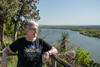
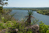
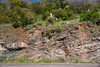


The above images may not be of the site on this page, but were taken nearby. They are loaded from Flickr so please click on them for image credits.
Click here to see more info for this site
Nearby sites
Click here to view sites on an interactive map of the areaKey: Red: member's photo, Blue: 3rd party photo, Yellow: other image, Green: no photo - please go there and take one, Grey: site destroyed
Download sites to:
KML (Google Earth)
GPX (GPS waypoints)
CSV (Garmin/Navman)
CSV (Excel)
To unlock full downloads you need to sign up as a Contributory Member. Otherwise downloads are limited to 50 sites.
Turn off the page maps and other distractions
Nearby sites listing. In the following links * = Image available
41.3km WSW 249° Enchanted Rock* Natural Stone / Erratic / Other Natural Feature
78.2km ENE 69° Gault Site Ancient Village or Settlement
79.5km ENE 69° Debra L. Friedkin Ancient Mine, Quarry or other Industry
94.8km SSE 151° Spring Lake Ancient Village or Settlement
101.6km SW 232° Stonehenge II (Ingram, TX)* Modern Stone Circle etc
110.0km SW 236° Stonehenge II (Original Location)* Modern Stone Circle etc
266.7km NNE 28° Caelum Moor* Modern Stone Circle etc
268.7km WSW 249° Delicado Shelter Rock Art
290.3km WSW 252° Little Sotol Ancient Village or Settlement
293.6km NNE 25° The Flower Mound Natural Stone / Erratic / Other Natural Feature
298.9km WSW 250° Seminole Canyon State Park and Historic Site* Rock Art
302.1km WSW 255° Hinds Cave Cave or Rock Shelter
308.1km ESE 108° Houston Museum of Natural Science* Museum
328.8km ENE 70° Caddo Mounds* Ancient Village or Settlement
397.1km WNW 292° UTPB Stonehenge Replica* Modern Stone Circle etc
401.8km NE 53° Kelsey Creek Dam site Ancient Village or Settlement
485.4km W 259° Bee Cave Canyon* Cave or Rock Shelter
539.6km SW 222° Cuatro Cienegas Footprints Ancient Trackway
555.0km SSW 204° Boca de Potrerillos Rock Art
582.8km NE 48° Ka-Do-Ha* Museum
590.7km ENE 66° Hedgepeth Mounds Artificial Mound
594.6km NE 36° Heavener Rune Stone* Carving
609.9km E 83° Marksville* Artificial Mound
612.8km ENE 66° Scott Place Mounds* Artificial Mound
613.0km NW 313° Blackwater Draw* Museum
View more nearby sites and additional images


 We would like to know more about this location. Please feel free to add a brief description and any relevant information in your own language.
 Wir möchten mehr über diese Stätte erfahren. Bitte zögern Sie nicht, eine kurze Beschreibung und relevante Informationen in Deutsch hinzuzufügen.
 Nous aimerions en savoir encore un peu sur les lieux. S'il vous plaît n'hesitez pas à ajouter une courte description et tous les renseignements pertinents dans votre propre langue.
 Quisieramos informarnos un poco más de las lugares. No dude en añadir una breve descripción y otros datos relevantes en su propio idioma.