<< Text Pages >> Coomasaharn Lake - Rock Art in Ireland (Republic of) in Co. Kerry

Submitted by Anthony_Weir on Monday, 15 March 2010  Page Views: 9129
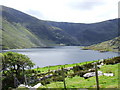
Rock ArtSite Name: Coomasaharn Lake
Country: Ireland (Republic of)
NOTE: This site is 3.618 km away from the location you searched for.

County: Co. Kerry Type: Rock Art
 Nearest Village: Coomasaharn
Map Ref: V632852
Latitude: 52.002487N  Longitude: 9.992767W
Condition:
5Perfect
4Almost Perfect
3Reasonable but with some damage
2Ruined but still recognisable as an ancient site
1Pretty much destroyed, possibly visible as crop marks
0No data.
-1Completely destroyed
4 Ambience:
5Superb
4Good
3Ordinary
2Not Good
1Awful
0No data.
4 Access:
5Can be driven to, probably with disabled access
4Short walk on a footpath
3Requiring a bit more of a walk
2A long walk
1In the middle of nowhere, a nightmare to find
0No data.
4 Accuracy:
5co-ordinates taken by GPS or official recorded co-ordinates
4co-ordinates scaled from a detailed map
3co-ordinates scaled from a bad map
2co-ordinates of the nearest village
1co-ordinates of the nearest town
0no data
4

Internal Links:
External Links:

Cup and Ring marks / Rock Art in Co. Kerry. At Coomasaharn, near the N end of Coomasaharn Lake are several horizontal rock surfaces decorated with circles, lines, cups and rings.

The best surface is 100 metres W of a modern bungalow at the end of the tarred road.

Note: Mast disagreements in Co. Kerry, see comment
You may be viewing yesterday's version of this page. To see the most up to date information please register for a free account.


Do not use the above information on other web sites or publications without permission of the contributor.

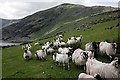
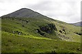
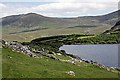
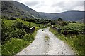
Nearby Images from Geograph Britain and Ireland:
V6384 : Curious Sheep by kevin higgins
by kevin higgins
©2010(licence)
V6385 : Kealduff Cliff by kevin higgins
by kevin higgins
©2010(licence)
V6384 : Coomasaharn Lake by kevin higgins
by kevin higgins
©2010(licence)
V6385 : Bridge and Minor Road by kevin higgins
by kevin higgins
©2010(licence)
V6385 : Sheep farm on north shore of Coomasaharn Lake by Ian Macnab
by Ian Macnab
©2007(licence)

The above images may not be of the site on this page, they are loaded from Geograph.
Please Submit an Image of this site or go out and take one for us!


Click here to see more info for this site

Nearby sites

Click here to view sites on an interactive map of the area

Key: Red: member's photo, Blue: 3rd party photo, Yellow: other image, Green: no photo - please go there and take one, Grey: site destroyed

Download sites to:
KML (Google Earth)
GPX (GPS waypoints)
CSV (Garmin/Navman)
CSV (Excel)

To unlock full downloads you need to sign up as a Contributory Member. Otherwise downloads are limited to 50 sites.


Turn off the page maps and other distractions

Nearby sites listing. In the following links * = Image available
 3.4km N 0° Coolnaharragill Rock Art (V633886)
 6.6km WSW 254° Gortnagulla Stone Row / Alignment (V568836)
 6.7km WSW 243° Teeromoyle* Standing Stones (V571823)
 7.0km NNE 25° Kilnabreck Lower* Standing Stones (V66339144)
 8.7km WSW 257° Garrydine Standing Stones
 9.1km W 264° Kells Modern Stone Circle* Modern Stone Circle etc (V5413584497)
 10.6km WSW 251° Ballynahow Beg* Rock Art (V5305682093)
 11.8km WSW 241° Srugreana Standing Stone (Menhir)
 13.6km ESE 107° Dromteewakeen Stone Row / Alignment (V761808)
 14.7km SSW 202° Derrineden E Stone Row / Alignment
 15.0km WSW 236° Canburrin Standing Stones
 15.1km ESE 118° Derrynablaha* Rock Art (V764778)
 15.2km SSW 203° Derrineden W Stone Row / Alignment
 15.5km ESE 118° Derrynablaha Stone Row* Standing Stone (Menhir) (V7666077519)
 16.6km SSW 209° Doory standing stone Standing Stone (Menhir)
 16.7km SSW 210° Doory row Stone Row / Alignment
 16.8km SSW 207° Dromod Stone Row* Stone Row / Alignment
 16.9km NW 324° Minard W Standing Stones (V536991)
 17.0km SE 130° Gortacloghane Stone Row / Alignment (V759738)
 17.1km SSW 203° Cahersavane* Standing Stones (V5605769610)
 17.2km E 100° Curraghmore Stone Row / Alignment (V801819)
 17.5km WSW 248° Cahersiveen standing stones* Standing Stones (V4674478981)
 17.7km NW 322° Dún na Manach wedge tomb* Wedge Tomb
 17.9km NNE 17° Caherpiece Standing Stone (Menhir)
 18.0km SSW 207° Dromod* Stone Circle (V545694)
View more nearby sites and additional images

<< El Porvenir

Coolnaharragill >>

Please add your thoughts on this site

Clickable Map of Ireland

New Book: Heavenly Art - Rock Art in Israel

New Book: Heavenly Art - Rock Art in Israel

Sponsors

Auto-Translation (Google)

Translate from English into:

"Coomasaharn Lake" | Login/Create an Account | 2 News and Comments
  
Go back to top of page    Comments are owned by the poster. We aren't responsible for their content.
Re: Bronze age remains block broadband plan by frogcottage42 on Tuesday, 16 March 2010
(User Info | Send a Message)
This site is somewhat North of my location but I will say that the concentration of rock art in that area is unique. That being said I am not sure that they have much evidence for dates and as far as bronze age material goes that area would be significantly emptier than the Beara or the area between Macroom and Bantry and there are huge grey roads snaking up the mountainside in these locations.
The roads required for the placement and maintenance of transmitters are very intrusive . An Bord Pleanála do not usually object unless there are financial implications and I do not believe they have supported many objections on archaeological grounds.
Anyone looking at the number of holiday homes and tax incentive second dwellings built in areas of extreme archaeological sensitivity would realize that planning authorities are less concerned with such considerations than the potential profits to landowners and developers. Perhaps the down turn in the economy might help save many sites which would otherwise be bulldozed .
As far as locations for transmitters are concerned there is extensive forestry in the area with large roads and this forestry has been encouraged entirely at the expense of the archaeology, many sites are now inaccessible and many others severely damaged by forestry activity
I know the Glenbeigh site well and see no reason why the transmitters cannot be placed within the area already damaged.
This argument hasn't reached me yet as they do not consider the provision of broadband a priority in my area. When it does I would be happy to show them spots that are already ruined on which to place a mast!
[ Reply to This ]

Bronze age remains block broadband plan by Andy B on Monday, 15 March 2010
(User Info | Send a Message)
The cyber age’s bid to spread its message into a pristine landscape has perished between a rock and a hard place in a Bronze Age valley.

Age-old archaeological remains are standing in the way of plans to bring modern internet communications to a scenic area of Kerry.

A telecommunications mast which would provide broadband to the mid-Kerry area would be a "new alien intrusion" on a very beautiful and almost pristine landscape.

That’s according to senior An Bord Pleanála inspector, Robert Ryan.

The area around the proposed location for a 12-metre mast at Coomasaharn, Glenbeigh, is "one of the most significant Bronze Age landscapes in the country," Kerry County Council also conceded.

The local authority noted the Glenbeigh area has the greatest concentration of ancient "rock art" in Ireland, with more than 100 recorded examples.

The Bronze Age dated from around 2200 BC to 500 BC.

Mr Ryan supported the council and upheld a decision to refuse Hutchinson 3G Ireland planning permission for the mast on archaeological grounds.

He also said the mast would damage the visual amenities of the area which is close to the popular Ring of Kerry tourist route.

Hutchinson 3G has the Government’s national contract to roll out broadband to previously unserviced rural areas.

The company claims there is a strong demand for broadband in the Glenbeigh area and no other site options were available.

Glenbeigh is a hotbed of opposition to masts, with objections to five such proposals in the general area.

Hutchinson 3G said that, given there were 67 objections to the current proposal, the possibility of finding another site was limited.

Company spokesman Brian Phelan said they would continue to try to bring broadband to such areas.

"Broadband has the potential to create hundreds of jobs, especially in small to medium-sized businesses, and is probably the most important thing for rural Ireland since rural electrification," he added.

Normally, An Bord Pleanála overturns Kerry County Council’s decisions in relation to masts because it does not agree with a controversial rule by the council which bans such masts on sites which are within a kilometre of houses, schools and other residential buildings.

On this occasion, however, Bord Pleanála – while still disagreeing with the one-kilometre rule – granted the appeal on grounds of protecting the sensitive landscape and local archaeology.

Read more: http://www.irishexaminer.com/ireland/bronze-age-remains-block-broadband-plan-113928.html#ixzz0b3CRIa4C
[ Reply to This ]

Your Name: Anonymous [ Register Now ]
Subject:


Add your comment or contribution to this page. Spam or offensive posts are deleted immediately, don't even bother

<<< What is five plus one as a number? (Please type the answer to this question in the little box on the left)
You can also embed videos and other things. For Youtube please copy and paste the 'embed code'.
For Google Street View please include Street View in the text.
Create a web link like this: <a href="https://www.megalithic.co.uk">This is a link</a>  

Allowed HTML is:
<p> <b> <i> <a> <img> <em> <br> <strong> <blockquote> <tt> <li> <ol> <ul> <object> <param> <embed> <iframe>

We would like to know more about this location. Please feel free to add a brief description and any relevant information in your own language.
Wir möchten mehr über diese Stätte erfahren. Bitte zögern Sie nicht, eine kurze Beschreibung und relevante Informationen in Deutsch hinzuzufügen.
Nous aimerions en savoir encore un peu sur les lieux. S'il vous plaît n'hesitez pas à ajouter une courte description et tous les renseignements pertinents dans votre propre langue.
Quisieramos informarnos un poco más de las lugares. No dude en añadir una breve descripción y otros datos relevantes en su propio idioma.