<< Text Pages >> Elk Hill Petroglyphs - Rock Art in United States in New England
Submitted by Andy B on Thursday, 19 June 2008 Page Views: 12446
Rock ArtSite Name: Elk Hill PetroglyphsCountry: United States
NOTE: This site is 69.467 km away from the location you searched for.
Region: New England Type: Rock Art
Latitude: 37.717500N Longitude: 78.08778W
Condition:
| 5 | Perfect |
| 4 | Almost Perfect |
| 3 | Reasonable but with some damage |
| 2 | Ruined but still recognisable as an ancient site |
| 1 | Pretty much destroyed, possibly visible as crop marks |
| 0 | No data. |
| -1 | Completely destroyed |
| 5 | Superb |
| 4 | Good |
| 3 | Ordinary |
| 2 | Not Good |
| 1 | Awful |
| 0 | No data. |
| 5 | Can be driven to, probably with disabled access |
| 4 | Short walk on a footpath |
| 3 | Requiring a bit more of a walk |
| 2 | A long walk |
| 1 | In the middle of nowhere, a nightmare to find |
| 0 | No data. |
| 5 | co-ordinates taken by GPS or official recorded co-ordinates |
| 4 | co-ordinates scaled from a detailed map |
| 3 | co-ordinates scaled from a bad map |
| 2 | co-ordinates of the nearest village |
| 1 | co-ordinates of the nearest town |
| 0 | no data |
Internal Links:
External Links:
Possible Rock Art in Virginia. Are finds artifacts or aging rocks?
An archaeologist with the state Department of Historic Resources is headed to western Goochland County with hopes of confirming a major historical find.
Chris Stevenson has gone on dozens of treasure hunts, only to be disappointed. But this one has potential, he said.
"There's something there," Stevenson said. "But whether it occurred in nature or culturally, we will have to wait and see."
The objects in question are possible sculptures and petroglyphs - carvings made into rock - of bears, eagles and human faces. Glyn Hall discovered the pieces while placing flags in the ground to mark boundaries for an organic vegetable garden.
"I looked down, and there was a face staring up a me," Hall said. "It was a bear. At first, I thought it was like a cloud where you see whatever you imagine."
Just to be sure, he took the small, thin rock to his house and washed it off. Soap and water soon uncovered the sculpted face of a black bear.
"I was amazed," Hall said. "I thought it was a once-in-a-lifetime find."
As he dug in the garden, though, he discovered dozens of arrowheads and what he thinks are more than 50 sculptures and petroglyphs.
Stevenson already has examined photos of Hall's rocks and said most were probably formed by nature and marked by the sharp blades of farm machinery, but he thinks a few could be of "historic origin."
"I definitely see the bear -- that one has some potential," he said. "A few could be someone fiddling around in historic times."
He plans to visit Hall on Monday to more closely examine the collection.
Hall, 53, discovered the bear May 1 near Elk Hill in western Goochland County. He lives on a 150-acre farm near the James River.
"Since that day, every day has been like a treasure hunt," he said. "It's been crazy."
The items he found could date to a few hundred years ago or several thousand, when American Indians detailed life through art. Tribes chose symbols to represent their clan, including bears and eagles.
The bear holds special meaning to Hall, whose great-grandmother was Cherokee. He wears a hammered silver bear necklace to honor the bear clan.
One of Hall's biggest discoveries happened two weeks ago next to the garden, where a boulder marks a corner. He was driving around the bend one night and his headlights hit the rock in a way that revealed what he sees as an Indian's face.
"He has his mouth open, like he's yelling out a warning," Hall said. "On the other side you can see an eagle's wings. It's truly amazing. I seem to have a gift for seeing things. I'm a bit of a Renaissance man."
Hall, the band leader for the gospel group Eagles in Flight, teaches music and dabbles in furniture-making. Perhaps it was his creativity that allowed him to zero in on the shapes, he said.
"It was meant for me to find, I'm sure," Hall said. "I believe this was definitely a spiritual gift."
Or it could be nothing more than the natural process of aging rock. When etchings are man-made, pecking (rubbing stone against stone to create a pattern) systematically covers an area, Stevenson said. Natural lines occur from flowing water and cracking.
"I do a reality check all the time," Hall said. "If it's natural, I won't mind saying so."
The next step, depending on what Stevenson determines when he visits, could be a professional archeological dig. In the meantime, Hall will continue scouring the landscape for more treasures.
Source: inRich.com
You may be viewing yesterday's version of this page. To see the most up to date information please register for a free account.
Do not use the above information on other web sites or publications without permission of the contributor.
Nearby Images from Flickr
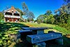

The above images may not be of the site on this page, but were taken nearby. They are loaded from Flickr so please click on them for image credits.
Click here to see more info for this site
Nearby sites
Click here to view sites on an interactive map of the areaKey: Red: member's photo, Blue: 3rd party photo, Yellow: other image, Green: no photo - please go there and take one, Grey: site destroyed
Download sites to:
KML (Google Earth)
GPX (GPS waypoints)
CSV (Garmin/Navman)
CSV (Excel)
To unlock full downloads you need to sign up as a Contributory Member. Otherwise downloads are limited to 50 sites.
Turn off the page maps and other distractions
Nearby sites listing. In the following links * = Image available
97.5km SE 141° Cactus Hill Ancient Village or Settlement
128.2km W 267° Foamhenge (Natural Bridge)* Modern Stone Circle etc
129.1km N 353° Thunderbird Archaeological District* Ancient Mine, Quarry or other Industry
139.4km NNE 22° Foamhenge (Cox Farms) Modern Stone Circle etc
155.0km N 7° Spout Run* Not Known (by us)
161.0km NE 34° Embassy of Costa Rica, Washington DC Carving
170.0km NE 45° Pig Point Ancient Village or Settlement
187.3km NE 54° Paw Paw Cove Natural Stone / Erratic / Other Natural Feature
239.0km WSW 255° Fort Bragg Misc. Earthwork
257.2km SW 236° Pilot Mountain* Natural Stone / Erratic / Other Natural Feature
283.7km NNE 31° Safe Harbor Petroglyphs* Rock Art
285.3km W 280° Armstrong Mountain* Artificial Mound
310.0km NNE 28° Bring Rocks Manheim* Modern Stone Circle etc
324.2km WNW 284° Criel Mound* Barrow Cemetery
326.2km WNW 284° Sunset Mound Artificial Mound
326.4km SSW 211° Town Creek Indian Mound* Misc. Earthwork
329.0km NW 306° Reynolds Mound* Artificial Mound
329.9km WNW 284° Dunbar Mound* Barrow Cemetery
335.8km NW 318° Grave Creek Mound* Artificial Mound
342.4km NNE 23° Boxcar Rocks* Natural Stone / Erratic / Other Natural Feature
348.4km NW 304° Marietta Earthworks - Conus* Artificial Mound
349.1km NW 304° Marietta Earthworks - Capitolium* Artificial Mound
349.1km NW 304° Campus Martius* Museum
349.4km NW 304° Marietta Earthworks - Quadranaou* Pyramid / Mastaba
349.4km NW 304° Marietta Earthworks* Misc. Earthwork
View more nearby sites and additional images


 We would like to know more about this location. Please feel free to add a brief description and any relevant information in your own language.
 Wir möchten mehr über diese Stätte erfahren. Bitte zögern Sie nicht, eine kurze Beschreibung und relevante Informationen in Deutsch hinzuzufügen.
 Nous aimerions en savoir encore un peu sur les lieux. S'il vous plaît n'hesitez pas à ajouter une courte description et tous les renseignements pertinents dans votre propre langue.
 Quisieramos informarnos un poco más de las lugares. No dude en añadir una breve descripción y otros datos relevantes en su propio idioma.