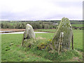
<< Other Photo Pages >> Crew Lower - Standing Stones in Ireland (Northern) in Co. Tyrone
Submitted by vicky on Sunday, 22 December 2002 Page Views: 4082
Neolithic and Bronze AgeSite Name: Crew LowerCountry: Ireland (Northern)
NOTE: This site is 3.037 km away from the location you searched for.
County: Co. Tyrone Type: Standing Stones
Map Ref: H315848
Discoverer Map Number: D12
Latitude: 54.710250N Longitude: 7.512047W
Condition:
| 5 | Perfect |
| 4 | Almost Perfect |
| 3 | Reasonable but with some damage |
| 2 | Ruined but still recognisable as an ancient site |
| 1 | Pretty much destroyed, possibly visible as crop marks |
| 0 | No data. |
| -1 | Completely destroyed |
| 5 | Superb |
| 4 | Good |
| 3 | Ordinary |
| 2 | Not Good |
| 1 | Awful |
| 0 | No data. |
| 5 | Can be driven to, probably with disabled access |
| 4 | Short walk on a footpath |
| 3 | Requiring a bit more of a walk |
| 2 | A long walk |
| 1 | In the middle of nowhere, a nightmare to find |
| 0 | No data. |
| 5 | co-ordinates taken by GPS or official recorded co-ordinates |
| 4 | co-ordinates scaled from a detailed map |
| 3 | co-ordinates scaled from a bad map |
| 2 | co-ordinates of the nearest village |
| 1 | co-ordinates of the nearest town |
| 0 | no data |
Internal Links:
External Links:
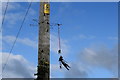
Pair of Standing Stones in Co. Tyrone
Have you visited this site? Please add a comment below.
You may be viewing yesterday's version of this page. To see the most up to date information please register for a free account.
Do not use the above information on other web sites or publications without permission of the contributor.
davidmorgan has found this location on Google Street View:
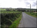
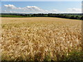
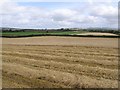
Nearby Images from Geograph Britain and Ireland:
©2006(licence)
©2009(licence)
©2014(licence)
©2009(licence)
©2019(licence)
The above images may not be of the site on this page, they are loaded from Geograph.
Please Submit an Image of this site or go out and take one for us!
Click here to see more info for this site
Nearby sites
Click here to view sites on an interactive map of the areaKey: Red: member's photo, Blue: 3rd party photo, Yellow: other image, Green: no photo - please go there and take one, Grey: site destroyed
Download sites to:
KML (Google Earth)
GPX (GPS waypoints)
CSV (Garmin/Navman)
CSV (Excel)
To unlock full downloads you need to sign up as a Contributory Member. Otherwise downloads are limited to 50 sites.
Turn off the page maps and other distractions
Nearby sites listing. In the following links * = Image available
6.0km ESE 106° Ballyrenan* Portal Tomb (H3733083180)
7.0km WNW 302° Creevy Upper Stone Row / Alignment (H255885)
8.4km ESE 121° Glassmullagh Stone Row / Alignment (H387805)
8.4km ESE 122° Glasmullagh Stone Circle (H387804)
9.9km WSW 243° Leitrim Portal Tomb* Portal Tomb (H227803)
10.1km ENE 72° Glenknock Portal Tomb Portal Tomb (H411879)
10.6km ENE 74° Crosh Portal Tomb Portal Tomb (H417878)
11.6km W 281° Garvagh Court Tomb Court Tomb (H201869)
12.7km N 353° Croaghan Hill* Cairn
12.9km ESE 103° Reaghan S Stone Circle (H441819)
12.9km ESE 103° Reaghan N Stone Circle (H441819)
12.9km ESE 103° Golan E Stone Circle (H44158193)
13.0km ESE 107° Golan Circle Stone Circle (H440810)
13.5km NNW 342° Kilmonaster Site A* Passage Grave
13.5km NNW 342° Kilmonaster Site D* Passage Grave
13.6km SSW 205° Ally Court Cairn Court Tomb (H25777247)
14.4km SW 221° Crockalaghta* Chambered Tomb (H222738)
15.0km E 89° Dunbunrawer C Stone Circle (H465851)
15.0km E 89° Dunbunrawer B Stone Circle (H465851)
15.0km SW 226° Scraghy NW* Stone Circle (H208743)
15.1km S 181° Dooish Stone Row / Alignment (H314697)
15.7km SW 222° Scraghy SE Stone Circle (H211730)
15.8km S 182° Dooish Stone Circle (H310690)
16.1km SW 218° Meenacloy Standing Stones* Standing Stones
16.5km E 93° Dunbunrawer A Stone Circle (H480840)
View more nearby sites and additional images


 We would like to know more about this location. Please feel free to add a brief description and any relevant information in your own language.
 Wir möchten mehr über diese Stätte erfahren. Bitte zögern Sie nicht, eine kurze Beschreibung und relevante Informationen in Deutsch hinzuzufügen.
 Nous aimerions en savoir encore un peu sur les lieux. S'il vous plaît n'hesitez pas à ajouter une courte description et tous les renseignements pertinents dans votre propre langue.
 Quisieramos informarnos un poco más de las lugares. No dude en añadir una breve descripción y otros datos relevantes en su propio idioma.