<< Other Photo Pages >> St Vincent - Yambou Pass - Rock Art in Caribbean Islands
Submitted by durhamnature on Wednesday, 30 January 2013 Page Views: 5769
Rock ArtSite Name: St Vincent - Yambou PassCountry: Caribbean Islands
NOTE: This site is 203.032 km away from the location you searched for.
Type: Rock Art
Nearest Village: Mespotamia
Latitude: 13.172000N Longitude: 61.155W
Condition:
| 5 | Perfect |
| 4 | Almost Perfect |
| 3 | Reasonable but with some damage |
| 2 | Ruined but still recognisable as an ancient site |
| 1 | Pretty much destroyed, possibly visible as crop marks |
| 0 | No data. |
| -1 | Completely destroyed |
| 5 | Superb |
| 4 | Good |
| 3 | Ordinary |
| 2 | Not Good |
| 1 | Awful |
| 0 | No data. |
| 5 | Can be driven to, probably with disabled access |
| 4 | Short walk on a footpath |
| 3 | Requiring a bit more of a walk |
| 2 | A long walk |
| 1 | In the middle of nowhere, a nightmare to find |
| 0 | No data. |
| 5 | co-ordinates taken by GPS or official recorded co-ordinates |
| 4 | co-ordinates scaled from a detailed map |
| 3 | co-ordinates scaled from a bad map |
| 2 | co-ordinates of the nearest village |
| 1 | co-ordinates of the nearest town |
| 0 | no data |
Be the first person to rate this site - see the 'Contribute!' box in the right hand menu.
Internal Links:
External Links:
I have visited· I would like to visit
Samaipata would like to visit
")
The exact site location is unknown, the lat-long reference is to Tambou River Valley.
You may be viewing yesterday's version of this page. To see the most up to date information please register for a free account.
")
")
Do not use the above information on other web sites or publications without permission of the contributor.
Nearby Images from Flickr


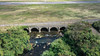
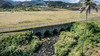
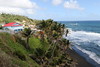
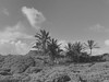
The above images may not be of the site on this page, but were taken nearby. They are loaded from Flickr so please click on them for image credits.
Click here to see more info for this site
Nearby sites
Click here to view sites on an interactive map of the areaKey: Red: member's photo, Blue: 3rd party photo, Yellow: other image, Green: no photo - please go there and take one, Grey: site destroyed
Download sites to:
KML (Google Earth)
GPX (GPS waypoints)
CSV (Garmin/Navman)
CSV (Excel)
To unlock full downloads you need to sign up as a Contributory Member. Otherwise downloads are limited to 50 sites.
Turn off the page maps and other distractions
Nearby sites listing. In the following links * = Image available
8.3km NNE 14° St Vincent, Colonarie* Rock Art
12.1km WNW 282° St Vincent, Buccament* Rock Art
14.3km WNW 298° St Vincent - Borrouallie* Rock Art
121.0km SSW 208° Man-Face petroglyph (Union, Grenada)* Rock Art
121.4km SSW 206° Mt Rich Grenada (Caribbean)* Rock Art
121.8km SSW 208° Duquense Bay Petroglyphs, Grenada (Caribbean)* Rock Art
122.7km SSW 209° Rock Art near Waltham, Victoria, Grenada* Rock Art
124.3km SSW 209° Rock Art near Victoria, Grenada* Rock Art
264.8km S 183° Blanchisseuse Ancient Village or Settlement
315.5km N 351° Trois Rivières Rock Carvings Rock Art
431.4km N 352° Indian Creek Ancient Village or Settlement
631.7km SSE 160° Wyva Creek Shell Mound Artificial Mound
794.3km NW 313° Ponce Plaza (Puerto Rico) Rock Art
828.7km NW 314° Caguana* Standing Stones
833.2km NW 316° La Cueva del Indio (Puerto Rico)* Rock Art
852.6km W 263° Curaçao Hato Caves Rock Art
1105.0km WNW 303° Padre Nuestro Caves (Dominican Republic) Rock Art
1162.3km NW 305° Raul de Monteclaro (Dominican Rep) Rock Art
1275.5km WNW 299° Las Caritas de Los Indios* Rock Art
1293.1km WSW 245° El Porvenir Not Known (by us)
1408.4km W 262° Ciudad Perdida* Ancient Village or Settlement
1408.6km W 263° El Pueblito Ancient Village or Settlement
1436.1km SE 132° Mont d'Argent rock art* Rock Art
1596.4km WSW 240° El Infiernito* Standing Stones
1633.7km SE 136° Calçoene Stone Circle* Stone Circle
View more nearby sites and additional images


 We would like to know more about this location. Please feel free to add a brief description and any relevant information in your own language.
 Wir möchten mehr über diese Stätte erfahren. Bitte zögern Sie nicht, eine kurze Beschreibung und relevante Informationen in Deutsch hinzuzufügen.
 Nous aimerions en savoir encore un peu sur les lieux. S'il vous plaît n'hesitez pas à ajouter une courte description et tous les renseignements pertinents dans votre propre langue.
 Quisieramos informarnos un poco más de las lugares. No dude en añadir una breve descripción y otros datos relevantes en su propio idioma.