<< Text Pages >> El Castiellu (El Puirtu) - Castro or Chafurdão in Spain in Asturias
Submitted by johnstone on Tuesday, 25 February 2020 Page Views: 348
Iron Age and Later PrehistorySite Name: El Castiellu (El Puirtu)Country: Spain Region: Asturias Type: Castro or Chafurdão
Nearest Town: Avilés Nearest Village: Gozón
Latitude: 43.626940N Longitude: 5.90027W
Condition:
| 5 | Perfect |
| 4 | Almost Perfect |
| 3 | Reasonable but with some damage |
| 2 | Ruined but still recognisable as an ancient site |
| 1 | Pretty much destroyed, possibly visible as crop marks |
| 0 | No data. |
| -1 | Completely destroyed |
| 5 | Superb |
| 4 | Good |
| 3 | Ordinary |
| 2 | Not Good |
| 1 | Awful |
| 0 | No data. |
| 5 | Can be driven to, probably with disabled access |
| 4 | Short walk on a footpath |
| 3 | Requiring a bit more of a walk |
| 2 | A long walk |
| 1 | In the middle of nowhere, a nightmare to find |
| 0 | No data. |
| 5 | co-ordinates taken by GPS or official recorded co-ordinates |
| 4 | co-ordinates scaled from a detailed map |
| 3 | co-ordinates scaled from a bad map |
| 2 | co-ordinates of the nearest village |
| 1 | co-ordinates of the nearest town |
| 0 | no data |
Be the first person to rate this site - see the 'Contribute!' box in the right hand menu.
Internal Links:
External Links:
Castro in Asturias
You may be viewing yesterday's version of this page. To see the most up to date information please register for a free account.
Do not use the above information on other web sites or publications without permission of the contributor.
Nearby Images from Flickr

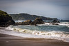
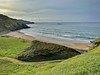
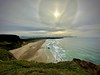

The above images may not be of the site on this page, but were taken nearby. They are loaded from Flickr so please click on them for image credits.
Click here to see more info for this site
Nearby sites
Click here to view sites on an interactive map of the areaKey: Red: member's photo, Blue: 3rd party photo, Yellow: other image, Green: no photo - please go there and take one, Grey: site destroyed
Download sites to:
KML (Google Earth)
GPX (GPS waypoints)
CSV (Garmin/Navman)
CSV (Excel)
To unlock full downloads you need to sign up as a Contributory Member. Otherwise downloads are limited to 50 sites.
Turn off the page maps and other distractions
Nearby sites listing. In the following links * = Image available
4.2km SSW 210° El Canto la Figal Castro or Chafurdão
11.5km SSE 148° La Barrera Castro or Chafurdão
12.4km S 185° El Picu Castiellu (Xuncéu) Castro or Chafurdão
12.5km S 189° El Llugar Castro or Chafurdão
13.7km SSW 210° La Peñona Castro or Chafurdão
13.8km SSE 150° El Castru (Güerno) Castro or Chafurdão
14.4km SE 142° Dolmen del Cierru Los Llanos* Burial Chamber or Dolmen
15.0km SE 145° El Castiellu (El Pasquín) Castro or Chafurdão
15.1km SE 133° Dolmen de San Pablo* Barrow Cemetery
16.8km SE 144° El Cuetu (San Andrés) Castro or Chafurdão
17.0km WSW 236° El Castillu de Samartín Castro or Chafurdão
17.0km ESE 112° Yacimiento Arqueológico Campa de Torres* Castro or Chafurdão
18.7km WSW 245° El Campón (La Carcabina) Castro or Chafurdão
19.2km SW 215° Cueva de Candamo Cave or Rock Shelter
21.4km WSW 248° El Castru (Cuideiru) Castro or Chafurdão
22.6km SSW 196° Cueva de La Paloma Cave or Rock Shelter
23.7km SW 216° La Cueva de la Peña* Cave or Rock Shelter
24.0km SSW 207° La Pica'l Castru (Villar) Castro or Chafurdão
24.9km S 191° El Picu Ruedes Castro or Chafurdão
25.0km S 170° El Castiellu (Villapérez) Castro or Chafurdão
25.4km SW 217° El Castiellu (La Mortera) Castro or Chafurdão
25.5km S 174° El Picu Castiellu (Quintana) Castro or Chafurdão
25.8km SSW 194° Cueva Oscura de Ania Cave or Rock Shelter
26.2km SW 231° El Cogollu Castro or Chafurdão
26.6km SSE 168° El Picu (Cuyences) Castro or Chafurdão
View more nearby sites and additional images


 We would like to know more about this location. Please feel free to add a brief description and any relevant information in your own language.
 Wir möchten mehr über diese Stätte erfahren. Bitte zögern Sie nicht, eine kurze Beschreibung und relevante Informationen in Deutsch hinzuzufügen.
 Nous aimerions en savoir encore un peu sur les lieux. S'il vous plaît n'hesitez pas à ajouter une courte description et tous les renseignements pertinents dans votre propre langue.
 Quisieramos informarnos un poco más de las lugares. No dude en añadir una breve descripción y otros datos relevantes en su propio idioma.