<< Our Photo Pages >> Yacimiento Arqueológico Campa de Torres - Castro or Chafurdão in Spain in Asturias
Submitted by Armand on Wednesday, 15 December 2010 Page Views: 5061
Iron Age and Later PrehistorySite Name: Yacimiento Arqueológico Campa de Torres Alternative Name: La Campa TorresCountry: Spain
NOTE: This site is 3.998 km away from the location you searched for.
Region: Asturias Type: Castro or Chafurdão
Nearest Town: Gijón
Latitude: 43.569140N Longitude: 5.70444W
Condition:
| 5 | Perfect |
| 4 | Almost Perfect |
| 3 | Reasonable but with some damage |
| 2 | Ruined but still recognisable as an ancient site |
| 1 | Pretty much destroyed, possibly visible as crop marks |
| 0 | No data. |
| -1 | Completely destroyed |
| 5 | Superb |
| 4 | Good |
| 3 | Ordinary |
| 2 | Not Good |
| 1 | Awful |
| 0 | No data. |
| 5 | Can be driven to, probably with disabled access |
| 4 | Short walk on a footpath |
| 3 | Requiring a bit more of a walk |
| 2 | A long walk |
| 1 | In the middle of nowhere, a nightmare to find |
| 0 | No data. |
| 5 | co-ordinates taken by GPS or official recorded co-ordinates |
| 4 | co-ordinates scaled from a detailed map |
| 3 | co-ordinates scaled from a bad map |
| 2 | co-ordinates of the nearest village |
| 1 | co-ordinates of the nearest town |
| 0 | no data |
Internal Links:
External Links:
")
Also known as Natural Archaeological Park of La Campa Torres
You may be viewing yesterday's version of this page. To see the most up to date information please register for a free account.
")
")
")
")
Do not use the above information on other web sites or publications without permission of the contributor.
Nearby Images from Flickr

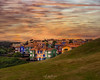
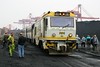
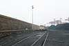
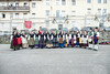
The above images may not be of the site on this page, but were taken nearby. They are loaded from Flickr so please click on them for image credits.
Click here to see more info for this site
Nearby sites
Click here to view sites on an interactive map of the areaKey: Red: member's photo, Blue: 3rd party photo, Yellow: other image, Green: no photo - please go there and take one, Grey: site destroyed
Download sites to:
KML (Google Earth)
GPX (GPS waypoints)
CSV (Garmin/Navman)
CSV (Excel)
To unlock full downloads you need to sign up as a Contributory Member. Otherwise downloads are limited to 50 sites.
Turn off the page maps and other distractions
Nearby sites listing. In the following links * = Image available
6.2km SW 230° Dolmen de San Pablo* Barrow Cemetery
8.4km SW 234° Dolmen del Cierru Los Llanos* Burial Chamber or Dolmen
9.2km SW 219° El Cuetu (San Andrés) Castro or Chafurdão
9.4km SW 231° El Castiellu (El Pasquín) Castro or Chafurdão
10.2km WSW 251° La Barrera Castro or Chafurdão
10.4km WSW 238° El Castru (Güerno) Castro or Chafurdão
17.0km WNW 292° El Castiellu (El Puirtu) Castro or Chafurdão
17.7km SSE 156° El Picu Castiellu (La Collá) Castro or Chafurdão
17.9km WSW 251° El Picu Castiellu (Xuncéu) Castro or Chafurdão
18.0km ESE 122° Túmulos de Cordal de Peón Barrow Cemetery
18.1km W 279° El Canto la Figal Castro or Chafurdão
18.7km WSW 252° El Llugar Castro or Chafurdão
19.9km SSE 153° La Pica'l Castru (Aramanti) Castro or Chafurdão
20.0km SSE 150° Castiellu el Peñón Castro or Chafurdão
20.1km E 96° El Cercu la Barquerona Castro or Chafurdão
20.2km SSE 159° El Picu Castiellu (Marcenao) Castro or Chafurdão
20.8km SSW 203° El Cuetu (Llugones) Castro or Chafurdão
21.4km SSW 212° El Castiellu (Villapérez) Castro or Chafurdão
21.5km SE 127° La Corolla Castro or Chafurdão
21.8km ESE 124° El Castillo (Camoca) Castro or Chafurdão
22.1km SSW 207° El Picu (Cuyences) Castro or Chafurdão
22.9km SW 215° El Picu Castiellu (Quintana) Castro or Chafurdão
23.4km WSW 257° La Peñona Castro or Chafurdão
23.7km SSW 209° La Cogolla (Fitoria) Castro or Chafurdão
24.0km SE 140° El Castiellu (Acéu) Castro or Chafurdão
View more nearby sites and additional images


 We would like to know more about this location. Please feel free to add a brief description and any relevant information in your own language.
 Wir möchten mehr über diese Stätte erfahren. Bitte zögern Sie nicht, eine kurze Beschreibung und relevante Informationen in Deutsch hinzuzufügen.
 Nous aimerions en savoir encore un peu sur les lieux. S'il vous plaît n'hesitez pas à ajouter une courte description et tous les renseignements pertinents dans votre propre langue.
 Quisieramos informarnos un poco más de las lugares. No dude en añadir una breve descripción y otros datos relevantes en su propio idioma.