

<< Our Photo Pages >> Tobar Cill'An Aonghais - Holy Well or Sacred Spring in Scotland in Argyll
Submitted by KiwiBetsy on Monday, 16 October 2006 Page Views: 4878
Springs and Holy WellsSite Name: Tobar Cill'An AonghaisCountry: Scotland County: Argyll Type: Holy Well or Sacred Spring
Nearest Town: Tarbert Nearest Village: Ardpatrick
Map Ref: NR772613
Latitude: 55.793484N Longitude: 5.555733W
Condition:
| 5 | Perfect |
| 4 | Almost Perfect |
| 3 | Reasonable but with some damage |
| 2 | Ruined but still recognisable as an ancient site |
| 1 | Pretty much destroyed, possibly visible as crop marks |
| 0 | No data. |
| -1 | Completely destroyed |
| 5 | Superb |
| 4 | Good |
| 3 | Ordinary |
| 2 | Not Good |
| 1 | Awful |
| 0 | No data. |
| 5 | Can be driven to, probably with disabled access |
| 4 | Short walk on a footpath |
| 3 | Requiring a bit more of a walk |
| 2 | A long walk |
| 1 | In the middle of nowhere, a nightmare to find |
| 0 | No data. |
| 5 | co-ordinates taken by GPS or official recorded co-ordinates |
| 4 | co-ordinates scaled from a detailed map |
| 3 | co-ordinates scaled from a bad map |
| 2 | co-ordinates of the nearest village |
| 1 | co-ordinates of the nearest town |
| 0 | no data |
Internal Links:
External Links:
")
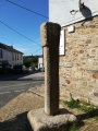
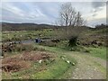
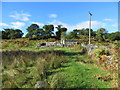
This well is supposed to have healing properties. It sits on the northern side of the B8024 on the grass verge of the road between Dunmore and Ardpatrick. It is just past a relatively new mausoleum which can be seen from the well and shares the same side of the road. The mausoleum stands in a much older burial ground which is possibly dedicated to Oengus the Culdee who was a pupil of St Columba, or to St Aengus of Tallacht.
You may be viewing yesterday's version of this page. To see the most up to date information please register for a free account.
")
")
Do not use the above information on other web sites or publications without permission of the contributor.
Andy B has found this location on Google Street View:
Nearby Images from Geograph Britain and Ireland:
©2021(licence)
©2021(licence)
©2022(licence)
©2022(licence)
©2013(licence)
The above images may not be of the site on this page, they are loaded from Geograph.
Please Submit an Image of this site or go out and take one for us!
Click here to see more info for this site
Nearby sites
Key: Red: member's photo, Blue: 3rd party photo, Yellow: other image, Green: no photo - please go there and take one, Grey: site destroyed
Download sites to:
KML (Google Earth)
GPX (GPS waypoints)
CSV (Garmin/Navman)
CSV (Excel)
To unlock full downloads you need to sign up as a Contributory Member. Otherwise downloads are limited to 50 sites.
Turn off the page maps and other distractions
Nearby sites listing. In the following links * = Image available
1.9km SW 228° Ardpatrick* Standing Stone (Menhir) (NR757601)
3.0km W 274° Carse Standing Stones East* Standing Stones (NR7424661640)
3.1km W 274° Carse Standing Stones West* Standing Stone (Menhir) (NR74146166)
5.2km S 187° Dun Skeig* Hillfort (NR76315612)
6.6km S 170° Loch Ciaran* Standing Stone (Menhir) (NR78035479)
7.0km WNW 293° Kilberry* Sculptured Stone (NR709643)
8.0km SSW 202° Correchrevie Cairn* Cairn (NR738540)
8.5km NW 308° Cretshengan* Standing Stone (Menhir) (NR70726689)
9.1km NE 44° Avinagillan* Standing Stone (Menhir) (NR8390367461)
9.1km NW 315° Dun Cragach Stone Fort or Dun (NR71086805)
9.2km NE 51° Escart* Stone Row / Alignment (NR8464266794)
9.8km SSW 202° Ballochroy* Stone Row / Alignment (NR7309352426)
9.8km ESE 105° Glenreasdale* Chambered Cairn (NR866583)
12.4km NE 54° Mealdarroch Stone Row / Alignment (NR877680)
13.0km ESE 104° Skipness Rock Art (NR8967357519)
13.2km SW 234° Cnoc nan Gobhar Stone* Standing Stone (Menhir) (NR6607454042)
14.0km SW 232° Kinerarach (Gigha)* Standing Stone (Menhir) (NR6568453210)
14.7km SW 230° Old Wife's Grave, The (Gigha, Isle of) Cairn (NR655524)
14.7km SW 229° Tarbert (Gigha)* Standing Stone (Menhir) (NR6554952292)
15.5km NNW 331° Kilmory Knap* Sculptured Stone (NR703752)
15.5km N 349° St Columba's Cave* Cave or Rock Shelter (NR751767)
16.7km N 359° Achahoish* Standing Stone (Menhir) (NR7773778016)
16.8km N 2° Caisteal Torr Stone Fort or Dun (NR78567807)
17.1km ENE 66° Port Leathan* Cairn (NR93226754)
17.1km SW 224° Druimyeonbeg (Isle of Gigha) Cairn (NR64634958)
View more nearby sites and additional images


 We would like to know more about this location. Please feel free to add a brief description and any relevant information in your own language.
 Wir möchten mehr über diese Stätte erfahren. Bitte zögern Sie nicht, eine kurze Beschreibung und relevante Informationen in Deutsch hinzuzufügen.
 Nous aimerions en savoir encore un peu sur les lieux. S'il vous plaît n'hesitez pas à ajouter une courte description et tous les renseignements pertinents dans votre propre langue.
 Quisieramos informarnos un poco más de las lugares. No dude en añadir una breve descripción y otros datos relevantes en su propio idioma.