


<< Text Pages >> Mealdarroch - Stone Row / Alignment in Scotland in Argyll
Submitted by Anonymous on Tuesday, 01 October 2002 Page Views: 5991
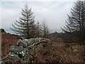
Neolithic and Bronze AgeSite Name: MealdarrochCountry: Scotland
NOTE: This site is 1.56 km away from the location you searched for.
County: Argyll Type: Stone Row / Alignment
Map Ref: NR877680 Landranger Map Number: 62
Latitude: 55.858303N Longitude: 5.393806W
Condition:
| 5 | Perfect |
| 4 | Almost Perfect |
| 3 | Reasonable but with some damage |
| 2 | Ruined but still recognisable as an ancient site |
| 1 | Pretty much destroyed, possibly visible as crop marks |
| 0 | No data. |
| -1 | Completely destroyed |
| 5 | Superb |
| 4 | Good |
| 3 | Ordinary |
| 2 | Not Good |
| 1 | Awful |
| 0 | No data. |
| 5 | Can be driven to, probably with disabled access |
| 4 | Short walk on a footpath |
| 3 | Requiring a bit more of a walk |
| 2 | A long walk |
| 1 | In the middle of nowhere, a nightmare to find |
| 0 | No data. |
| 5 | co-ordinates taken by GPS or official recorded co-ordinates |
| 4 | co-ordinates scaled from a detailed map |
| 3 | co-ordinates scaled from a bad map |
| 2 | co-ordinates of the nearest village |
| 1 | co-ordinates of the nearest town |
| 0 | no data |
Internal Links:
External Links:
A Row of Three Stones (Alignment) in Argyll
Have you visited this site? Please contribute a description or any thoughts by adding a comment.
You may be viewing yesterday's version of this page. To see the most up to date information please register for a free account.
Do not use the above information on other web sites or publications without permission of the contributor.
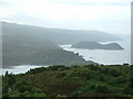
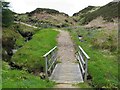
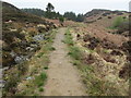
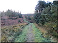
Nearby Images from Geograph Britain and Ireland:
©2007(licence)
©2007(licence)
©2010(licence)
©2013(licence)
©2015(licence)
The above images may not be of the site on this page, they are loaded from Geograph.
Please Submit an Image of this site or go out and take one for us!
Click here to see more info for this site
Nearby sites
Key: Red: member's photo, Blue: 3rd party photo, Yellow: other image, Green: no photo - please go there and take one, Grey: site destroyed
Download sites to:
KML (Google Earth)
GPX (GPS waypoints)
CSV (Garmin/Navman)
CSV (Excel)
To unlock full downloads you need to sign up as a Contributory Member. Otherwise downloads are limited to 50 sites.
Turn off the page maps and other distractions
Nearby sites listing. In the following links * = Image available
3.3km WSW 246° Escart* Stone Row / Alignment (NR8464266794)
3.8km W 259° Avinagillan* Standing Stone (Menhir) (NR8390367461)
5.4km E 87° Low Stillaig* Rock Art (NR93146798)
5.5km E 84° Cnoc Pollphail* Standing Stones (NR93166835)
5.5km E 92° Port Leathan* Cairn (NR93226754)
5.8km E 89° Creag Loisgte* Standing Stone (Menhir) (NR93506779)
6.1km NE 37° Ardmarnock* Chambered Cairn (NR91647265)
7.4km NNE 33° Ardmarnoch 3 Rock Art (NR91987401)
7.4km NNE 32° Auchalick Wood* Hillfort (NR92007407)
7.4km NNE 33° Ardmarnoch 4* Rock Art (NR921740)
7.7km E 85° Colachla* Stone Fort or Dun (NR95456832)
8.0km NNE 26° Inveryne Stone Row* Stone Row / Alignment (NR9157374974)
9.0km NNE 27° Inveryne Rock Art* Rock Art (NR92177578)
9.7km S 184° Glenreasdale* Chambered Cairn (NR866583)
10.0km ENE 68° Kames* Standing Stones (NR97177137)
10.6km SSE 167° Skipness Rock Art (NR8967357519)
12.0km ENE 76° St Michael's Grave* Chambered Cairn (NR9947070314)
12.0km ESE 105° Ardlamont Point* Rock Art (NR99146439)
12.2km ENE 72° Aultmore Burn Fort* Hillfort (NR9946871279)
12.2km ENE 75° Glenvoidean* Chambered Cairn (NR9970870570)
12.3km NNE 21° Fearnoch Stone* Standing Stone (Menhir) (NR92637932)
12.4km SW 235° Tobar Cill'An Aonghais* Holy Well or Sacred Spring (NR772613)
12.4km NNE 21° Fearnoch Cairn* Cairn (NR9268879398)
12.8km NNE 20° Fearnoch Rock Art* Rock Art (NR92617980)
13.0km E 81° Carnbaan* Chambered Cairn (NS0063269316)
View more nearby sites and additional images


 We would like to know more about this location. Please feel free to add a brief description and any relevant information in your own language.
 Wir möchten mehr über diese Stätte erfahren. Bitte zögern Sie nicht, eine kurze Beschreibung und relevante Informationen in Deutsch hinzuzufügen.
 Nous aimerions en savoir encore un peu sur les lieux. S'il vous plaît n'hesitez pas à ajouter une courte description et tous les renseignements pertinents dans votre propre langue.
 Quisieramos informarnos un poco más de las lugares. No dude en añadir una breve descripción y otros datos relevantes en su propio idioma.