<< Our Photo Pages >> Badnabay - Chambered Cairn in Scotland in Highlands
Submitted by markj99 on Monday, 11 November 2002 Page Views: 5482
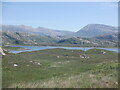
Neolithic and Bronze AgeSite Name: BadnabayCountry: Scotland
NOTE: This site is 4.567 km away from the location you searched for.
County: Highlands Type: Chambered Cairn
Nearest Town: Durness
Map Ref: NC218468 Landranger Map Number: 9
Latitude: 58.373275N Longitude: 5.048785W
Condition:
| 5 | Perfect |
| 4 | Almost Perfect |
| 3 | Reasonable but with some damage |
| 2 | Ruined but still recognisable as an ancient site |
| 1 | Pretty much destroyed, possibly visible as crop marks |
| 0 | No data. |
| -1 | Completely destroyed |
| 5 | Superb |
| 4 | Good |
| 3 | Ordinary |
| 2 | Not Good |
| 1 | Awful |
| 0 | No data. |
| 5 | Can be driven to, probably with disabled access |
| 4 | Short walk on a footpath |
| 3 | Requiring a bit more of a walk |
| 2 | A long walk |
| 1 | In the middle of nowhere, a nightmare to find |
| 0 | No data. |
| 5 | co-ordinates taken by GPS or official recorded co-ordinates |
| 4 | co-ordinates scaled from a detailed map |
| 3 | co-ordinates scaled from a bad map |
| 2 | co-ordinates of the nearest village |
| 1 | co-ordinates of the nearest town |
| 0 | no data |
Be the first person to rate this site - see the 'Contribute!' box in the right hand menu.
Internal Links:
External Links:
")
You may be viewing yesterday's version of this page. To see the most up to date information please register for a free account.
")
")
")
Do not use the above information on other web sites or publications without permission of the contributor.
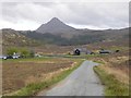
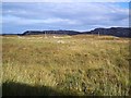
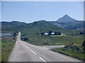
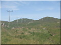
Nearby Images from Geograph Britain and Ireland:
©2018(licence)
©2005(licence)
©2021(licence)
©2021(licence)
©2021(licence)
The above images may not be of the site on this page, they are loaded from Geograph.
Please Submit an Image of this site or go out and take one for us!
Click here to see more info for this site
Nearby sites
Key: Red: member's photo, Blue: 3rd party photo, Yellow: other image, Green: no photo - please go there and take one, Grey: site destroyed
Download sites to:
KML (Google Earth)
GPX (GPS waypoints)
CSV (Garmin/Navman)
CSV (Excel)
To unlock full downloads you need to sign up as a Contributory Member. Otherwise downloads are limited to 50 sites.
Turn off the page maps and other distractions
Nearby sites listing. In the following links * = Image available
6.4km SW 230° Cnoc An Daimh* Chambered Cairn (NC1667342937)
12.7km S 178° Kylestrome Broch* Broch or Nuraghe (NC217341)
14.4km SSW 197° An Dun (Loch Ardbhair)* Broch or Nuraghe (NC16893324)
20.8km NE 43° Ach A' Chorrain Cairn* Cairn (NC36656149)
21.0km NE 41° River Dionard Broch or Nuraghe (NC36336200)
21.3km S 173° Allt Sgiathaig* Chambered Cairn (NC23412552)
21.8km NE 42° Ach A' Chorrain Chambered Cairn Chambered Cairn (NC37156233)
22.5km NE 41° Kyle of Durness Cairn* Round Cairn (NC37336312)
22.5km SSW 192° Loch Assynt Crannog (NC1603225018)
23.2km S 172° Ardvreck* Chambered Cairn (NC24142371)
23.4km NE 50° Kyle of Durness Wheelhouse* Broch or Nuraghe (NC4048761009)
23.8km NE 40° Sarsgrum* Cairn (NC37926435)
23.9km E 92° Dun Dornaigil* Broch or Nuraghe (NC457450)
24.2km SW 226° Loch Na Claise Crannog (NC03543082)
25.3km ENE 61° Camus An Duin Broch or Nuraghe (NC44595797)
25.4km SSE 168° Carrachan Dubh Chambered Cairn (NC26102176)
25.4km NE 53° Laid Souterrain (Fogou, Earth House) (NC42816126)
26.1km ENE 58° Dun Neachdie Broch or Nuraghe (NC446597)
26.2km SW 221° Clachtoll Broch* Broch or Nuraghe (NC03652785)
26.2km SW 221° Clachtoll Stone Circle* Stone Circle (NC037278)
26.8km NE 38° Balnakeil Stone Circle* Stone Circle (NC392673)
26.9km ENE 67° Creagan na Speireig Cairn (NC47205603)
27.2km ENE 57° Heilam Hut Circle (4) Cairn (NC45426042)
27.4km ENE 63° Arnaboll Cairn Cairn (NC46875806)
27.5km ENE 58° Heilam Hut Circle (1) Cairn (NC45916026)
View more nearby sites and additional images


 We would like to know more about this location. Please feel free to add a brief description and any relevant information in your own language.
 Wir möchten mehr über diese Stätte erfahren. Bitte zögern Sie nicht, eine kurze Beschreibung und relevante Informationen in Deutsch hinzuzufügen.
 Nous aimerions en savoir encore un peu sur les lieux. S'il vous plaît n'hesitez pas à ajouter une courte description et tous les renseignements pertinents dans votre propre langue.
 Quisieramos informarnos un poco más de las lugares. No dude en añadir una breve descripción y otros datos relevantes en su propio idioma.