


<< Text Pages >> River Dionard - Broch or Nuraghe in Scotland in Sutherland
Submitted by SolarMegalith on Tuesday, 01 November 2011 Page Views: 3054
Iron Age and Later PrehistorySite Name: River DionardCountry: Scotland County: Sutherland Type: Broch or Nuraghe
Map Ref: NC36336200
Latitude: 58.515295N Longitude: 4.811554W
Condition:
| 5 | Perfect |
| 4 | Almost Perfect |
| 3 | Reasonable but with some damage |
| 2 | Ruined but still recognisable as an ancient site |
| 1 | Pretty much destroyed, possibly visible as crop marks |
| 0 | No data. |
| -1 | Completely destroyed |
| 5 | Superb |
| 4 | Good |
| 3 | Ordinary |
| 2 | Not Good |
| 1 | Awful |
| 0 | No data. |
| 5 | Can be driven to, probably with disabled access |
| 4 | Short walk on a footpath |
| 3 | Requiring a bit more of a walk |
| 2 | A long walk |
| 1 | In the middle of nowhere, a nightmare to find |
| 0 | No data. |
| 5 | co-ordinates taken by GPS or official recorded co-ordinates |
| 4 | co-ordinates scaled from a detailed map |
| 3 | co-ordinates scaled from a bad map |
| 2 | co-ordinates of the nearest village |
| 1 | co-ordinates of the nearest town |
| 0 | no data |
Internal Links:
External Links:
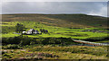
Broch in Sutherland
Remains of a broch preserved as a mound of 34 m diameter. Remains of the walls are still distinguishable.
MacKie E.W. 2007. The Roundhouses, Brochs and Wheelhouses of Atlantic Scotland c. 700 BC – AD 500. Part 2 (I). Oxford: Archaeopress
You may be viewing yesterday's version of this page. To see the most up to date information please register for a free account.
Do not use the above information on other web sites or publications without permission of the contributor.
Nearby Images from Geograph Britain and Ireland:
©2016(licence)
©2016(licence)
©2007(licence)
©2010(licence)
©2017(licence)
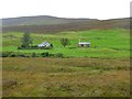
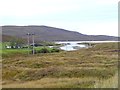
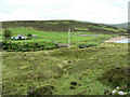
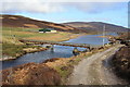
The above images may not be of the site on this page, they are loaded from Geograph.
Please Submit an Image of this site or go out and take one for us!
Click here to see more info for this site
Nearby sites
Key: Red: member's photo, Blue: 3rd party photo, Yellow: other image, Green: no photo - please go there and take one, Grey: site destroyed
Download sites to:
KML (Google Earth)
GPX (GPS waypoints)
CSV (Garmin/Navman)
CSV (Excel)
To unlock full downloads you need to sign up as a Contributory Member. Otherwise downloads are limited to 50 sites.
Turn off the page maps and other distractions
Nearby sites listing. In the following links * = Image available
601m SE 146° Ach A' Chorrain Cairn* Cairn (NC36656149)
881m ENE 66° Ach A' Chorrain Chambered Cairn Chambered Cairn (NC37156233)
1.5km NE 39° Kyle of Durness Cairn* Round Cairn (NC37336312)
2.8km NNE 32° Sarsgrum* Cairn (NC37926435)
4.3km E 101° Kyle of Durness Wheelhouse* Broch or Nuraghe (NC4048761009)
6.0km NNE 26° Balnakeil Stone Circle* Stone Circle (NC392673)
6.5km E 94° Laid Souterrain (Fogou, Earth House) (NC42816126)
7.5km NE 45° Smoo Cave* Cave or Rock Shelter (NC4188367123)
8.6km ESE 103° Dun Neachdie Broch or Nuraghe (NC446597)
9.2km ESE 114° Camus An Duin Broch or Nuraghe (NC44595797)
9.2km E 97° Heilam Hut Circle (4) Cairn (NC45426042)
9.6km E 96° Heilam Hut Circle (3) Cairn (NC45876052)
9.7km E 97° Heilam Hut Circle (2) Cairn (NC45896036)
9.7km E 98° Heilam Hut Circle (1) Cairn (NC45916026)
9.8km E 96° Heilam Broch* Broch or Nuraghe (NC46026056)
10.9km E 93° Weirs Hut Circle (2) Cairn (NC47236104)
10.9km ESE 103° Arnaboll Hut Circle (2) Cairn (NC46895903)
11.0km E 94° Weirs Hut Circle (1) Cairn (NC47276079)
11.0km ESE 104° Arnaboll Hut Circle (1) Cairn (NC46915893)
11.2km ESE 108° Arnaboll Cairn Cairn (NC46875806)
11.7km ESE 109° Lochside Cairn Cairn (NC47265772)
12.4km ESE 116° Creagan na Speireig Cairn (NC47205603)
19.4km SSE 149° Dun Dornaigil* Broch or Nuraghe (NC457450)
20.1km E 82° West Strathan Carving (Melness) Rock Art (NC5642864084)
20.2km E 82° West Strathan* Broch or Nuraghe (NC56456401)
View more nearby sites and additional images


 We would like to know more about this location. Please feel free to add a brief description and any relevant information in your own language.
 Wir möchten mehr über diese Stätte erfahren. Bitte zögern Sie nicht, eine kurze Beschreibung und relevante Informationen in Deutsch hinzuzufügen.
 Nous aimerions en savoir encore un peu sur les lieux. S'il vous plaît n'hesitez pas à ajouter une courte description et tous les renseignements pertinents dans votre propre langue.
 Quisieramos informarnos un poco más de las lugares. No dude en añadir una breve descripción y otros datos relevantes en su propio idioma.