<< Our Photo Pages >> Castilly Tumulus - Round Barrow(s) in England in Cornwall
Submitted by MikeAitch on Thursday, 08 April 2010 Page Views: 3780
Neolithic and Bronze AgeSite Name: Castilly Tumulus Alternative Name: Innis Downs TumulusCountry: England
NOTE: This site is 0.712 km away from the location you searched for.
County: Cornwall Type: Round Barrow(s)
Nearest Town: Bodmin Nearest Village: Lanivet
Map Ref: SX02846258
Latitude: 50.429889N Longitude: 4.777363W
Condition:
| 5 | Perfect |
| 4 | Almost Perfect |
| 3 | Reasonable but with some damage |
| 2 | Ruined but still recognisable as an ancient site |
| 1 | Pretty much destroyed, possibly visible as crop marks |
| 0 | No data. |
| -1 | Completely destroyed |
| 5 | Superb |
| 4 | Good |
| 3 | Ordinary |
| 2 | Not Good |
| 1 | Awful |
| 0 | No data. |
| 5 | Can be driven to, probably with disabled access |
| 4 | Short walk on a footpath |
| 3 | Requiring a bit more of a walk |
| 2 | A long walk |
| 1 | In the middle of nowhere, a nightmare to find |
| 0 | No data. |
| 5 | co-ordinates taken by GPS or official recorded co-ordinates |
| 4 | co-ordinates scaled from a detailed map |
| 3 | co-ordinates scaled from a bad map |
| 2 | co-ordinates of the nearest village |
| 1 | co-ordinates of the nearest town |
| 0 | no data |
Internal Links:
External Links:
I have visited· I would like to visit
mikeaitch has visited here
")
You may be viewing yesterday's version of this page. To see the most up to date information please register for a free account.
")
")
")
Do not use the above information on other web sites or publications without permission of the contributor.
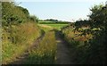
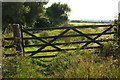
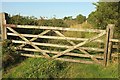
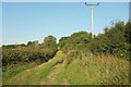
Nearby Images from Geograph Britain and Ireland:
©2017(licence)
©2017(licence)
©2017(licence)
©2017(licence)

©2017(licence)
The above images may not be of the site on this page, they are loaded from Geograph.
Please Submit an Image of this site or go out and take one for us!
Click here to see more info for this site
Nearby sites
Key: Red: member's photo, Blue: 3rd party photo, Yellow: other image, Green: no photo - please go there and take one, Grey: site destroyed
Download sites to:
KML (Google Earth)
GPX (GPS waypoints)
CSV (Garmin/Navman)
CSV (Excel)
To unlock full downloads you need to sign up as a Contributory Member. Otherwise downloads are limited to 50 sites.
Turn off the page maps and other distractions
Nearby sites listing. In the following links * = Image available
313m ENE 57° Castilly Henge* Henge (SX03116274)
1.9km NNE 31° The Annicu Stone* Sculptured Stone (SX039642)
1.9km ENE 66° Reperry Cross* Ancient Cross (SX0463963316)
3.2km ENE 74° St Ingunger Farm Cross* Ancient Cross (SX05976334)
3.3km E 82° Fenton Pits Cross* Ancient Cross (SX061629)
3.4km ESE 103° Helman Tor* Causewayed Enclosure (SX06166166)
3.8km E 86° Lesquite Cross* Ancient Cross (SX06666269)
4.2km E 85° Lesquite Quoit* Burial Chamber or Dolmen (SX07076276)
4.3km SSE 152° Luxulyan stones* Natural Stone / Erratic / Other Natural Feature (SX0474658699)
4.4km WSW 256° St Gundred's Well* Holy Well or Sacred Spring (SW985617)
4.8km SW 229° Roche Rock* Rock Outcrop (SW99105962)
4.8km WSW 237° Menevegar Menhir* Standing Stone (Menhir) (SW98676011)
4.9km SW 233° Roche Cross* Ancient Cross (SW98795978)
5.1km SSE 151° Luxulyan Cross* Ancient Cross (SX05185806)
5.2km W 279° Demelza Castle* Ancient Village or Settlement (SW977636)
5.2km SSE 149° St Cyors's Well* Holy Well or Sacred Spring (SX054580)
5.6km ENE 77° Holy Well (Lanhydrock)* Holy Well or Sacred Spring (SX084636)
5.7km NNE 28° Scarlett's Well* Holy Well or Sacred Spring (SX0566767503)
5.7km W 267° Belowda Beacon tumuli* Barrow Cemetery (SW97136254)
5.7km ENE 78° Lanhydrock* Ancient Cross (SX085636)
5.9km SE 128° Trethew Cross* Ancient Cross (SX07355881)
5.9km SSW 210° Hensbarrow* Round Barrow(s) (SW99685754)
6.1km NE 37° Cocks Well* Holy Well or Sacred Spring (SX067673)
6.1km SE 124° St Bryvyth's Well* Holy Well or Sacred Spring (SX078590)
6.1km NE 36° Berrycombe Cross* Ancient Cross (SX0661067414)
View more nearby sites and additional images


 We would like to know more about this location. Please feel free to add a brief description and any relevant information in your own language.
 Wir möchten mehr über diese Stätte erfahren. Bitte zögern Sie nicht, eine kurze Beschreibung und relevante Informationen in Deutsch hinzuzufügen.
 Nous aimerions en savoir encore un peu sur les lieux. S'il vous plaît n'hesitez pas à ajouter une courte description et tous les renseignements pertinents dans votre propre langue.
 Quisieramos informarnos un poco más de las lugares. No dude en añadir una breve descripción y otros datos relevantes en su propio idioma.