<< Text Pages >> Elphinstone Fort - Hillfort in Scotland in Renfrewshire
Submitted by AstroGeologist on Monday, 06 May 2019 Page Views: 1236
Iron Age and Later PrehistorySite Name: Elphinstone Fort Alternative Name: Elphinstone Wood Fort, Elphinstone HillfortCountry: Scotland
NOTE: This site is 1.028 km away from the location you searched for.
County: Renfrewshire Type: Hillfort
Nearest Town: Port Glasgow Nearest Village: Kilmacolm
Map Ref: NS37506995
Latitude: 55.895169N Longitude: 4.600309W
Condition:
| 5 | Perfect |
| 4 | Almost Perfect |
| 3 | Reasonable but with some damage |
| 2 | Ruined but still recognisable as an ancient site |
| 1 | Pretty much destroyed, possibly visible as crop marks |
| 0 | No data. |
| -1 | Completely destroyed |
| 5 | Superb |
| 4 | Good |
| 3 | Ordinary |
| 2 | Not Good |
| 1 | Awful |
| 0 | No data. |
| 5 | Can be driven to, probably with disabled access |
| 4 | Short walk on a footpath |
| 3 | Requiring a bit more of a walk |
| 2 | A long walk |
| 1 | In the middle of nowhere, a nightmare to find |
| 0 | No data. |
| 5 | co-ordinates taken by GPS or official recorded co-ordinates |
| 4 | co-ordinates scaled from a detailed map |
| 3 | co-ordinates scaled from a bad map |
| 2 | co-ordinates of the nearest village |
| 1 | co-ordinates of the nearest town |
| 0 | no data |
Internal Links:
External Links:
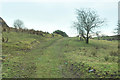
Elphinstone Fort is a medium sized Iron Age HillFort, situated on a raised Volcanic Plateau that slopes down onto Lawfield Dam.
Situated in the middle of Elphinstone Woods, the Fort has a rough NNW-SSE alignment, measuring approximately 60m x 25m. It is located 150m above sea level and is protected on 3 sides by steep rocky crags (The Fort is at the top of a Crag & Tail formation, formed about 10,000 year's ago at the end of the Younger Dryas)
Defensively, the Fort had 3m thick stone walls, now mostly obliterated but still visible in some places, the wall followed the natural contour of the rocky crags, with the entrance at the gentler SSE end.
For more information : Canmore ID 42238
You may be viewing yesterday's version of this page. To see the most up to date information please register for a free account.
Do not use the above information on other web sites or publications without permission of the contributor.
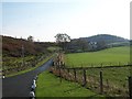
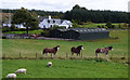
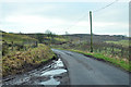
Nearby Images from Geograph Britain and Ireland:
©2005(licence)
©2018(licence)
©2013(licence)
©2018(licence)
©2013(licence)
The above images may not be of the site on this page, they are loaded from Geograph.
Please Submit an Image of this site or go out and take one for us!
Click here to see more info for this site
Nearby sites
Key: Red: member's photo, Blue: 3rd party photo, Yellow: other image, Green: no photo - please go there and take one, Grey: site destroyed
Download sites to:
KML (Google Earth)
GPX (GPS waypoints)
CSV (Garmin/Navman)
CSV (Excel)
To unlock full downloads you need to sign up as a Contributory Member. Otherwise downloads are limited to 50 sites.
Turn off the page maps and other distractions
Nearby sites listing. In the following links * = Image available
764m SSE 160° Lawfield Cairn* Cairn (NS37736922)
1.1km S 182° Barlogan Cairn* Cairn (NS37426887)
1.3km SE 135° St Fillan's Holy Well (Kilallan)* Holy Well or Sacred Spring (NS38406899)
1.4km SE 137° St Fillan's Seat (Kilallan)* Natural Stone / Erratic / Other Natural Feature (NS38396892)
2.9km SE 126° Sewn Dun Hillfort (NS39766816)
3.2km ESE 105° Barochan Hillfort Hillfort (NS40566902)
3.4km NW 312° High Castlehill Fort Hillfort (NS3505972281)
3.5km SSE 161° Law Hill Dun Hillfort (NS38506659)
3.6km WNW 300° Craigmarloch Fort Hillfort (NS34437185)
3.7km N 8° Langbank Crannog (West)* Crannog (NS3813073550)
3.7km WNW 287° Pennytersal Mounds Artificial Mound (NS3402071145)
4.3km SE 141° Houston South Mound Cairn (NS4010066487)
4.4km SE 142° Houston Tumulus Barrow Cemetery (NS40066640)
4.4km NE 41° Langbank Crannog (East)* Crannog (NS4049773171)
4.6km WNW 296° Cunston Cist Cist (NS33407210)
4.7km SE 139° Back O' Hill Farm Cup Marked Stone Rock Art (NS40456623)
4.8km SSE 155° Broom Cist Cist (NS39356552)
4.9km SW 214° Dun Gotter Hillfort (NS3458666033)
5.0km NNE 26° Dumbarton Hilllfort* Hillfort (NS399744)
5.2km W 281° Devol 1 Rock Art (NS324711)
5.3km NW 312° Bogle Stane* Natural Stone / Erratic / Other Natural Feature (NS3370773634)
5.5km WNW 297° Devol Moor Ancient Village or Settlement (NS3269872597)
5.7km NE 43° Dumbuck Crannog* Crannog (NS41577392)
5.9km ENE 62° Longhaugh Point Menhir* Standing Stone (Menhir) (NS4279972498)
6.0km S 174° Lawmarnock Cup Marks Rock Art (NS3794264004)
View more nearby sites and additional images


 We would like to know more about this location. Please feel free to add a brief description and any relevant information in your own language.
 Wir möchten mehr über diese Stätte erfahren. Bitte zögern Sie nicht, eine kurze Beschreibung und relevante Informationen in Deutsch hinzuzufügen.
 Nous aimerions en savoir encore un peu sur les lieux. S'il vous plaît n'hesitez pas à ajouter une courte description et tous les renseignements pertinents dans votre propre langue.
 Quisieramos informarnos un poco más de las lugares. No dude en añadir una breve descripción y otros datos relevantes en su propio idioma.