


<< Text Pages >> Devol Moor - Ancient Village or Settlement in Scotland in Inverclyde
Submitted by AstroGeologist on Saturday, 08 June 2019 Page Views: 1298
Multi-periodSite Name: Devol Moor Alternative Name: Devol Prehistoric SettlementCountry: Scotland County: Inverclyde Type: Ancient Village or Settlement
Nearest Town: Port Glasgow Nearest Village: Kilmacolm
Map Ref: NS3269872597
Latitude: 55.917281N Longitude: 4.678649W
Condition:
| 5 | Perfect |
| 4 | Almost Perfect |
| 3 | Reasonable but with some damage |
| 2 | Ruined but still recognisable as an ancient site |
| 1 | Pretty much destroyed, possibly visible as crop marks |
| 0 | No data. |
| -1 | Completely destroyed |
| 5 | Superb |
| 4 | Good |
| 3 | Ordinary |
| 2 | Not Good |
| 1 | Awful |
| 0 | No data. |
| 5 | Can be driven to, probably with disabled access |
| 4 | Short walk on a footpath |
| 3 | Requiring a bit more of a walk |
| 2 | A long walk |
| 1 | In the middle of nowhere, a nightmare to find |
| 0 | No data. |
| 5 | co-ordinates taken by GPS or official recorded co-ordinates |
| 4 | co-ordinates scaled from a detailed map |
| 3 | co-ordinates scaled from a bad map |
| 2 | co-ordinates of the nearest village |
| 1 | co-ordinates of the nearest town |
| 0 | no data |
Internal Links:
External Links:
Ancient Village or Settlement in Inverclyde
A Prehistoric Settlement on Devol Moor in the West Renfrewshire Hills.
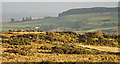
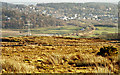
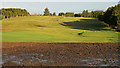
In the hills behind Devol and Auchinleck in Port Glasgow is a large sprawling moor covering an area of approximately 8km². The moorland is practically unchanged and untouched for thousand's of years and it goes as far West as the Devol Burn (On the other side are the Greenock Moors) and South to the Gryffe Water.
In 1964 "F. Newall" found remains of a Hut Circle of late Bronze Age or Early Iron Age.
A couple of Denuded Enclosures have also been documented, along with lots of man made Turf Mounds scattered across the moor, with some around the Pennytersal and Priestside area having the appearance of Cairns. A micro Obsidian Blade was recovered from a Mound found near the Hut Circle.
There was once a Cist somewhere around the Cunston area, although it's remains were destroyed by a farmer. In 2005 a Cairn was recorded near Harelaw, and to the South of the moor near the Gryffe Water several Cup Marked Rocks have been found. 2 Stone Axes, a Shale Spindle Whorl and a flake of Flint were discovered at Auchenfoyle, and a Rotary Quern, barbed Flint Arrownhead and Iron Slag recorded around Mathernock.
For more information : Canmore ID 42433
You may be viewing yesterday's version of this page. To see the most up to date information please register for a free account.
Do not use the above information on other web sites or publications without permission of the contributor.
Nearby Images from Geograph Britain and Ireland:
©2013(licence)
©2019(licence)
©2011(licence)
©2013(licence)
©2013(licence)
The above images may not be of the site on this page, they are loaded from Geograph.
Please Submit an Image of this site or go out and take one for us!
Click here to see more info for this site
Nearby sites
Key: Red: member's photo, Blue: 3rd party photo, Yellow: other image, Green: no photo - please go there and take one, Grey: site destroyed
Download sites to:
KML (Google Earth)
GPX (GPS waypoints)
CSV (Garmin/Navman)
CSV (Excel)
To unlock full downloads you need to sign up as a Contributory Member. Otherwise downloads are limited to 50 sites.
Turn off the page maps and other distractions
Nearby sites listing. In the following links * = Image available
858m ESE 123° Cunston Cist Cist (NS33407210)
1.2km WNW 284° Harelaw Cairn Cairn (NS3155572939)
1.4km NE 42° Bogle Stane* Natural Stone / Erratic / Other Natural Feature (NS3370773634)
1.5km S 189° Devol 1 Rock Art (NS324711)
1.6km SW 223° Devol 2 Rock Art (NS31547144)
1.9km ESE 111° Craigmarloch Fort Hillfort (NS34437185)
2.0km SE 136° Pennytersal Mounds Artificial Mound (NS3402071145)
2.0km SW 230° Devol 3 Rock Art (NS3110071370)
2.4km E 95° High Castlehill Fort Hillfort (NS3505972281)
3.6km W 272° Corlick Hill Cairn* Cairn (NS2904872850)
3.8km W 268° Corlick Hill Cup Mark Rock Art (NS28887263)
4.0km SSW 203° Burnbank Cairn Cairn (NS3095368963)
4.5km WSW 253° Gryffe Cup Marks Rock Art (NS2834271413)
4.6km SW 229° Green Water Cup Mark Rock Art (NS2913469705)
4.7km WSW 254° Greenock Moors* Ancient Village or Settlement (NS2816071511)
4.8km WSW 254° Gryffe Cairn A Cairn (NS2802271427)
5.0km W 269° Darndaff Moor Cairn(s)* Cairn (NS2770772714)
5.0km WSW 254° Gryffe Cairn B Cairn (NS2780071359)
5.1km W 278° Whitelees Moor Cairn Cairn (NS2770573526)
5.1km W 279° Whitelees Moor 2 Rock Art (NS2769173585)
5.1km WSW 244° Brewfield Cairn Cairn (NS2799370496)
5.2km WSW 257° Darneme 1 Rock Art (NS27597166)
5.2km WSW 257° Darneme 2 Rock Art (NS2753471644)
5.3km WSW 258° Darneme 3 Rock Art (NS27517166)
5.5km ESE 117° Elphinstone Fort Hillfort (NS37506995)
View more nearby sites and additional images


 We would like to know more about this location. Please feel free to add a brief description and any relevant information in your own language.
 Wir möchten mehr über diese Stätte erfahren. Bitte zögern Sie nicht, eine kurze Beschreibung und relevante Informationen in Deutsch hinzuzufügen.
 Nous aimerions en savoir encore un peu sur les lieux. S'il vous plaît n'hesitez pas à ajouter une courte description et tous les renseignements pertinents dans votre propre langue.
 Quisieramos informarnos un poco más de las lugares. No dude en añadir una breve descripción y otros datos relevantes en su propio idioma.