<< Our Photo Pages >> Cefn Brafle - Chambered Tomb in Wales in Carmarthenshire
Submitted by vicky on Saturday, 21 September 2002 Page Views: 7017
Neolithic and Bronze AgeSite Name: Cefn BrafleCountry: Wales County: Carmarthenshire Type: Chambered Tomb
Nearest Town: Whitland Nearest Village: Cross Hands
Map Ref: SN196229 Landranger Map Number: 145
Latitude: 51.875413N Longitude: 4.622079W
Condition:
| 5 | Perfect |
| 4 | Almost Perfect |
| 3 | Reasonable but with some damage |
| 2 | Ruined but still recognisable as an ancient site |
| 1 | Pretty much destroyed, possibly visible as crop marks |
| 0 | No data. |
| -1 | Completely destroyed |
| 5 | Superb |
| 4 | Good |
| 3 | Ordinary |
| 2 | Not Good |
| 1 | Awful |
| 0 | No data. |
| 5 | Can be driven to, probably with disabled access |
| 4 | Short walk on a footpath |
| 3 | Requiring a bit more of a walk |
| 2 | A long walk |
| 1 | In the middle of nowhere, a nightmare to find |
| 0 | No data. |
| 5 | co-ordinates taken by GPS or official recorded co-ordinates |
| 4 | co-ordinates scaled from a detailed map |
| 3 | co-ordinates scaled from a bad map |
| 2 | co-ordinates of the nearest village |
| 1 | co-ordinates of the nearest town |
| 0 | no data |
Internal Links:
External Links:
")
A capstone and two uprights survive. Have you visited this site? Please add a comment below.
You may be viewing yesterday's version of this page. To see the most up to date information please register for a free account.
")
")
")
Do not use the above information on other web sites or publications without permission of the contributor.
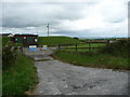
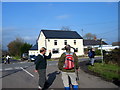
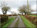
Nearby Images from Geograph Britain and Ireland:
©2016(licence)
©2011(licence)
©2014(licence)
©2024(licence)

©2008(licence)
The above images may not be of the site on this page, they are loaded from Geograph.
Please Submit an Image of this site or go out and take one for us!
Click here to see more info for this site
Nearby sites
Key: Red: member's photo, Blue: 3rd party photo, Yellow: other image, Green: no photo - please go there and take one, Grey: site destroyed
Download sites to:
KML (Google Earth)
GPX (GPS waypoints)
CSV (Garmin/Navman)
CSV (Excel)
To unlock full downloads you need to sign up as a Contributory Member. Otherwise downloads are limited to 50 sites.
Turn off the page maps and other distractions
Nearby sites listing. In the following links * = Image available
1m E 90° Crosshands* Standing Stones (SN196229)
3.5km SSW 209° Henllan Amgoed Inscribed Stone* Standing Stone (Menhir) (SN1776719862)
3.7km NW 315° Gwal y Filiast* Chambered Tomb (SN17052564)
3.8km NNE 28° Tumulus at Pantglas* Cairn (SN215262)
4.1km NNE 24° Crug Hywel Cairn Cairn (SN214266)
4.3km NW 310° Bach-sylw* Standing Stones (SN16422575)
4.3km NNW 328° St Clydwen's Church Cross Stone* Early Christian Sculptured Stone (SN17452660)
4.6km SSW 202° St Canna's Stone (Llangan)* Natural Stone / Erratic / Other Natural Feature (SN17701874)
4.8km WNW 300° Maen Hir Farm 1* Standing Stone (Menhir) (SN155255)
4.9km WNW 300° Efailwen-Isaf Barrow* Round Barrow(s) (SN15482550)
4.9km WNW 299° Coynant Maenhir Standing Stone (Menhir) (SN15412540)
4.9km WNW 300° Rhos Coynant Round Barrow(s) (SN154255)
5.1km NW 304° Maen Hir Farm 4* Standing Stone (Menhir) (SN15452589)
5.4km WNW 297° Maen Hir Farm 2 and 3* Standing Stones (SN149255)
5.6km NNE 23° Ffynnonwen Iron Age Settlement Ancient Village or Settlement (SN2228)
5.7km N 353° Efessangus stone* Early Christian Sculptured Stone (SN191286)
5.7km NW 309° Carreg Fyrddin Standing Stone (Menhir) (SN153267)
5.9km WNW 303° Pantymenyn Ancient Village or Settlement (SN148263)
6.2km NW 318° Carn Besi* Chambered Tomb (SN15632768)
6.3km WNW 292° Capel Nebo Stone* Standing Stone (Menhir) (SN13852541)
6.3km NW 307° Castell Garw* Ancient Village or Settlement (SN147269)
6.5km NW 307° Glandymawr* Cairn (SN14562702)
6.5km WNW 299° Glandy Cross Tumulus* Barrow Cemetery (SN140263)
6.5km SW 225° Triangle of stones near Llanddewi Velfrey* Modern Stone Circle etc (SN1477418468)
6.5km WNW 302° Meini Gwyr* Henge (SN14172658)
View more nearby sites and additional images


 We would like to know more about this location. Please feel free to add a brief description and any relevant information in your own language.
 Wir möchten mehr über diese Stätte erfahren. Bitte zögern Sie nicht, eine kurze Beschreibung und relevante Informationen in Deutsch hinzuzufügen.
 Nous aimerions en savoir encore un peu sur les lieux. S'il vous plaît n'hesitez pas à ajouter une courte description et tous les renseignements pertinents dans votre propre langue.
 Quisieramos informarnos un poco más de las lugares. No dude en añadir una breve descripción y otros datos relevantes en su propio idioma.