


<< Text Pages >> Gelliwig - Ancient Palace in Wales in Gwynedd
Submitted by VirtHist on Saturday, 21 July 2007 Page Views: 20482
Multi-periodSite Name: Gelliwig Alternative Name: Llys Arthur, Arthur's Court, Gelliweg, Celliwig, KelliwicCountry: Wales
NOTE: This site is 1.132 km away from the location you searched for.
County: Gwynedd Type: Ancient Palace
Map Ref: SH252299
Latitude: 52.838175N Longitude: 4.596578W
Condition:
| 5 | Perfect |
| 4 | Almost Perfect |
| 3 | Reasonable but with some damage |
| 2 | Ruined but still recognisable as an ancient site |
| 1 | Pretty much destroyed, possibly visible as crop marks |
| 0 | No data. |
| -1 | Completely destroyed |
| 5 | Superb |
| 4 | Good |
| 3 | Ordinary |
| 2 | Not Good |
| 1 | Awful |
| 0 | No data. |
| 5 | Can be driven to, probably with disabled access |
| 4 | Short walk on a footpath |
| 3 | Requiring a bit more of a walk |
| 2 | A long walk |
| 1 | In the middle of nowhere, a nightmare to find |
| 0 | No data. |
| 5 | co-ordinates taken by GPS or official recorded co-ordinates |
| 4 | co-ordinates scaled from a detailed map |
| 3 | co-ordinates scaled from a bad map |
| 2 | co-ordinates of the nearest village |
| 1 | co-ordinates of the nearest town |
| 0 | no data |
Be the first person to rate this site - see the 'Contribute!' box in the right hand menu.
Internal Links:
External Links:
This is the site argued by Steve Blake and Scott Llyod in their books on the historical Arthur to be the possible site of Arthur's court (llys). The Welsh never called Arthur a king until after the English turned him into one and their conclusions are that Arthur was simply the leader of a warband on the Llyn Peninsula serving under King Maelgwyn of Gwynedd, in the late 5th or early 6th century.
According to legend, Ireland's Wicklow Mountains could be seen from Arthur's court. It is not possible to see the Wicklow Mountains from anywhere on the Cornish coast. But the mountains can be seen from the Llyn Peninsula, although Mr Blake admits they can also be viewed from Pembrokeshire.
"You can see the Wicklow Mountains from Pembrokeshire on a very, very good day. But there is absolutely no supporting evidence from the early material [for Pembrokeshire as the seat of Arthur's court]."
The Gelliweg they refer to isn’t a town or a village but actually two buildings: Gelliweg Farm and Plas Gelliweg. ‘Gelli’ in modern Welsh means ‘grove’. There is no modern Welsh ‘weg’ (as far as I know), although ‘wig’ could come from ‘gwig’ meaning ‘wood’. (In Old German it means ‘way’, but that’s highly unlikely). I wondered about it coming form the Irish, the Llyn Peninsula being named after the men of Lienster who colonized it, but Gaelic has no ‘w’ in its alphabet.
You may be viewing yesterday's version of this page. To see the most up to date information please register for a free account.
")
Do not use the above information on other web sites or publications without permission of the contributor.
Nearby Images from Geograph Britain and Ireland:
©2007(licence)
©2007(licence)
©2007(licence)
©2007(licence)
©2007(licence)
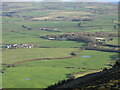
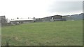
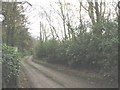
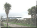
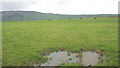
The above images may not be of the site on this page, they are loaded from Geograph.
Please Submit an Image of this site or go out and take one for us!
Click here to see more info for this site
Nearby sites
Key: Red: member's photo, Blue: 3rd party photo, Yellow: other image, Green: no photo - please go there and take one, Grey: site destroyed
Download sites to:
KML (Google Earth)
GPX (GPS waypoints)
CSV (Garmin/Navman)
CSV (Excel)
To unlock full downloads you need to sign up as a Contributory Member. Otherwise downloads are limited to 50 sites.
Turn off the page maps and other distractions
Nearby sites listing. In the following links * = Image available
1.1km WSW 246° Tyn-y-parc Holy Well* Holy Well or Sacred Spring (SH242295)
1.1km WSW 245° Ffynnon Saint (Rhiw)* Holy Well or Sacred Spring (SH24202947)
1.8km W 268° Mynydd Rhiw Neolithic axe factory* Ancient Mine, Quarry or other Industry (SH23392991)
1.8km SW 230° Tan-Y-Muriau* Chambered Cairn (SH23772877)
1.9km W 262° Mynydd Rhiw Cairn 3* Cairn (SH23302972)
2.0km W 260° Mynydd Rhiw Cairn 2* Cairn (SH23262962)
2.0km W 259° Mynydd Rhiw Cairn 1* Cairn (SH23262960)
2.0km WSW 256° Mynydd Rhiw South* Cairn (SH23242949)
2.0km W 279° Castell Caeron Hillfort (SH232303)
2.3km SW 230° Ffynnon Aelrhiw* Holy Well or Sacred Spring (SH23382847)
2.7km SW 226° Bronheulog* Burial Chamber or Dolmen (SH23192812)
2.7km SW 232° Rhiw fort* Ancient Village or Settlement (SH23002831)
2.9km WNW 298° Ffynnon Fair (Gwynedd)* Holy Well or Sacred Spring (SH22663139)
3.2km NW 304° Cae Newydd Mynachdy Hillfort (SH22593178)
3.3km NNW 331° Meyllteyrn* Standing Stone (Menhir) (SH23713283)
3.4km SW 217° Tuhwnt-I'r-Mynyd Cairn (SH23062731)
3.4km SW 227° Capel Tan-Y-Foel* Standing Stone (Menhir) (SH22612767)
3.5km SW 222° Mynydd y Graig* Hillfort (SH228274)
3.6km WSW 257° Meillionydd double ringwork* Hillfort (SH21692924)
4.2km W 280° Maenhir Penygroeslon Standing Stone (Menhir) (SH21093079)
4.3km NE 54° Pandy Standing Stone* Standing Stone (Menhir) (SH28783229)
4.6km E 100° St Cian's Church (Llangian)* Early Christian Sculptured Stone (SH297289)
4.9km ESE 108° Pen-Y-Gaer (Llanengan) Hillfort (SH29862824)
5.0km ESE 123° Ffynnon Engan* Holy Well or Sacred Spring (SH29302707)
5.0km NNE 26° Carnfadryn standing stone west Standing Stone (Menhir) (SH2759034311)
View more nearby sites and additional images


 We would like to know more about this location. Please feel free to add a brief description and any relevant information in your own language.
 Wir möchten mehr über diese Stätte erfahren. Bitte zögern Sie nicht, eine kurze Beschreibung und relevante Informationen in Deutsch hinzuzufügen.
 Nous aimerions en savoir encore un peu sur les lieux. S'il vous plaît n'hesitez pas à ajouter une courte description et tous les renseignements pertinents dans votre propre langue.
 Quisieramos informarnos un poco más de las lugares. No dude en añadir una breve descripción y otros datos relevantes en su propio idioma.