<< Text Pages >> Mynydd Mynytho Hut Circle - Ancient Village or Settlement in Wales in Gwynedd
Submitted by coldrum on Wednesday, 27 January 2010 Page Views: 4172
Multi-periodSite Name: Mynydd Mynytho Hut CircleCountry: Wales
NOTE: This site is 0.512 km away from the location you searched for.
County: Gwynedd Type: Ancient Village or Settlement
Map Ref: SH30183105
Latitude: 52.850096N Longitude: 4.523322W
Condition:
| 5 | Perfect |
| 4 | Almost Perfect |
| 3 | Reasonable but with some damage |
| 2 | Ruined but still recognisable as an ancient site |
| 1 | Pretty much destroyed, possibly visible as crop marks |
| 0 | No data. |
| -1 | Completely destroyed |
| 5 | Superb |
| 4 | Good |
| 3 | Ordinary |
| 2 | Not Good |
| 1 | Awful |
| 0 | No data. |
| 5 | Can be driven to, probably with disabled access |
| 4 | Short walk on a footpath |
| 3 | Requiring a bit more of a walk |
| 2 | A long walk |
| 1 | In the middle of nowhere, a nightmare to find |
| 0 | No data. |
| 5 | co-ordinates taken by GPS or official recorded co-ordinates |
| 4 | co-ordinates scaled from a detailed map |
| 3 | co-ordinates scaled from a bad map |
| 2 | co-ordinates of the nearest village |
| 1 | co-ordinates of the nearest town |
| 0 | no data |
Be the first person to rate this site - see the 'Contribute!' box in the right hand menu.
Internal Links:
External Links:
Ancient Settlement in Gwynedd
"On the gentler S and SE-facing slopes of Mynydd Mynytho, burnt off vegetation has revealed widespread scatters of scree. Linear and curvilinear arrangements are visible as well as 'platforms'. It is not clear to what extent these are natural or artificial. An artificial bank appears to enclose the hilltop (NPRN300264) and just outside of this on the E is the most pronounced stone setting which forms a curvilinear arrangement 10m-12m across overall."
Source: Coflein.
You may be viewing yesterday's version of this page. To see the most up to date information please register for a free account.
Do not use the above information on other web sites or publications without permission of the contributor.
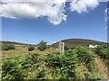
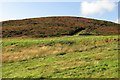
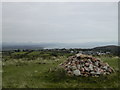
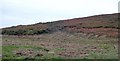
Nearby Images from Geograph Britain and Ireland:
©2022(licence)
©2017(licence)
©2005(licence)
©2010(licence)
©2014(licence)
The above images may not be of the site on this page, they are loaded from Geograph.
Please Submit an Image of this site or go out and take one for us!
Click here to see more info for this site
Nearby sites
Key: Red: member's photo, Blue: 3rd party photo, Yellow: other image, Green: no photo - please go there and take one, Grey: site destroyed
Download sites to:
KML (Google Earth)
GPX (GPS waypoints)
CSV (Garmin/Navman)
CSV (Excel)
To unlock full downloads you need to sign up as a Contributory Member. Otherwise downloads are limited to 50 sites.
Turn off the page maps and other distractions
Nearby sites listing. In the following links * = Image available
50m NW 305° Foel Gron* Hillfort (SH30143108)
243m ENE 69° Ffynnon Arian Holy Well or Sacred Spring (SH30413113)
750m ESE 102° Ffynnon Fyw Holy Well or Sacred Spring (SH30913087)
1.9km NW 310° Pandy Standing Stone* Standing Stone (Menhir) (SH28783229)
2.2km S 191° St Cian's Church (Llangian)* Early Christian Sculptured Stone (SH297289)
2.3km E 87° Mynydd Tir-y-Cwmwd* Chambered Tomb (SH32513110)
2.4km SE 126° The Warren, Abersoch, Submerged Forest and Peat Exposures Natural Stone / Erratic / Other Natural Feature (SH3207729590)
2.8km S 184° Pen-Y-Gaer (Llanengan) Hillfort (SH29862824)
4.1km S 190° Ffynnon Engan* Holy Well or Sacred Spring (SH29302707)
4.1km S 189° St Engan’s Church (Llanengan)* Ancient Temple (SH29412703)
4.2km NW 320° Carnfadryn standing stone west Standing Stone (Menhir) (SH2759034311)
4.4km S 186° Castell Hillfort (Llanengan)* Hillfort (SH29562665)
4.7km NNW 330° Carn Fadrun* Hillfort (SH280352)
4.7km NNW 331° Carn Fadrun Cist Cairn (SH2803735220)
5.1km WSW 255° Gelliwig Ancient Palace (SH252299)
5.5km N 349° Madryn Castle Standing Stone* Standing Stone (Menhir) (SH2932436498)
6.2km WSW 253° Tyn-y-parc Holy Well* Holy Well or Sacred Spring (SH242295)
6.2km WSW 253° Ffynnon Saint (Rhiw)* Holy Well or Sacred Spring (SH24202947)
6.3km S 185° Castel Cilan* Round Barrow(s) (SH294248)
6.3km N 353° Meillionen* Standing Stone (Menhir) (SH2960237370)
6.4km S 176° Pared Mawr Promontory Fort / Cliff Castle (SH30392468)
6.7km WNW 283° Meyllteyrn* Standing Stone (Menhir) (SH23713283)
6.8km WSW 248° Tan-Y-Muriau* Chambered Cairn (SH23772877)
6.9km WSW 258° Mynydd Rhiw Neolithic axe factory* Ancient Mine, Quarry or other Industry (SH23392991)
7.0km WSW 257° Mynydd Rhiw Cairn 3* Cairn (SH23302972)
View more nearby sites and additional images


 We would like to know more about this location. Please feel free to add a brief description and any relevant information in your own language.
 Wir möchten mehr über diese Stätte erfahren. Bitte zögern Sie nicht, eine kurze Beschreibung und relevante Informationen in Deutsch hinzuzufügen.
 Nous aimerions en savoir encore un peu sur les lieux. S'il vous plaît n'hesitez pas à ajouter une courte description et tous les renseignements pertinents dans votre propre langue.
 Quisieramos informarnos un poco más de las lugares. No dude en añadir una breve descripción y otros datos relevantes en su propio idioma.