<< Text Pages >> King's Well (Carsphairn) - Holy Well or Sacred Spring in Scotland in Dumfries and Galloway
Submitted by Anne T on Tuesday, 21 June 2022 Page Views: 344
Springs and Holy WellsSite Name: King's Well (Carsphairn)Country: Scotland
NOTE: This site is 3.294 km away from the location you searched for.
County: Dumfries and Galloway Type: Holy Well or Sacred Spring
Nearest Town: Kirkcudbright Nearest Village: Carsphairn
Map Ref: NX5043591268
Latitude: 55.192984N Longitude: 4.351094W
Condition:
| 5 | Perfect |
| 4 | Almost Perfect |
| 3 | Reasonable but with some damage |
| 2 | Ruined but still recognisable as an ancient site |
| 1 | Pretty much destroyed, possibly visible as crop marks |
| 0 | No data. |
| -1 | Completely destroyed |
| 5 | Superb |
| 4 | Good |
| 3 | Ordinary |
| 2 | Not Good |
| 1 | Awful |
| 0 | No data. |
| 5 | Can be driven to, probably with disabled access |
| 4 | Short walk on a footpath |
| 3 | Requiring a bit more of a walk |
| 2 | A long walk |
| 1 | In the middle of nowhere, a nightmare to find |
| 0 | No data. |
| 5 | co-ordinates taken by GPS or official recorded co-ordinates |
| 4 | co-ordinates scaled from a detailed map |
| 3 | co-ordinates scaled from a bad map |
| 2 | co-ordinates of the nearest village |
| 1 | co-ordinates of the nearest town |
| 0 | no data |
Be the first person to rate this site - see the 'Contribute!' box in the right hand menu.
Internal Links:
External Links:
Holy Well or Sacred Spring in Dumfries and Galloway
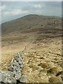
Information about this well has been collected by the Can You Dig It: Lost Wells of Galloway project, who tell us that this well first appeared on the 1st edition Ordnance Survey map of 1852, and "continues to appear through to current mapping (2022)".
They add that the well "sits at 587m (1925ft) on the saddle between Meaul Hill (695m (2250ft)) and Carinsgarroch (659m/2153ft). Nearby on some of the maps is King's Stone [note: see King's Stone (Carsphairn)] ... it is tempting to assume (the name of the well) refers to Robert the Bruce who was known to be at Glentrool and Clatteringshaws in 1307 (both less than 10 miles away as the crow flies) and at Glenluce/Whithorn in 1329 ... of course the well may have been named in jest by shepherds or men building nearby drystane dykes from 1700s."
Recorded as Canmore Site ID 63885, which tells us: "King's Well, a small clear spring. Traditionally, Robert the Bruce drank out of it."
If anyone has visited this well or has any information about it (admittedly it's in a remote spot!) and whether its pure spring water was used for healing or restorative purposes, please let us know by adding a comment here.
The Lost Wells of Galloway project is a community project, "setting out to map and better understand lost wells in Galloway, considering how we relate to these historic features now and how this has changed over time".
You may be viewing yesterday's version of this page. To see the most up to date information please register for a free account.
Do not use the above information on other web sites or publications without permission of the contributor.
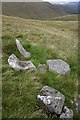
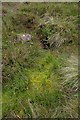
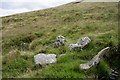
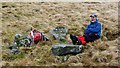
Nearby Images from Geograph Britain and Ireland:
©2011(licence)
©2011(licence)
©2011(licence)
©2016(licence)
©2016(licence)
The above images may not be of the site on this page, they are loaded from Geograph.
Please Submit an Image of this site or go out and take one for us!
Click here to see more info for this site
Nearby sites
Key: Red: member's photo, Blue: 3rd party photo, Yellow: other image, Green: no photo - please go there and take one, Grey: site destroyed
Download sites to:
KML (Google Earth)
GPX (GPS waypoints)
CSV (Garmin/Navman)
CSV (Excel)
To unlock full downloads you need to sign up as a Contributory Member. Otherwise downloads are limited to 50 sites.
Turn off the page maps and other distractions
Nearby sites listing. In the following links * = Image available
25m W 273° King's Stone (Carsphairn) Natural Stone / Erratic / Other Natural Feature (NX50419127)
5.6km ENE 76° Cairn Avel* Cairn (NX55949245)
5.7km ENE 57° Holm Of Daltallochan Stone Circle* Stone Circle (NX55289422)
5.7km ENE 57° Holm of Daltallochan Standing Stone* Standing Stone (Menhir) (NX55399420)
6.2km NE 56° Green Well of Scotland (Carsphairn)* Holy Well or Sacred Spring (NX5573494565)
6.4km E 89° Bardennoch* Cairn (NX56859120)
6.6km E 92° Braidenoch Cross Slabs* Early Christian Sculptured Stone (NX57099081)
6.9km ESE 121° Physic Well (Kells) Holy Well or Sacred Spring (NX5622587525)
8.2km NNE 15° Lamford Burn* Cairn (NX52829916)
8.3km W 279° Moss Knowes* Natural Stone / Erratic / Other Natural Feature (NX42239281)
8.9km SSW 210° Devil's Bowling Green* Natural Stone / Erratic / Other Natural Feature (NX45658375)
9.5km ESE 115° Stroangassel Stone Circle (NX589869)
9.5km N 0° Cairnennock Cairn (NS50800078)
9.6km SW 223° Grey Man of the Merrick* Natural Stone / Erratic / Other Natural Feature (NX43658450)
10.7km NE 51° Gold Wells (Carsphairn) Holy Well or Sacred Spring (NX5896497793)
10.7km NNE 24° Brownhill Burn* Cairn (NS55210089)
11.0km NNE 25° Water of Deugh* Chambered Cairn (NS55420114)
12.0km WNW 302° Cairnwhapple Stone* Natural Stone / Erratic / Other Natural Feature (NX40399796)
12.3km ESE 109° Mackilston N* Cairn (NX61968682)
12.3km ESE 109° Mackilston S* Cairn (NX61968678)
12.9km E 85° Smittons Bridge* Cairn (NX63409188)
13.2km E 85° Stroanfreggan Craig* Hillfort (NX63709206)
13.5km E 87° Stroanfreggan Cairn* Cairn (NX64019142)
13.9km WSW 243° Kirriemore* Chambered Cairn (NX37738544)
14.2km E 79° Round Craigs* Cairn (NX64519355)
View more nearby sites and additional images


 We would like to know more about this location. Please feel free to add a brief description and any relevant information in your own language.
 Wir möchten mehr über diese Stätte erfahren. Bitte zögern Sie nicht, eine kurze Beschreibung und relevante Informationen in Deutsch hinzuzufügen.
 Nous aimerions en savoir encore un peu sur les lieux. S'il vous plaît n'hesitez pas à ajouter une courte description et tous les renseignements pertinents dans votre propre langue.
 Quisieramos informarnos un poco más de las lugares. No dude en añadir una breve descripción y otros datos relevantes en su propio idioma.