<< Our Photo Pages >> Lady Well (Shevlock) - Holy Well or Sacred Spring in England in Cornwall
Submitted by Rory on Tuesday, 05 October 2004 Page Views: 6997
Springs and Holy WellsSite Name: Lady Well (Shevlock)Country: England
NOTE: This site is 3.645 km away from the location you searched for.
County: Cornwall Type: Holy Well or Sacred Spring
Nearest Town: Saltash Nearest Village: Shevlock
Map Ref: SX37425488 Landranger Map Number: 201
Latitude: 50.371298N Longitude: 4.287599W
Condition:
| 5 | Perfect |
| 4 | Almost Perfect |
| 3 | Reasonable but with some damage |
| 2 | Ruined but still recognisable as an ancient site |
| 1 | Pretty much destroyed, possibly visible as crop marks |
| 0 | No data. |
| -1 | Completely destroyed |
| 5 | Superb |
| 4 | Good |
| 3 | Ordinary |
| 2 | Not Good |
| 1 | Awful |
| 0 | No data. |
| 5 | Can be driven to, probably with disabled access |
| 4 | Short walk on a footpath |
| 3 | Requiring a bit more of a walk |
| 2 | A long walk |
| 1 | In the middle of nowhere, a nightmare to find |
| 0 | No data. |
| 5 | co-ordinates taken by GPS or official recorded co-ordinates |
| 4 | co-ordinates scaled from a detailed map |
| 3 | co-ordinates scaled from a bad map |
| 2 | co-ordinates of the nearest village |
| 1 | co-ordinates of the nearest town |
| 0 | no data |
Internal Links:
External Links:
I have visited· I would like to visit
cazzyjane has visited here
 (PID:20907)")
Cheryl Straffon (in Fentynyow Kernow) was delighted by Lady Well when she first encountered it, surmising it to be “clearly a early pagan site.” The fact that this old baptismal well has a dedication different to the local church, would tend support Straffon’s impression. The waters seep out from the structure rather than gather into any depth of pool.
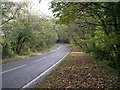
Access Lady Well is in fact on private land, but the landowner has put in no fencing between the footpath leading up from Crafthole and the field where the well sits.
Travel east out of Sheviock on the A387. After taking the very first turning right, stop almost immediately by a gate to your right. The well is through the gate and up the hill, past a quarry and in the north east corner of that plot of land.
You may be viewing yesterday's version of this page. To see the most up to date information please register for a free account.
 (PID:20906)")
Do not use the above information on other web sites or publications without permission of the contributor.
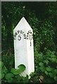
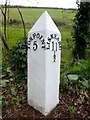
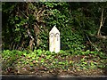
Nearby Images from Geograph Britain and Ireland:
©2017(licence)
©2020(licence)
©2007(licence)
©2005(licence)
©2007(licence)
The above images may not be of the site on this page, they are loaded from Geograph.
Please Submit an Image of this site or go out and take one for us!
Click here to see more info for this site
Nearby sites
Key: Red: member's photo, Blue: 3rd party photo, Yellow: other image, Green: no photo - please go there and take one, Grey: site destroyed
Download sites to:
KML (Google Earth)
GPX (GPS waypoints)
CSV (Garmin/Navman)
CSV (Excel)
To unlock full downloads you need to sign up as a Contributory Member. Otherwise downloads are limited to 50 sites.
Turn off the page maps and other distractions
Nearby sites listing. In the following links * = Image available
1.1km SW 232° Market Cross, Crafthole* Ancient Cross (SX36505420)
1.1km W 276° Stumpy Cross* Ancient Cross (SX36285504)
3.6km NW 326° Venton Gwavas* Holy Well or Sacred Spring (SX355579)
4.4km NE 42° Trehan Cross* Ancient Cross (SX405581)
6.6km NNE 21° Holy Well near Saltash Holy Well or Sacred Spring (SX400610)
7.2km NNE 24° St Mary the Virgin (Cornwall)* Holy Well or Sacred Spring (SX4055461327)
7.6km SE 143° Garry Wells* Holy Well or Sacred Spring (SX418487)
7.8km ESE 109° St Julian's Well (Maker)* Holy Well or Sacred Spring (SX447521)
7.8km ESE 105° Mount Edgecombe Barrow* Round Barrow(s) (SX4495052600)
7.9km SE 145° Rame Head* Hillfort (SX41804825)
8.6km NW 314° Padderbury Top Ancient Village or Settlement (SX3139661023)
10.1km E 94° Plymouth Giants Hill Figure or Geoglyph (SX475539)
10.2km WNW 285° Bin Down (East Looe)* Ancient Village or Settlement (SX2764957830)
10.7km E 95° St Helena Volcanic Stone* Modern Stone Circle etc (SX48075368)
11.3km W 266° Barrow near Looe Barrow Cemetery (SX2611054356)
11.4km E 97° Mount Batten Ancient Mine, Quarry or other Industry (SX4876053196)
11.6km NNW 326° Quethiock Cross* Ancient Cross (SX31296471)
11.6km E 94° Cattedown Bone Cave Cave or Rock Shelter (SX490537)
11.8km NNE 19° St Indract's Well* Holy Well or Sacred Spring (SX417659)
11.8km WSW 256° St Martin's Well (Shutta) Holy Well or Sacred Spring (SX258524)
11.9km W 261° St Mary's Well (Cornwall)* Holy Well or Sacred Spring (SX256534)
12.1km NNW 342° Collects Well* Holy Well or Sacred Spring (SX3399466483)
12.9km W 259° Portlooe Cross* Ancient Cross (SX24625289)
13.0km NNW 344° Cadson Bury* Hillfort (SX342675)
13.7km WNW 281° St Cuby's Well (Duloe)* Holy Well or Sacred Spring (SX24085796)
View more nearby sites and additional images


 We would like to know more about this location. Please feel free to add a brief description and any relevant information in your own language.
 Wir möchten mehr über diese Stätte erfahren. Bitte zögern Sie nicht, eine kurze Beschreibung und relevante Informationen in Deutsch hinzuzufügen.
 Nous aimerions en savoir encore un peu sur les lieux. S'il vous plaît n'hesitez pas à ajouter une courte description et tous les renseignements pertinents dans votre propre langue.
 Quisieramos informarnos un poco más de las lugares. No dude en añadir una breve descripción y otros datos relevantes en su propio idioma.