<< Our Photo Pages >> Altlarie - Cairn in Scotland in Moray
Submitted by vicky on Tuesday, 12 August 2003 Page Views: 6120
Neolithic and Bronze AgeSite Name: Altlarie Alternative Name: Tom a' ChladhaCountry: Scotland
NOTE: This site is 15.955 km away from the location you searched for.
County: Moray Type: Cairn
Nearest Village: Newtonmore
Map Ref: NN726995 Landranger Map Number: 35
Latitude: 57.068853N Longitude: 4.102836W
Condition:
| 5 | Perfect |
| 4 | Almost Perfect |
| 3 | Reasonable but with some damage |
| 2 | Ruined but still recognisable as an ancient site |
| 1 | Pretty much destroyed, possibly visible as crop marks |
| 0 | No data. |
| -1 | Completely destroyed |
| 5 | Superb |
| 4 | Good |
| 3 | Ordinary |
| 2 | Not Good |
| 1 | Awful |
| 0 | No data. |
| 5 | Can be driven to, probably with disabled access |
| 4 | Short walk on a footpath |
| 3 | Requiring a bit more of a walk |
| 2 | A long walk |
| 1 | In the middle of nowhere, a nightmare to find |
| 0 | No data. |
| 5 | co-ordinates taken by GPS or official recorded co-ordinates |
| 4 | co-ordinates scaled from a detailed map |
| 3 | co-ordinates scaled from a bad map |
| 2 | co-ordinates of the nearest village |
| 1 | co-ordinates of the nearest town |
| 0 | no data |
Be the first person to rate this site - see the 'Contribute!' box in the right hand menu.
Internal Links:
External Links:
I have visited· I would like to visit
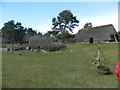
Megalithicmatt visited on 19th Jun 2021 - their rating: Cond: 1 Amb: 3 Access: 4 This rounded hillock lies within Newtonmore's Highland Folk Museum. The site is free to access. One lower side of the hillock has been truncated by the railway. The top is flattened off with the vague outline of a building on top out of which trees are growing. There are some exposed stones on the east side of the hill but otherwise nothing obvious left to indicate this once had a cairn and standing stones.
")
Have you visited this site? Please add a comment below.
You may be viewing yesterday's version of this page. To see the most up to date information please register for a free account.
Do not use the above information on other web sites or publications without permission of the contributor.
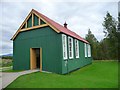
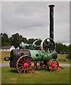
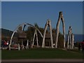
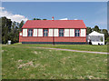
Nearby Images from Geograph Britain and Ireland:
©2010(licence)
©2022(licence)
©2010(licence)
©2018(licence)
©2016(licence)
The above images may not be of the site on this page, they are loaded from Geograph.
Please Submit an Image of this site or go out and take one for us!
Click here to see more info for this site
Nearby sites
Key: Red: member's photo, Blue: 3rd party photo, Yellow: other image, Green: no photo - please go there and take one, Grey: site destroyed
Download sites to:
KML (Google Earth)
GPX (GPS waypoints)
CSV (Garmin/Navman)
CSV (Excel)
To unlock full downloads you need to sign up as a Contributory Member. Otherwise downloads are limited to 50 sites.
Turn off the page maps and other distractions
Nearby sites listing. In the following links * = Image available
3.5km ENE 78° Kingussie Standing Stones (NH761001)
3.6km WNW 282° Sidhean Mor Dail A' Chaorainn* Hillfort (NH69060039)
4.8km W 267° Glenbanchor Cairn (NN678994)
5.6km ENE 63° Lynchat* Souterrain (Fogou, Earth House) (NH77670193)
10.7km ENE 60° Dunachton* Class I Pictish Symbol Stone (NH820046)
12.7km NE 54° Kincraig Chambered Cairn Chambered Cairn (NH83140660)
14.9km NE 51° Delfour* Cairn (NH844086)
15.8km WSW 244° Dun da Lamh* Stone Fort or Dun (NN582929)
17.2km NE 51° Ballinluig Cairn* Chambered Cairn (NH86380989)
22.0km NE 49° Aviemore* Stone Circle (NH89681347)
24.1km NE 47° Loch nan Carraigean* Cairn (NH90781547)
24.2km NE 47° Grenish* Stone Circle (NH90781550)
25.0km NE 45° Avielochan* Chambered Tomb (NH908167)
25.9km NE 51° Pityoulish Standing Stone* Standing Stone (Menhir) (NH93251521)
26.5km NE 51° Lynchurn Class I Pictish Symbol Stone (NH93841551)
28.4km NNW 341° Dhuallow Clava Cairn (NH644267)
28.8km NE 43° Deishar* Round Cairn (NH928201)
30.0km NE 44° Drumuillie* Round Cairn (NH940206)
32.2km NE 46° Tullochgorum Stones* Standing Stones (NH96702101)
32.2km NE 45° Toum Cairn* Cairn (NH9601621757)
32.3km NE 46° Tullochgorum Cairn* Stone Circle (NH96482130)
33.5km NE 41° Easter Gallovie* Round Cairn (NH956240)
33.8km N 351° Croftcroy Chambered Tomb Chambered Tomb (NH683331)
33.9km N 351° Croftcroy Stone Circle* Stone Circle (NH6835133191)
34.0km NNW 344° Eastertown Cairn* Cairn (NH64203245)
View more nearby sites and additional images


 We would like to know more about this location. Please feel free to add a brief description and any relevant information in your own language.
 Wir möchten mehr über diese Stätte erfahren. Bitte zögern Sie nicht, eine kurze Beschreibung und relevante Informationen in Deutsch hinzuzufügen.
 Nous aimerions en savoir encore un peu sur les lieux. S'il vous plaît n'hesitez pas à ajouter une courte description et tous les renseignements pertinents dans votre propre langue.
 Quisieramos informarnos un poco más de las lugares. No dude en añadir una breve descripción y otros datos relevantes en su propio idioma.