<< Text Pages >> Wasteberry Camp - Hillfort in England in Devon
Submitted by coldrum on Wednesday, 26 October 2011 Page Views: 3373
Iron Age and Later PrehistorySite Name: Wasteberry Camp Alternative Name: Lyneham WarrenCountry: England
NOTE: This site is 2.742 km away from the location you searched for.
County: Devon Type: Hillfort
Map Ref: SX5738854066
Latitude: 50.369165N Longitude: 4.006691W
Condition:
| 5 | Perfect |
| 4 | Almost Perfect |
| 3 | Reasonable but with some damage |
| 2 | Ruined but still recognisable as an ancient site |
| 1 | Pretty much destroyed, possibly visible as crop marks |
| 0 | No data. |
| -1 | Completely destroyed |
| 5 | Superb |
| 4 | Good |
| 3 | Ordinary |
| 2 | Not Good |
| 1 | Awful |
| 0 | No data. |
| 5 | Can be driven to, probably with disabled access |
| 4 | Short walk on a footpath |
| 3 | Requiring a bit more of a walk |
| 2 | A long walk |
| 1 | In the middle of nowhere, a nightmare to find |
| 0 | No data. |
| 5 | co-ordinates taken by GPS or official recorded co-ordinates |
| 4 | co-ordinates scaled from a detailed map |
| 3 | co-ordinates scaled from a bad map |
| 2 | co-ordinates of the nearest village |
| 1 | co-ordinates of the nearest town |
| 0 | no data |
Be the first person to rate this site - see the 'Contribute!' box in the right hand menu.
Internal Links:
External Links:
I have visited· I would like to visit
MortenKiil visited on 30th Dec 2013 - their rating: Cond: 2 Amb: 3 Access: 3 Private Land.
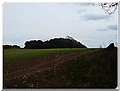
"Earthwork remains of an Iron Age bivallate hillfort. Also the site of a medieval deer park and post-medieval warren. Situated 800 metres north west of Lyneham House. The hillfort consists of three lines of ramparts on the north and west sides of the spur which are between 15 metres to 40 metres apart. The entrance lies to the north west. Despite some damage by ploughing and stock erosion the earthworks are well preserved. The inner rampart of the hillfort was reused to form part of the pale for Lyneham deer park which was in existence by 1610. The rabbit warren was situated on the valley floor on the east side of Warren Wood. The ruin of a single-roomed warrener's house is situated within the ramparts of the hillfort. Scheduled."
Source: Pastscape.
You may be viewing yesterday's version of this page. To see the most up to date information please register for a free account.
Do not use the above information on other web sites or publications without permission of the contributor.
Nearby Images from Geograph Britain and Ireland:
©2013(licence)
©2013(licence)
©2013(licence)
©2013(licence)
©2010(licence)
The above images may not be of the site on this page, they are loaded from Geograph.
Please Submit an Image of this site or go out and take one for us!
Click here to see more info for this site
Nearby sites
Key: Red: member's photo, Blue: 3rd party photo, Yellow: other image, Green: no photo - please go there and take one, Grey: site destroyed
Download sites to:
KML (Google Earth)
GPX (GPS waypoints)
CSV (Garmin/Navman)
CSV (Excel)
To unlock full downloads you need to sign up as a Contributory Member. Otherwise downloads are limited to 50 sites.
Turn off the page maps and other distractions
Nearby sites listing. In the following links * = Image available
4.5km WSW 254° Elburton Cross* Ancient Cross (SX5304952984)
4.8km W 265° Elburton Burial Mound Round Barrow(s) (SX526538)
6.1km SE 124° Holbury Camp (Devon) Hillfort (SX62385049)
6.2km N 359° Crownhill Down Cairn Circle* Cairn (SX57486026)
6.3km NNW 330° Boringdon Camp* Hillfort (SX544596)
6.3km WSW 256° Burrow Hill Round Barrow(s) (SX512527)
6.5km E 96° Holy Well, Ermington* Holy Well or Sacred Spring (SX6380853189)
6.5km NNE 21° Delamore House dolmen* Modern Stone Circle etc (SX5991760112)
8.1km NNW 347° Collard Tor circle Stone Circle (SX5584062030)
8.1km NNW 348° Collard Tor E* Stone Row / Alignment (SX55856204)
8.1km NNW 347° Collard Tor W* Stone Row / Alignment (SX5583362045)
8.3km N 6° Cholwich Town Cairn Circle* Stone Circle (SX58466225)
8.3km NNE 26° Rook Tor Ring Cairn (SX612614)
8.3km N 6° Cholwichtown stone row* Stone Row / Alignment (SX585623)
8.4km W 266° Cattedown Bone Cave Cave or Rock Shelter (SX490537)
8.5km NNW 345° Shaugh Moor South Stone Circle (SX554623)
8.5km NNE 15° Penn Beacon Platform Cairn Circle Cairn (SX59826225)
8.6km W 263° Mount Batten Ancient Mine, Quarry or other Industry (SX4876053196)
8.7km NNW 345° Hawk's Tor (Shaugh Moor) Cave or Rock Shelter (SX55396250)
8.7km NNE 13° Penn Beacon SW* Multiple Stone Rows / Avenue (SX5952062471)
8.7km NNE 13° Penn Beacon 1 Cairn Circle & Cist* Cairn (SX5953262482)
8.7km ENE 60° Addicombe Cairn and Enclosure* Cairn (SX651582)
8.8km NE 44° Burford Down Stone Row* Stone Row / Alignment (SX63696016)
8.8km NE 44° Burford Down Cairn Circle* Stone Circle (SX6370060170)
8.8km NE 52° Harford settlement* Ancient Village or Settlement (SX6444559313)
View more nearby sites and additional images


 We would like to know more about this location. Please feel free to add a brief description and any relevant information in your own language.
 Wir möchten mehr über diese Stätte erfahren. Bitte zögern Sie nicht, eine kurze Beschreibung und relevante Informationen in Deutsch hinzuzufügen.
 Nous aimerions en savoir encore un peu sur les lieux. S'il vous plaît n'hesitez pas à ajouter une courte description et tous les renseignements pertinents dans votre propre langue.
 Quisieramos informarnos un poco más de las lugares. No dude en añadir una breve descripción y otros datos relevantes en su propio idioma.