<< Text Pages >> Boiling Springs (Cambusbarron) - Holy Well or Sacred Spring in Scotland in Stirling
Submitted by Anne T on Tuesday, 02 May 2017 Page Views: 1499
Springs and Holy WellsSite Name: Boiling Springs (Cambusbarron)Country: Scotland County: Stirling Type: Holy Well or Sacred Spring
Nearest Town: Stirling Nearest Village: Cambusbarron
Map Ref: NS77879124
Latitude: 56.098280N Longitude: 3.964877W
Condition:
| 5 | Perfect |
| 4 | Almost Perfect |
| 3 | Reasonable but with some damage |
| 2 | Ruined but still recognisable as an ancient site |
| 1 | Pretty much destroyed, possibly visible as crop marks |
| 0 | No data. |
| -1 | Completely destroyed |
| 5 | Superb |
| 4 | Good |
| 3 | Ordinary |
| 2 | Not Good |
| 1 | Awful |
| 0 | No data. |
| 5 | Can be driven to, probably with disabled access |
| 4 | Short walk on a footpath |
| 3 | Requiring a bit more of a walk |
| 2 | A long walk |
| 1 | In the middle of nowhere, a nightmare to find |
| 0 | No data. |
| 5 | co-ordinates taken by GPS or official recorded co-ordinates |
| 4 | co-ordinates scaled from a detailed map |
| 3 | co-ordinates scaled from a bad map |
| 2 | co-ordinates of the nearest village |
| 1 | co-ordinates of the nearest town |
| 0 | no data |
Be the first person to rate this site - see the 'Contribute!' box in the right hand menu.
Internal Links:
External Links:
Holy Well or Sacred Spring in Stirling
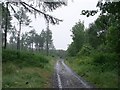
The Northern Antiquarian (TNA) features an old line drawing of this pair of Boiling Springs, located to the west of Cambusbarron in Stirlingshire. See their page for
Boiling Springs, Cambusbarron, Stirlingshire, which gives a brief 'archaeology and history'. The springs no longer exist, possibly have been absorbed into the quarries at Gillies Hill, although TNA mentions that one of them was close to the old building of Fir Park, whose overgrown remains are within the woods at grid-reference NS 7787 9124.
Canmore ID 121635 has a record for the quarry (date unassigned), together with a tang and barbed arrowhead and a quern found nearby, but has no further information.
The TNA page also mentions that the picturesque well heads were: "then situated in a marshy dell and surrounded by a dense pine wood near to the ancient ‘Boiling Springs’, now dried up by the sinking of the lime pits, and immediately off the old bridle road from Stirling to Glasgow by Murrayshall, shows very ancient remains of wells connected with the original water supply of Stirling by lead pipes from ‘Lessfeerie Springs’, situated in the Touch Hills." Canmore ID 46271 mentions the lime kilns and includes a photograph, but there is no mention of the springs.
Note: If anyone has any further information about these springs and well heads, please add them to this page
You may be viewing yesterday's version of this page. To see the most up to date information please register for a free account.
Do not use the above information on other web sites or publications without permission of the contributor.
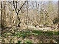
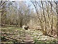
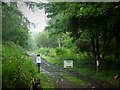
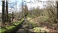
Nearby Images from Geograph Britain and Ireland:
©2021(licence)
©2021(licence)
©2020(licence)
©2012(licence)
©2010(licence)
The above images may not be of the site on this page, they are loaded from Geograph.
Please Submit an Image of this site or go out and take one for us!
Click here to see more info for this site
Nearby sites
Key: Red: member's photo, Blue: 3rd party photo, Yellow: other image, Green: no photo - please go there and take one, Grey: site destroyed
Download sites to:
KML (Google Earth)
GPX (GPS waypoints)
CSV (Garmin/Navman)
CSV (Excel)
To unlock full downloads you need to sign up as a Contributory Member. Otherwise downloads are limited to 50 sites.
Turn off the page maps and other distractions
Nearby sites listing. In the following links * = Image available
579m SW 226° Wallstale Dun* Stone Fort or Dun (NS77449085)
1.1km WNW 296° Gillies Hill* Hillfort (NS76879176)
1.3km WSW 239° Wester Craigend Dun* Stone Fort or Dun (NS7677790621)
1.3km N 356° Chapel Well (Cambusbarron)* Holy Well or Sacred Spring (NS77819251)
1.3km WSW 251° Castlehill Dun* Stone Fort or Dun (NS76619084)
1.4km N 4° Birkill House Cairn (NS780926)
1.5km NNE 19° Coneypark Nursery (Cambusbarron)* Cairn (NS78409263)
1.7km N 10° Douglas Terrace (Cambusbarron) Cairn (NS782929)
1.8km N 359° St Thomas's Well (Cambusbarron)* Holy Well or Sacred Spring (NS7788493056)
1.8km NNE 14° King's Park Cup and Rings* Rock Art (NS7837892998)
2.0km NE 51° Randolphfield Stones* Standing Stones (NS79449244)
2.2km ENE 58° Wester Livilands* Broch or Nuraghe (NS7979692369)
2.5km NE 44° St Ninian's Well (Stirling)* Holy Well or Sacred Spring (NS7969093012)
2.8km W 261° Castlehill Wood Dun* Stone Fort or Dun (NS75089090)
2.9km NNE 20° Butt Well* Holy Well or Sacred Spring (NS78949389)
3.6km NNE 22° Our Lady's Well (Stirling) Holy Well or Sacred Spring (NS79329454)
3.9km ESE 105° St Ninians Cursus Cursus (NS81599016)
3.9km ESE 105° St Ninians Cursus Cursus (NS81679012)
4.2km WNW 286° St Corbet's Well (Touch) Holy Well or Sacred Spring (NS738925)
4.6km WSW 242° King's Yett (St Ninian's) Cairn (NS73738922)
5.3km NNE 28° Bel Stane (Causewayhead) Standing Stone (Menhir) (NS805958)
5.4km NNE 33° Abbey Craig Vitrified Fort* Hillfort (NS80949565)
5.4km SSW 197° Loch Coulter Crannog* Crannog (NS761861)
6.3km NNE 24° Pathfoot Stone* Standing Stone (Menhir) (NS8060496871)
6.3km NNE 32° Airthrey Stone* Standing Stone (Menhir) (NS81409650)
View more nearby sites and additional images


 We would like to know more about this location. Please feel free to add a brief description and any relevant information in your own language.
 Wir möchten mehr über diese Stätte erfahren. Bitte zögern Sie nicht, eine kurze Beschreibung und relevante Informationen in Deutsch hinzuzufügen.
 Nous aimerions en savoir encore un peu sur les lieux. S'il vous plaît n'hesitez pas à ajouter une courte description et tous les renseignements pertinents dans votre propre langue.
 Quisieramos informarnos un poco más de las lugares. No dude en añadir una breve descripción y otros datos relevantes en su propio idioma.