<< Our Photo Pages >> Pathfoot Stone - Standing Stone (Menhir) in Scotland in Stirling
Submitted by rogerkread on Saturday, 08 May 2021 Page Views: 3887
Neolithic and Bronze AgeSite Name: Pathfoot Stone Alternative Name: Airthrey Castle WestCountry: Scotland
NOTE: This site is 0.208 km away from the location you searched for.
County: Stirling Type: Standing Stone (Menhir)
Nearest Town: Stirling Nearest Village: Bridge of Allan
Map Ref: NS8060496871
Latitude: 56.149534N Longitude: 3.923478W
Condition:
| 5 | Perfect |
| 4 | Almost Perfect |
| 3 | Reasonable but with some damage |
| 2 | Ruined but still recognisable as an ancient site |
| 1 | Pretty much destroyed, possibly visible as crop marks |
| 0 | No data. |
| -1 | Completely destroyed |
| 5 | Superb |
| 4 | Good |
| 3 | Ordinary |
| 2 | Not Good |
| 1 | Awful |
| 0 | No data. |
| 5 | Can be driven to, probably with disabled access |
| 4 | Short walk on a footpath |
| 3 | Requiring a bit more of a walk |
| 2 | A long walk |
| 1 | In the middle of nowhere, a nightmare to find |
| 0 | No data. |
| 5 | co-ordinates taken by GPS or official recorded co-ordinates |
| 4 | co-ordinates scaled from a detailed map |
| 3 | co-ordinates scaled from a bad map |
| 2 | co-ordinates of the nearest village |
| 1 | co-ordinates of the nearest town |
| 0 | no data |
Internal Links:
External Links:
I have visited· I would like to visit
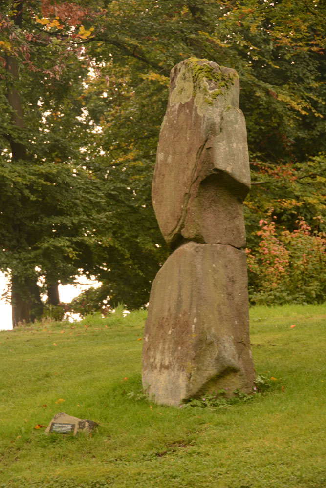
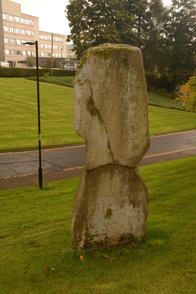
Anne T visited on 26th Sep 2017 - their rating: Cond: 2 Amb: 3 Access: 5 Pathfoot Standing Stone, University of Stirling: Walking back across the campus from Logie Old Church, we got caught in a very heavy shower of rain and had to shelter by the student residences at the western side of the campus.
When I caught sight of this, I thought this was a sculpture, not a real standing stone at first. It is at the side of Armitage Road, just north of its’ (busy) junction with Grange Road at the north western side of the campus. We clambered up the wet, slippery slope to take some photos, stared at by the passing students.
By this time, my feet were aching, as we’d spent the best part of 2 hours walking round and round the campus. With Stirling Castle still to come, I welcomed getting back into the car.

It is easily found in the grounds of Stirling University - enter through the main gates and take the road veering left - you'll soon see it on the bank to the left.
For more information see Canmore ID 47166, which contains an entry from 1963 saying: "This standing stone has been removed since the date of visit by the RCAHMS (in 1952). It had fallen many years ago, and when visited, the basal portion, 3' 10" high, had been re-erected, with two large fragments lying at its base. The original stone is said (A F Hutchison 1893) to have been 9'4" high. The re-erected part measures 2' 10" x 1' 10" at base." In 1978 they add: "This stone has been re-erected; originally it stood 2.8m high."
The Northern Antiquarian (TNA) also features a page for this standing stone - see their entry for Pathfoot Stone, Airthrey, Stirling, Stirlingshire, which includes directions for finding the stone, photographs, a Royal Commission report from 1952 and local folklore.
Additional text by Anne T and Jess Mischke
You may be viewing yesterday's version of this page. To see the most up to date information please register for a free account.





Do not use the above information on other web sites or publications without permission of the contributor.
Click here to see more info for this site
Nearby sites
Key: Red: member's photo, Blue: 3rd party photo, Yellow: other image, Green: no photo - please go there and take one, Grey: site destroyed
Download sites to:
KML (Google Earth)
GPX (GPS waypoints)
CSV (Garmin/Navman)
CSV (Excel)
To unlock full downloads you need to sign up as a Contributory Member. Otherwise downloads are limited to 50 sites.
Turn off the page maps and other distractions
Nearby sites listing. In the following links * = Image available
660m WNW 298° Lentran (Bridge of Allan) Cist (NS80039720)
847m ESE 106° The Victoria Stone* Marker Stone (NS8141296608)
876m ESE 113° Airthrey Stone* Standing Stone (Menhir) (NS81409650)
937m E 83° Logie Old Kirk (Stirling)* Early Christian Sculptured Stone (NS81549696)
1.1km S 184° Bel Stane (Causewayhead) Standing Stone (Menhir) (NS805958)
1.3km SSE 163° Abbey Craig Vitrified Fort* Hillfort (NS80949565)
1.4km NNE 31° Fairy Well (Logie)* Holy Well or Sacred Spring (NS81359804)
1.6km NW 321° Fairy Knowe (Bridge of Allan)* Cairn (NS79619818)
2.3km N 355° Cuparlaw Wood (Bridge of Allan) Cairn (NS80469916)
2.4km NNE 14° Pendreich 3 (Bridge of Allan) Cairn (NS81259922)
2.4km NNE 14° Pendreich 1 (Bridge of Allan) Cairn (NS8124499236)
2.5km N 10° Split Stone (Bridge of Allan) Standing Stone (Menhir) (NS8111699311)
2.6km NNE 12° Pendreich 2 (Bridge of Allan) Cairn (NS81239938)
2.7km SSW 207° Our Lady's Well (Stirling) Holy Well or Sacred Spring (NS79329454)
2.9km NNE 14° The Great Stane O' Pendreigh* Standing Stone (Menhir) (NS8138299686)
3.4km SSW 208° Butt Well* Holy Well or Sacred Spring (NS78949389)
4.0km SSW 192° St Ninian's Well (Stirling)* Holy Well or Sacred Spring (NS7969093012)
4.1km NW 326° Kippenross House (Dunblane) Cairn (NN78370036)
4.5km SSW 208° King's Park Cup and Rings* Rock Art (NS7837892998)
4.6km S 189° Wester Livilands* Broch or Nuraghe (NS7979692369)
4.6km SSW 193° Randolphfield Stones* Standing Stones (NS79449244)
4.6km SSW 210° Douglas Terrace (Cambusbarron) Cairn (NS782929)
4.7km SW 214° St Thomas's Well (Cambusbarron)* Holy Well or Sacred Spring (NS7788493056)
4.8km SSW 206° Coneypark Nursery (Cambusbarron)* Cairn (NS78409263)
5.0km SSW 210° Birkill House Cairn (NS780926)
View more nearby sites and additional images


 We would like to know more about this location. Please feel free to add a brief description and any relevant information in your own language.
 Wir möchten mehr über diese Stätte erfahren. Bitte zögern Sie nicht, eine kurze Beschreibung und relevante Informationen in Deutsch hinzuzufügen.
 Nous aimerions en savoir encore un peu sur les lieux. S'il vous plaît n'hesitez pas à ajouter une courte description et tous les renseignements pertinents dans votre propre langue.
 Quisieramos informarnos un poco más de las lugares. No dude en añadir una breve descripción y otros datos relevantes en su propio idioma.