<< Our Photo Pages >> Dinas Bach (Cilycwm) - Hillfort in Wales in Carmarthenshire
Submitted by geoffstickland on Friday, 14 August 2020 Page Views: 687
Iron Age and Later PrehistorySite Name: Dinas Bach (Cilycwm)Country: Wales County: Carmarthenshire Type: Hillfort
Nearest Town: Llandovery Nearest Village: Rhandirmwyn
Map Ref: SN77704310
Latitude: 52.072719N Longitude: 3.78581W
Condition:
| 5 | Perfect |
| 4 | Almost Perfect |
| 3 | Reasonable but with some damage |
| 2 | Ruined but still recognisable as an ancient site |
| 1 | Pretty much destroyed, possibly visible as crop marks |
| 0 | No data. |
| -1 | Completely destroyed |
| 5 | Superb |
| 4 | Good |
| 3 | Ordinary |
| 2 | Not Good |
| 1 | Awful |
| 0 | No data. |
| 5 | Can be driven to, probably with disabled access |
| 4 | Short walk on a footpath |
| 3 | Requiring a bit more of a walk |
| 2 | A long walk |
| 1 | In the middle of nowhere, a nightmare to find |
| 0 | No data. |
| 5 | co-ordinates taken by GPS or official recorded co-ordinates |
| 4 | co-ordinates scaled from a detailed map |
| 3 | co-ordinates scaled from a bad map |
| 2 | co-ordinates of the nearest village |
| 1 | co-ordinates of the nearest town |
| 0 | no data |
Internal Links:
External Links:
I have visited· I would like to visit
geoffstickland has visited here
 (PID:214632)")
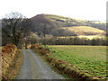
Although Coflein declines to to ascribe a period to this site, it does have all the features of a typical hill fort. There is a flat area about the size of a tennis court at the top of a steep hill (I walked up it!). There is a small mound in the middle of the summit and the site has commanding views in all directions.
You may be viewing yesterday's version of this page. To see the most up to date information please register for a free account.
 (PID:214631)")
Do not use the above information on other web sites or publications without permission of the contributor.
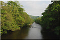
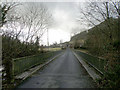
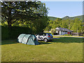
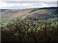
Nearby Images from Geograph Britain and Ireland:
©2009(licence)
©2009(licence)
©2013(licence)
©2011(licence)
©2009(licence)
The above images may not be of the site on this page, they are loaded from Geograph.
Please Submit an Image of this site or go out and take one for us!
Click here to see more info for this site
Nearby sites
Key: Red: member's photo, Blue: 3rd party photo, Yellow: other image, Green: no photo - please go there and take one, Grey: site destroyed
Download sites to:
KML (Google Earth)
GPX (GPS waypoints)
CSV (Garmin/Navman)
CSV (Excel)
To unlock full downloads you need to sign up as a Contributory Member. Otherwise downloads are limited to 50 sites.
Turn off the page maps and other distractions
Nearby sites listing. In the following links * = Image available
1.4km SE 140° Pen Rhiw'r Onen Cairn* Cairn (SN78604197)
1.5km SSE 159° PEN-Y-RHIW FACH CAIRN Round Barrow(s) (SN78234165)
1.6km E 89° Garreg Garn Fair* Standing Stone (Menhir) (SN79334310)
1.6km E 91° Garn fawr (Carmarthenshire)* Cairn (SN79334304)
2.2km S 188° Dinas Bach (Llanfair ar y Bryn)* Hillfort (SN77354093)
2.2km SSE 162° Gwynfaes Maenhir* Standing Stone (Menhir) (SN78334097)
2.3km ESE 119° Cae Pentwyr* Cairn (SN79674196)
2.5km ENE 72° Bryn Poeth Uchaf (North & South)* Ring Cairn (SN80054382)
2.6km ENE 66° Cerrig Cynant* Stone Circle (SN80114411)
2.8km NNW 345° Gelli Burial Chamber* Chambered Cairn (SN7703845843)
2.9km N 357° Ty Newydd Standing Stone* Standing Stone (Menhir) (SN776460)
3.0km NE 43° Carn Wen (Rhandirmwyn)* Cairn (SN79834527)
3.7km E 95° Maes Mynach Cairn Cemetery - Cwm Lwnor Cairn (SN81404266)
3.8km NE 44° Carreg Craig y Moch Standing Stone (Menhir) (SN804458)
4.1km NE 38° Carn Twrch* Cairn (SN80344630)
4.2km E 95° Maes Mynach Cairn Cemetery - Cwm Lwyndr Cairn Cairn (SN81844266)
4.2km NE 34° Cerrig Cedny* Cairn (SN80144651)
4.3km NNW 333° Randirmwyn Standing Stone* Standing Stone (Menhir) (SN758470)
4.4km S 175° Pen Y Gaer (Cynghordy)* Hillfort (SN77993869)
4.4km WNW 290° Mynydd Mallaen* Standing Stone (Menhir) (SN73564471)
4.7km NNW 331° Cefn Gwenffrwd Maenhir* Standing Stone (Menhir) (SN75514725)
4.8km ENE 63° Cynant Fach Cairn* Cairn (SN82054515)
5.0km WNW 292° Maen Bach* Standing Stone (Menhir) (SN73084507)
5.4km SSE 149° Cefn Pâl North Defended Enclosure* Hillfort (SN80433840)
5.7km SSE 152° Cefn Pâl South Defended Enclosure* Hillfort (SN80253805)
View more nearby sites and additional images


 We would like to know more about this location. Please feel free to add a brief description and any relevant information in your own language.
 Wir möchten mehr über diese Stätte erfahren. Bitte zögern Sie nicht, eine kurze Beschreibung und relevante Informationen in Deutsch hinzuzufügen.
 Nous aimerions en savoir encore un peu sur les lieux. S'il vous plaît n'hesitez pas à ajouter une courte description et tous les renseignements pertinents dans votre propre langue.
 Quisieramos informarnos un poco más de las lugares. No dude en añadir una breve descripción y otros datos relevantes en su propio idioma.