

<< Our Photo Pages >> Pen Y Gaer (Cynghordy) - Hillfort in Wales in Carmarthenshire
Submitted by geoffstickland on Monday, 04 January 2021 Page Views: 629
Iron Age and Later PrehistorySite Name: Pen Y Gaer (Cynghordy)Country: Wales County: Carmarthenshire Type: Hillfort
Nearest Town: Llandovery Nearest Village: Cynghordy
Map Ref: SN77993869
Latitude: 52.033153N Longitude: 3.780005W
Condition:
| 5 | Perfect |
| 4 | Almost Perfect |
| 3 | Reasonable but with some damage |
| 2 | Ruined but still recognisable as an ancient site |
| 1 | Pretty much destroyed, possibly visible as crop marks |
| 0 | No data. |
| -1 | Completely destroyed |
| 5 | Superb |
| 4 | Good |
| 3 | Ordinary |
| 2 | Not Good |
| 1 | Awful |
| 0 | No data. |
| 5 | Can be driven to, probably with disabled access |
| 4 | Short walk on a footpath |
| 3 | Requiring a bit more of a walk |
| 2 | A long walk |
| 1 | In the middle of nowhere, a nightmare to find |
| 0 | No data. |
| 5 | co-ordinates taken by GPS or official recorded co-ordinates |
| 4 | co-ordinates scaled from a detailed map |
| 3 | co-ordinates scaled from a bad map |
| 2 | co-ordinates of the nearest village |
| 1 | co-ordinates of the nearest town |
| 0 | no data |
Internal Links:
External Links:
I have visited· I would like to visit
geoffstickland has visited here
 (PID:221313)")
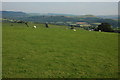
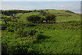
An Iron Age Hill Fort set on a prominent hill overlooking the town of Llandovery. Signs can be discerned of a bank and shallow ditch when viewed from the South West but there are little signs of human habitation. It is a natural defensive position being steeply sloped on all sides.
You may be viewing yesterday's version of this page. To see the most up to date information please register for a free account.
Do not use the above information on other web sites or publications without permission of the contributor.
Nearby Images from Geograph Britain and Ireland:
©2022(licence)
©2014(licence)
©2022(licence)
©2008(licence)
©2008(licence)
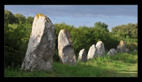
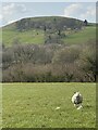
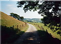
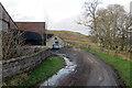
The above images may not be of the site on this page, they are loaded from Geograph.
Please Submit an Image of this site or go out and take one for us!
Click here to see more info for this site
Nearby sites
Key: Red: member's photo, Blue: 3rd party photo, Yellow: other image, Green: no photo - please go there and take one, Grey: site destroyed
Download sites to:
KML (Google Earth)
GPX (GPS waypoints)
CSV (Garmin/Navman)
CSV (Excel)
To unlock full downloads you need to sign up as a Contributory Member. Otherwise downloads are limited to 50 sites.
Turn off the page maps and other distractions
Nearby sites listing. In the following links * = Image available
2.3km N 7° Gwynfaes Maenhir* Standing Stone (Menhir) (SN78334097)
2.3km NNW 343° Dinas Bach (Llanfair ar y Bryn)* Hillfort (SN77354093)
2.3km ESE 104° Cefn Pâl South Defended Enclosure* Hillfort (SN80253805)
2.4km E 95° Cefn Pâl North Defended Enclosure* Hillfort (SN80433840)
2.5km WSW 246° Pen Y Gaer (Cilycwm)* Hillfort (SN75683773)
2.6km WSW 241° Troed y Rhiw (Cilycwm)* Misc. Earthwork (SN75643746)
3.0km N 3° PEN-Y-RHIW FACH CAIRN Round Barrow(s) (SN78234165)
3.2km SSE 168° Cefn Crug Iron Age Defended enclosure* Hillfort (SN786355)
3.3km N 9° Pen Rhiw'r Onen Cairn* Cairn (SN78604197)
3.7km NNE 26° Cae Pentwyr* Cairn (SN79674196)
3.7km SSW 195° Llandovery Roman Fort - Alabum* Hillfort (SN76973514)
3.9km SSE 158° Allt ynys-y-Bordeau Stone Circle (possible)* Stone Circle (SN79353503)
4.2km SSE 161° Ynys Y Borde Earthwork* Hillfort (SN79273472)
4.4km N 355° Dinas Bach (Cilycwm)* Hillfort (SN77704310)
4.5km NNE 16° Garn fawr (Carmarthenshire)* Cairn (SN79334304)
4.6km NNE 15° Garreg Garn Fair* Standing Stone (Menhir) (SN79334310)
5.2km NE 39° Maes Mynach Cairn Cemetery - Cwm Lwnor Cairn (SN81404266)
5.5km NE 43° Maes Mynach Cairn Cemetery - Cwm Lwyndr Cairn Cairn (SN81844266)
5.5km NNE 20° Bryn Poeth Uchaf (North & South)* Ring Cairn (SN80054382)
5.8km NNE 20° Cerrig Cynant* Stone Circle (SN80114411)
6.5km W 259° Berrisbrook Standing Stones* Standing Stone (Menhir) (SN71603761)
6.8km NNE 14° Carn Wen (Rhandirmwyn)* Cairn (SN79834527)
6.8km NE 52° Sugar Loaf Hill Fort* Hillfort (SN83484278)
7.0km W 275° Nant-Iwrch Cairn* Ring Cairn (SN71043946)
7.2km N 351° Gelli Burial Chamber* Chambered Cairn (SN7703845843)
View more nearby sites and additional images


 We would like to know more about this location. Please feel free to add a brief description and any relevant information in your own language.
 Wir möchten mehr über diese Stätte erfahren. Bitte zögern Sie nicht, eine kurze Beschreibung und relevante Informationen in Deutsch hinzuzufügen.
 Nous aimerions en savoir encore un peu sur les lieux. S'il vous plaît n'hesitez pas à ajouter une courte description et tous les renseignements pertinents dans votre propre langue.
 Quisieramos informarnos un poco más de las lugares. No dude en añadir una breve descripción y otros datos relevantes en su propio idioma.