<< Our Photo Pages >> Ffynnon Digain - Holy Well or Sacred Spring in Wales in Conwy
Submitted by TimPrevett on Monday, 17 September 2007 Page Views: 5681
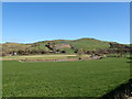
Springs and Holy WellsSite Name: Ffynnon Digain Alternative Name: St Digain's WellCountry: Wales County: Conwy Type: Holy Well or Sacred Spring
Nearest Village: Llangernyw
Map Ref: SH87146833
Latitude: 53.200029N Longitude: 3.691002W
Condition:
| 5 | Perfect |
| 4 | Almost Perfect |
| 3 | Reasonable but with some damage |
| 2 | Ruined but still recognisable as an ancient site |
| 1 | Pretty much destroyed, possibly visible as crop marks |
| 0 | No data. |
| -1 | Completely destroyed |
| 5 | Superb |
| 4 | Good |
| 3 | Ordinary |
| 2 | Not Good |
| 1 | Awful |
| 0 | No data. |
| 5 | Can be driven to, probably with disabled access |
| 4 | Short walk on a footpath |
| 3 | Requiring a bit more of a walk |
| 2 | A long walk |
| 1 | In the middle of nowhere, a nightmare to find |
| 0 | No data. |
| 5 | co-ordinates taken by GPS or official recorded co-ordinates |
| 4 | co-ordinates scaled from a detailed map |
| 3 | co-ordinates scaled from a bad map |
| 2 | co-ordinates of the nearest village |
| 1 | co-ordinates of the nearest town |
| 0 | no data |
Internal Links:
External Links:
")
Holy Well, attributed to St Digain, north from Llangernyw.
You may be viewing yesterday's version of this page. To see the most up to date information please register for a free account.
Do not use the above information on other web sites or publications without permission of the contributor.
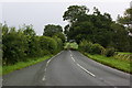
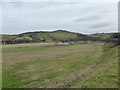
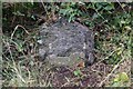
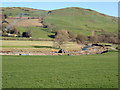
Nearby Images from Geograph Britain and Ireland:
©2010(licence)
©2015(licence)
©2019(licence)
©2019(licence)
©2019(licence)
The above images may not be of the site on this page, they are loaded from Geograph.
Please Submit an Image of this site or go out and take one for us!
Click here to see more info for this site
Nearby sites
Key: Red: member's photo, Blue: 3rd party photo, Yellow: other image, Green: no photo - please go there and take one, Grey: site destroyed
Download sites to:
KML (Google Earth)
GPX (GPS waypoints)
CSV (Garmin/Navman)
CSV (Excel)
To unlock full downloads you need to sign up as a Contributory Member. Otherwise downloads are limited to 50 sites.
Turn off the page maps and other distractions
Nearby sites listing. In the following links * = Image available
943m SSE 157° St Digain (Llangernyw)* Ancient Cross (SH8749567455)
5.2km SE 145° Rhos Domen Barrow Cemetery (SH900640)
6.9km S 174° Gwytherin Churchyard* Stone Row / Alignment (SH87676147)
7.5km SE 132° Cau Du Barrow* Round Barrow(s) (SH9256063160)
7.8km ESE 103° Plas Newydd Barrow* Round Barrow(s) (SH94716644)
7.8km SE 141° Boncyn Crwn Barrow* Round Barrow(s) (SH9192062170)
7.9km SW 234° Ffynnon Ddoged (Llanddoged)* Holy Well or Sacred Spring (SH806638)
8.0km WSW 256° Caer Oleu Hillfort (SH79296651)
8.7km N 352° Ffynnon Elian Holy Well or Sacred Spring (SH86077692)
8.9km SW 230° Ffynnon Newydd Holy Well or Sacred Spring (SH80196278)
9.2km NNE 26° Pen-y-Corddyn-Mawr* Hillfort (SH914765)
9.6km SSE 152° Aled Isaf Reservoir Standing Stone* Standing Stone (Menhir) (SH915598)
9.6km W 281° St Mary's Church (Caerhun) Early Christian Sculptured Stone (SH77697040)
9.7km SSE 153° Llyn Aled Isaf Ancient Village or Settlement (SH91295959)
9.7km WSW 251° Trefriw Chalybeate Well and Bath* Holy Well or Sacred Spring (SH7784465308)
10.0km SE 136° Blaen y Cwm Barrow* Round Barrow(s) (SH93916091)
10.1km SW 225° Llanrwst Gorsedd Circle* Modern Stone Circle etc (SH7985261376)
10.1km W 265° Porth Llwyd Burial Chamber or Dolmen (SH77036777)
10.1km NW 308° Hendre Waelod* Burial Chamber or Dolmen (SH79297474)
10.6km SE 135° Rhiwiau Barrow* Round Barrow(s) (SH94466063)
10.7km NE 36° Castel Cawr* Hillfort (SH937768)
10.7km ENE 70° Mynydd-y-Gaer* Hillfort (SH973718)
11.0km W 281° Maes y Castell Hut Circles* Ancient Village or Settlement (SH76357067)
12.0km SSW 192° Maen Pebyll* Long Barrow (SH844566)
12.1km WSW 258° Cae Du* Cairn (SH75206616)
View more nearby sites and additional images


 We would like to know more about this location. Please feel free to add a brief description and any relevant information in your own language.
 Wir möchten mehr über diese Stätte erfahren. Bitte zögern Sie nicht, eine kurze Beschreibung und relevante Informationen in Deutsch hinzuzufügen.
 Nous aimerions en savoir encore un peu sur les lieux. S'il vous plaît n'hesitez pas à ajouter une courte description et tous les renseignements pertinents dans votre propre langue.
 Quisieramos informarnos un poco más de las lugares. No dude en añadir una breve descripción y otros datos relevantes en su propio idioma.