<< Our Photo Pages >> Dinas Melin-y-Wig - Hillfort in Wales in Denbighshire
Submitted by postman on Wednesday, 24 October 2012 Page Views: 10311
Iron Age and Later PrehistorySite Name: Dinas Melin-y-WigCountry: Wales
NOTE: This site is 1.58 km away from the location you searched for.
County: Denbighshire Type: Hillfort
Nearest Town: Corwen Nearest Village: Melin-y-Wig
Map Ref: SJ049492
Latitude: 53.031599N Longitude: 3.419552W
Condition:
| 5 | Perfect |
| 4 | Almost Perfect |
| 3 | Reasonable but with some damage |
| 2 | Ruined but still recognisable as an ancient site |
| 1 | Pretty much destroyed, possibly visible as crop marks |
| 0 | No data. |
| -1 | Completely destroyed |
| 5 | Superb |
| 4 | Good |
| 3 | Ordinary |
| 2 | Not Good |
| 1 | Awful |
| 0 | No data. |
| 5 | Can be driven to, probably with disabled access |
| 4 | Short walk on a footpath |
| 3 | Requiring a bit more of a walk |
| 2 | A long walk |
| 1 | In the middle of nowhere, a nightmare to find |
| 0 | No data. |
| 5 | co-ordinates taken by GPS or official recorded co-ordinates |
| 4 | co-ordinates scaled from a detailed map |
| 3 | co-ordinates scaled from a bad map |
| 2 | co-ordinates of the nearest village |
| 1 | co-ordinates of the nearest town |
| 0 | no data |
Internal Links:
External Links:
")
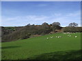
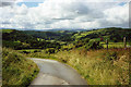
It isn't far from the road but there is no footpath to get here, you might want to ask permission at Clegyn Mawr farm. Not the best preserved of forts, the entrance is still evident and some earthworks may linger in the undergrowth.
The northern extremes of the fort are undefended due to sheer cliffs dropping down to the Afon Clwyd. The forts interior is large and clear, distant views of Snowdonia's mountains can be enjoyed.
You may be viewing yesterday's version of this page. To see the most up to date information please register for a free account.
")
")
")
Do not use the above information on other web sites or publications without permission of the contributor.
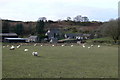
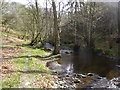
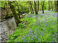
Nearby Images from Geograph Britain and Ireland:
©2007(licence)
©2017(licence)
©2013(licence)
©2017(licence)
©2005(licence)
The above images may not be of the site on this page, they are loaded from Geograph.
Please Submit an Image of this site or go out and take one for us!
Click here to see more info for this site
Nearby sites
Key: Red: member's photo, Blue: 3rd party photo, Yellow: other image, Green: no photo - please go there and take one, Grey: site destroyed
Download sites to:
KML (Google Earth)
GPX (GPS waypoints)
CSV (Garmin/Navman)
CSV (Excel)
To unlock full downloads you need to sign up as a Contributory Member. Otherwise downloads are limited to 50 sites.
Turn off the page maps and other distractions
Nearby sites listing. In the following links * = Image available
2.7km NNE 32° Ffynnon Sarah* Holy Well or Sacred Spring (SJ064515)
3.0km NNW 348° Caerau One (Denbighshire) Ancient Village or Settlement (SJ0432252169)
3.1km N 351° Caerau Two (Denbighshire)* Ancient Village or Settlement (SJ0446552227)
3.1km WNW 302° Preseb y Fawch Frech* Stone Circle (SJ023509)
3.2km N 357° Maen Llwyd (Denbighshire)* Standing Stone (Menhir) (SJ04795238)
3.4km N 356° Bryn Beddau Stone Circle* Stone Circle (SJ0472952587)
3.5km SE 129° Ffynnon Beuno (Gwyddelwern)* Holy Well or Sacred Spring (SJ07584692)
3.8km N 1° Bryn Beddau South* Cairn (SJ0505052970)
3.9km N 1° Bryn Beddau North* Ring Cairn (SJ0508053130)
4.1km N 4° Bedd Emlyn* Cairn (SJ0525053240)
5.5km NNW 345° Capel Hiraethog ring cairn* Ring Cairn (SJ036545)
5.5km SSE 158° Ffynnon Sulien* Holy Well or Sacred Spring (SJ06884409)
5.6km NNW 341° Capel Hiraethog III* Stone Circle (SJ032545)
5.7km S 169° Llyn-y-cefn Cursus Cursus (SJ05854355)
5.9km SSE 166° Llyn-y-cefn Cursus Cursus (SJ06254350)
5.9km SSE 166° Corwen Cursus Cursus (SJ06204343)
6.0km NW 321° Y Foel Frech Stone Circle (SJ012539)
6.0km SSE 166° Corwen Cursus Cursus (SJ06194335)
6.0km ESE 112° Bwrdd y Tri Arglwydd* Chambered Tomb (SJ10454682)
6.2km SE 140° Caer Drewyn* Hillfort (SJ0876544395)
6.4km SE 138° Pen Coed Mawr field system* Ancient Village or Settlement (SJ09124441)
6.5km E 90° Tom Dongen Round Barrow* Round Barrow(s) (SJ1137049060)
6.5km SSE 152° St Mael and St Sulien* Standing Stone (Menhir) (SJ0787243397)
6.6km SSE 154° Corwen Gorsedd Circle Modern Stone Circle etc (SJ0763443219)
7.0km WNW 293° Caer Ddunod* Hillfort (SH985520)
View more nearby sites and additional images


 We would like to know more about this location. Please feel free to add a brief description and any relevant information in your own language.
 Wir möchten mehr über diese Stätte erfahren. Bitte zögern Sie nicht, eine kurze Beschreibung und relevante Informationen in Deutsch hinzuzufügen.
 Nous aimerions en savoir encore un peu sur les lieux. S'il vous plaît n'hesitez pas à ajouter une courte description et tous les renseignements pertinents dans votre propre langue.
 Quisieramos informarnos un poco más de las lugares. No dude en añadir una breve descripción y otros datos relevantes en su propio idioma.