<< Other Photo Pages >> Castle Ditches Fort - Hillfort in Wales in South Glamorgan
Submitted by coldrum on Friday, 13 July 2007 Page Views: 4859
Iron Age and Later PrehistorySite Name: Castle Ditches FortCountry: Wales
NOTE: This site is 0.752 km away from the location you searched for.
County: South Glamorgan Type: Hillfort
Nearest Town: Llancarfon
Map Ref: ST059699
Latitude: 51.420275N Longitude: 3.354676W
Condition:
| 5 | Perfect |
| 4 | Almost Perfect |
| 3 | Reasonable but with some damage |
| 2 | Ruined but still recognisable as an ancient site |
| 1 | Pretty much destroyed, possibly visible as crop marks |
| 0 | No data. |
| -1 | Completely destroyed |
| 5 | Superb |
| 4 | Good |
| 3 | Ordinary |
| 2 | Not Good |
| 1 | Awful |
| 0 | No data. |
| 5 | Can be driven to, probably with disabled access |
| 4 | Short walk on a footpath |
| 3 | Requiring a bit more of a walk |
| 2 | A long walk |
| 1 | In the middle of nowhere, a nightmare to find |
| 0 | No data. |
| 5 | co-ordinates taken by GPS or official recorded co-ordinates |
| 4 | co-ordinates scaled from a detailed map |
| 3 | co-ordinates scaled from a bad map |
| 2 | co-ordinates of the nearest village |
| 1 | co-ordinates of the nearest town |
| 0 | no data |
Be the first person to rate this site - see the 'Contribute!' box in the right hand menu.
Internal Links:
External Links:
Coflein entry:
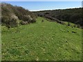
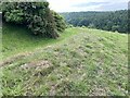
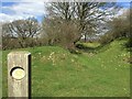
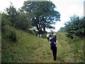
"A substantial univallate enclosure, about 350m east-west by 105-135m, set along a steep-sided east-west ridge between two streams; defined by a single bank, ditched and counterscarped; there is an entrance on the south, where excavation, 1963-4, revealed traces of an earlier, stone-walled enclosure: occupation is attested from the Iron Age through to the Romano-British period."
https://www.coflein.gov.uk/en/site/93040
You may be viewing yesterday's version of this page. To see the most up to date information please register for a free account.
Do not use the above information on other web sites or publications without permission of the contributor.
coldrum has found this location on Google Street View:
Nearby Images from Geograph Britain and Ireland:
©2016(licence)
©2020(licence)
©2016(licence)
©2015(licence)
©2016(licence)
The above images may not be of the site on this page, they are loaded from Geograph.
Please Submit an Image of this site or go out and take one for us!
Click here to see more info for this site
Nearby sites
Key: Red: member's photo, Blue: 3rd party photo, Yellow: other image, Green: no photo - please go there and take one, Grey: site destroyed
Download sites to:
KML (Google Earth)
GPX (GPS waypoints)
CSV (Garmin/Navman)
CSV (Excel)
To unlock full downloads you need to sign up as a Contributory Member. Otherwise downloads are limited to 50 sites.
Turn off the page maps and other distractions
Nearby sites listing. In the following links * = Image available
921m SW 219° Pen Onn Farmstead Ancient Village or Settlement (ST053692)
3.6km SE 137° Lower Porthkerry House Platform Ancient Village or Settlement (ST083672)
4.0km WNW 301° Cross Inn Well Holy Well or Sacred Spring (ST025720)
4.2km NW 304° Coed Hills Rural Art Space Modern Stone Circle etc (ST025723)
4.4km NNE 25° Redland Farm Standing Stone (Menhir) (ST07817382)
4.4km SE 132° Westward Corner Round Barrow* Round Barrow(s) (ST0916266901)
4.5km NNE 29° Coed-Y-Cwm* Chambered Cairn (ST08117378)
4.7km NE 44° Tinkinswood avenue* Stone Row / Alignment (ST09267323)
4.7km NNE 26° Cottrell Park Standing Stone* Standing Stone (Menhir) (ST0804574124)
4.7km NE 44° Tinkinswood standing stones* Standing Stones (ST09247327)
4.7km NE 43° Tinkinswood* Chambered Cairn (ST09217330)
4.8km NE 44° Tinkinswood 2* Burial Chamber or Dolmen (ST09337327)
4.8km ENE 59° St Lythans* Chambered Tomb (ST10097230)
4.8km NE 44° Tinkinswood quarry* Ancient Mine, Quarry or other Industry (ST09337331)
4.9km NE 44° Tinkinswood outliers* Rock Outcrop (ST09337334)
5.1km ESE 122° Barry Gorsedd Circle* Modern Stone Circle etc (ST1018967130)
5.4km ENE 67° Goldsland Wood Cave Cave or Rock Shelter (ST109719)
5.8km NNE 30° St Nicholas' Well (Glamorgan)* Holy Well or Sacred Spring (ST08937484)
5.8km SE 130° Cold Knap Round Barrow* Cairn (ST10306607)
5.9km NW 319° Llanquian Wood Fort Hillfort (ST021744)
6.0km N 3° Ffynnon Deilo* Holy Well or Sacred Spring (ST0633975904)
6.1km NE 51° St Lythans Down Round Barrow* Round Barrow(s) (ST10717367)
6.3km NE 48° Vianshill Round Barrow(s) (ST10717401)
6.4km NE 55° Marsyd Round Barrow(s) (ST11217352)
6.5km SE 126° Barry Island Cairns* Cairn (ST11076598)
View more nearby sites and additional images


 We would like to know more about this location. Please feel free to add a brief description and any relevant information in your own language.
 Wir möchten mehr über diese Stätte erfahren. Bitte zögern Sie nicht, eine kurze Beschreibung und relevante Informationen in Deutsch hinzuzufügen.
 Nous aimerions en savoir encore un peu sur les lieux. S'il vous plaît n'hesitez pas à ajouter une courte description et tous les renseignements pertinents dans votre propre langue.
 Quisieramos informarnos un poco más de las lugares. No dude en añadir una breve descripción y otros datos relevantes en su propio idioma.