<< Text Pages >> Commonbank SE - Stone Circle in Scotland in Perth and Kinross
Submitted by Tom_Bullock on Sunday, 14 July 2002 Page Views: 3669
Neolithic and Bronze AgeSite Name: Commonbank SECountry: Scotland
NOTE: This site is 2.088 km away from the location you searched for.
County: Perth and Kinross Type: Stone Circle
Map Ref: NO177247 Landranger Map Number: 53
Latitude: 56.407341N Longitude: 3.335258W
Condition:
| 5 | Perfect |
| 4 | Almost Perfect |
| 3 | Reasonable but with some damage |
| 2 | Ruined but still recognisable as an ancient site |
| 1 | Pretty much destroyed, possibly visible as crop marks |
| 0 | No data. |
| -1 | Completely destroyed |
| 5 | Superb |
| 4 | Good |
| 3 | Ordinary |
| 2 | Not Good |
| 1 | Awful |
| 0 | No data. |
| 5 | Can be driven to, probably with disabled access |
| 4 | Short walk on a footpath |
| 3 | Requiring a bit more of a walk |
| 2 | A long walk |
| 1 | In the middle of nowhere, a nightmare to find |
| 0 | No data. |
| 5 | co-ordinates taken by GPS or official recorded co-ordinates |
| 4 | co-ordinates scaled from a detailed map |
| 3 | co-ordinates scaled from a bad map |
| 2 | co-ordinates of the nearest village |
| 1 | co-ordinates of the nearest town |
| 0 | no data |
Internal Links:
External Links:
Ancient site in Perthshire
Have you visited this site? Please add a comment below.
You may be viewing yesterday's version of this page. To see the most up to date information please register for a free account.
Do not use the above information on other web sites or publications without permission of the contributor.
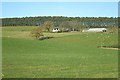
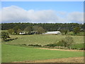
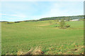
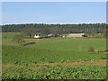
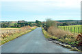
Nearby Images from Geograph Britain and Ireland:
©2017(licence)
©2019(licence)
©2013(licence)
©2005(licence)
©2013(licence)
The above images may not be of the site on this page, they are loaded from Geograph.
Please Submit an Image of this site or go out and take one for us!
Click here to see more info for this site
Nearby sites
Key: Red: member's photo, Blue: 3rd party photo, Yellow: other image, Green: no photo - please go there and take one, Grey: site destroyed
Download sites to:
KML (Google Earth)
GPX (GPS waypoints)
CSV (Garmin/Navman)
CSV (Excel)
To unlock full downloads you need to sign up as a Contributory Member. Otherwise downloads are limited to 50 sites.
Turn off the page maps and other distractions
Nearby sites listing. In the following links * = Image available
244m NW 304° Commonbank* Stone Row / Alignment (NO17502484)
252m WNW 302° Commonbank* Stone Circle (NO1748824837)
1.4km NNW 330° Arnbathie Fort* Hillfort (NO1703125894)
2.0km N 349° Shien Hill* Round Cairn (NO1735926678)
2.4km ENE 64° Evelick Hill Fort* Hillfort (NO199257)
2.9km WNW 301° Murrayshall* Standing Stone (Menhir) (NO1519926265)
3.4km NW 319° Shianbank SE* Stone Circle (NO15562729)
3.4km NW 319° Shianbank NW* Stone Circle (NO15552731)
3.7km ENE 67° Kilspindie* Stone Circle (NO2112826053)
3.9km NE 47° Beal Hill Stone Circle (NO206273)
4.2km SSE 151° St Madoes Stones* Stone Row / Alignment (NO197210)
4.7km WNW 291° Sandy Road East Stone Circle (NO13282646)
4.7km WNW 291° Sandy Road* Stone Circle (NO1327526463)
5.0km W 263° Murray Royal Hospital* Standing Stone (Menhir) (NO127242)
5.4km ENE 67° Rait Farm Cup Marked Stone* Sculptured Stone (NO2275326773)
5.6km SE 126° Grey Stone (St Madoes)* Standing Stone (Menhir) (NO22172131)
5.8km ENE 64° Fingask Castle* Standing Stone (Menhir) (NO22932716)
5.9km W 260° Perth Museum and Art Gallery* Museum (NO119238)
5.9km W 260° Inchyra* Class I Pictish Symbol Stone (NO119238)
6.0km WSW 250° South Inch, Perth Standing Stone (Menhir) (NO12002274)
6.2km SW 220° Moredun Top Hillfort (NO13621999)
6.4km NNW 344° Brownies Knowe Stone Circle (NO16063092)
6.6km SW 222° Moncreiffe Hill* Hillfort (NO13131988)
6.7km SW 216° Gask House Class II Pictish Symbol Stone (NO13661933)
6.7km SW 216° Boar Stone* Class III Pictish Cross Slab (NO13661933)
View more nearby sites and additional images


 We would like to know more about this location. Please feel free to add a brief description and any relevant information in your own language.
 Wir möchten mehr über diese Stätte erfahren. Bitte zögern Sie nicht, eine kurze Beschreibung und relevante Informationen in Deutsch hinzuzufügen.
 Nous aimerions en savoir encore un peu sur les lieux. S'il vous plaît n'hesitez pas à ajouter une courte description et tous les renseignements pertinents dans votre propre langue.
 Quisieramos informarnos un poco más de las lugares. No dude en añadir una breve descripción y otros datos relevantes en su propio idioma.