<< Our Photo Pages >> Perthi Common Cairns 1, 2, 3, 4 - Cairn in Wales in Powys
Submitted by geoffstickland on Tuesday, 06 October 2020 Page Views: 334
Neolithic and Bronze AgeSite Name: Perthi Common Cairns 1, 2, 3, 4Country: Wales
NOTE: This site is 1.874 km away from the location you searched for.
County: Powys Type: Cairn
Nearest Town: Builth Wells Nearest Village: Llansantfraed in Elwel
Map Ref: SO0940654856
Latitude: 52.184484N Longitude: 3.326502W
Condition:
| 5 | Perfect |
| 4 | Almost Perfect |
| 3 | Reasonable but with some damage |
| 2 | Ruined but still recognisable as an ancient site |
| 1 | Pretty much destroyed, possibly visible as crop marks |
| 0 | No data. |
| -1 | Completely destroyed |
| 5 | Superb |
| 4 | Good |
| 3 | Ordinary |
| 2 | Not Good |
| 1 | Awful |
| 0 | No data. |
| 5 | Can be driven to, probably with disabled access |
| 4 | Short walk on a footpath |
| 3 | Requiring a bit more of a walk |
| 2 | A long walk |
| 1 | In the middle of nowhere, a nightmare to find |
| 0 | No data. |
| 5 | co-ordinates taken by GPS or official recorded co-ordinates |
| 4 | co-ordinates scaled from a detailed map |
| 3 | co-ordinates scaled from a bad map |
| 2 | co-ordinates of the nearest village |
| 1 | co-ordinates of the nearest town |
| 0 | no data |
Internal Links:
External Links:
I have visited· I would like to visit
geoffstickland has visited here
")
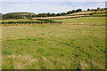
Perthi Common is a large, undulating area on the west of the village of Llansantfaed in Elwel. It is heavily infested with bracken and gorse and is quite hard to explore in search of the four cairns listed in Coflein. When one does manage to find them they are rather "unrewarding" with little to distinguish them from the surrounding undergrowth. It is only the precision of a ten figure map reference and a good GPS device that makes it possible to find and distinguish them at all. All four appear as little more than slight grass-covered mounds succumbing in various degrees to the encroaching vegetation. One of my less reawarding expeditions!
You may be viewing yesterday's version of this page. To see the most up to date information please register for a free account.
")
")
")
Do not use the above information on other web sites or publications without permission of the contributor.
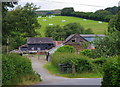
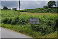
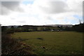
Nearby Images from Geograph Britain and Ireland:

©2018(licence)
©2019(licence)
©2019(licence)
©2008(licence)
©2012(licence)
The above images may not be of the site on this page, they are loaded from Geograph.
Please Submit an Image of this site or go out and take one for us!
Click here to see more info for this site
Nearby sites
Key: Red: member's photo, Blue: 3rd party photo, Yellow: other image, Green: no photo - please go there and take one, Grey: site destroyed
Download sites to:
KML (Google Earth)
GPX (GPS waypoints)
CSV (Garmin/Navman)
CSV (Excel)
To unlock full downloads you need to sign up as a Contributory Member. Otherwise downloads are limited to 50 sites.
Turn off the page maps and other distractions
Nearby sites listing. In the following links * = Image available
855m W 265° The Gaer* Hillfort (SO08555480)
909m SSW 213° Bryntwppa* Stone Row / Alignment (SO08905410)
1.3km WSW 250° Cilberllan Ring Cairn* Cairn (SO0815654436)
1.4km NNW 329° Castle Bank (Radnorshire)* Hillfort (SO08695608)
1.6km NNE 27° Cwm Stone* Standing Stone (Menhir) (SO10185630)
1.9km WSW 252° Cwm-Berwyn Round Cairn* Cairn (SO076543)
2.0km N 5° Gwernfach Cairns I,II,III & IV* Cairn (SO096568)
2.1km W 268° Cwmberwyn Camp* Hillfort (SO07275481)
2.1km NNW 334° Court Standing Stone* Standing Stone (Menhir) (SO08495680)
2.2km NNW 344° Court Stone Row* Stone Row / Alignment (SO08865695)
2.5km NW 323° Upper House Cairns I,II & III* Cairn (SO079569)
2.7km W 278° Carneddau Hill Cairn II* Round Barrow(s) (SO06705527)
2.8km W 281° Carneddau Hill Cairn I.* Round Barrow(s) (SO06645544)
2.9km WSW 253° Carneddau Hill Cairn* Cairn (SO06625407)
3.1km WSW 255° Four Parishes Standing Stone* Standing Stone (Menhir) (SO06395413)
3.1km W 263° Newmead Farm Cairn 1* Cairn (SO06305454)
3.1km W 262° Newmead Farm Cairn 2* Cairn (SO06295450)
3.2km WSW 253° Carneddau West* Cairn (SO06295395)
3.3km WSW 253° Newmead Farm Cairn 3* Cairn (SO0627153958)
3.4km N 1° Gelli Hill Circle* Stone Circle (SO095583)
3.5km N 7° Gelli Hill Cairn A* Cairn (SO09895828)
3.5km N 359° Gelli Hill Standing Stone* Standing Stone (Menhir) (SO09425837)
3.5km WSW 239° Caer Einon* Hillfort (SO06365309)
3.6km WSW 246° Carneddau Hill Stone* Standing Stone (Menhir) (SO06105344)
3.8km N 357° Gelli Hill Cairn B* Cairn (SO09305870)
View more nearby sites and additional images


 We would like to know more about this location. Please feel free to add a brief description and any relevant information in your own language.
 Wir möchten mehr über diese Stätte erfahren. Bitte zögern Sie nicht, eine kurze Beschreibung und relevante Informationen in Deutsch hinzuzufügen.
 Nous aimerions en savoir encore un peu sur les lieux. S'il vous plaît n'hesitez pas à ajouter une courte description et tous les renseignements pertinents dans votre propre langue.
 Quisieramos informarnos un poco más de las lugares. No dude en añadir una breve descripción y otros datos relevantes en su propio idioma.