


<< Our Photo Pages >> Oyce of Quindry - Standing Stone (Menhir) in Scotland in Orkney
Submitted by howar on Monday, 30 August 2004 Page Views: 7901
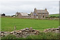
Neolithic and Bronze AgeSite Name: Oyce of QuindryCountry: Scotland County: Orkney Type: Standing Stone (Menhir)
Nearest Town: Kirkwall Nearest Village: St. Margaret's Hope
Map Ref: ND436925
Latitude: 58.816292N Longitude: 2.978206W
Condition:
| 5 | Perfect |
| 4 | Almost Perfect |
| 3 | Reasonable but with some damage |
| 2 | Ruined but still recognisable as an ancient site |
| 1 | Pretty much destroyed, possibly visible as crop marks |
| 0 | No data. |
| -1 | Completely destroyed |
| 5 | Superb |
| 4 | Good |
| 3 | Ordinary |
| 2 | Not Good |
| 1 | Awful |
| 0 | No data. |
| 5 | Can be driven to, probably with disabled access |
| 4 | Short walk on a footpath |
| 3 | Requiring a bit more of a walk |
| 2 | A long walk |
| 1 | In the middle of nowhere, a nightmare to find |
| 0 | No data. |
| 5 | co-ordinates taken by GPS or official recorded co-ordinates |
| 4 | co-ordinates scaled from a detailed map |
| 3 | co-ordinates scaled from a bad map |
| 2 | co-ordinates of the nearest village |
| 1 | co-ordinates of the nearest town |
| 0 | no data |
Internal Links:
External Links:
")
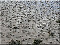
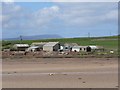
I am not surprised no-one has logged it before because it's in a tidal inlet ! First time I saw it through heavy mist as a broad stone, large enough to be seen from the road above. It may have had a far smaller stone to its right, difficult to tell with that mist about. Reaching a gate where you can look straight to Lyrawall on the other side of the Oyce and the stone is to the left and this side of the beck that runs through the Oyce.
Another day, coming from Kirkhouse I followed the shore that side of the Oyce of Quindry to seek out the stone. Coming to the Oyce of Quindry itself all of substance I could make out along the inlet was a big lump I had already seen through the binoculars. This resolved itself to a mass of seaweed over a boulder. Not quite as impressive or distinct as it had seemed on the day of the mist. As I neared it I could further see that it was a stone rather than a natural boulder. It was only as I came up to the end (albeit on the opposite shore) and passed by that I saw at least a long straight edge and made it out as not a broad stone but a standing stone leaning over at an acute angle.
You may be viewing yesterday's version of this page. To see the most up to date information please register for a free account.
")
Do not use the above information on other web sites or publications without permission of the contributor.
Nearby Images from Geograph Britain and Ireland:
©2006(licence)
©2006(licence)
©2015(licence)
©2006(licence)
©2019(licence)
The above images may not be of the site on this page, they are loaded from Geograph.
Please Submit an Image of this site or go out and take one for us!
Click here to see more info for this site
Nearby sites
Key: Red: member's photo, Blue: 3rd party photo, Yellow: other image, Green: no photo - please go there and take one, Grey: site destroyed
Download sites to:
KML (Google Earth)
GPX (GPS waypoints)
CSV (Garmin/Navman)
CSV (Excel)
To unlock full downloads you need to sign up as a Contributory Member. Otherwise downloads are limited to 50 sites.
Turn off the page maps and other distractions
Nearby sites listing. In the following links * = Image available
1.0km NNW 342° The Wart* Chambered Cairn (ND433935)
1.9km NW 323° Howe of Hoxa* Broch or Nuraghe (ND425940)
1.9km NW 322° Little Howe of Hoxa* Ancient Village or Settlement (ND4243694026)
1.9km NW 322° Little Howe of Hoxa* Ancient Village or Settlement (ND42439403)
2.9km S 181° Clouduhall Cairn* Round Cairn (ND43498958)
2.9km S 181° Clouduhall Stone* Standing Stone (Menhir) (ND43538957)
2.9km SW 223° Harra Brough* Broch or Nuraghe (ND41579038)
3.5km ESE 108° Eastside* Standing Stone (Menhir) (ND469914)
3.6km S 182° Weems Castle Broch or Nuraghe (ND434889)
3.7km ESE 114° Kirkhouse* Round Cairn (ND470909)
4.0km ESE 109° Kirk Ness* Round Cairn (ND47389117)
4.0km ESE 108° Kirk Ness Dyke* Ancient Village or Settlement (ND474912)
4.5km SE 140° Stews* Standing Stone (Menhir) (ND465890)
5.6km ENE 59° Kyelittle* Broch or Nuraghe (ND485953)
5.7km SSE 157° The Cairns Windwick Bay* Broch or Nuraghe (ND4578987256)
6.8km NE 54° St Lawrence's Church* Broch or Nuraghe (ND4917896425)
8.2km NE 39° Northfield Broch* Broch or Nuraghe (ND489988)
8.2km S 176° Ladykirk Stone* Rock Art (ND44008428)
8.7km SSE 156° Isbister: Tomb Of The Eagles* Chambered Cairn (ND47048449)
8.8km SSE 160° Liddel 2 Burnt Mound Ancient Village or Settlement (ND46498416)
8.8km SSE 160° Isbister: Bronze Age House* Ancient Village or Settlement (ND46468411)
8.9km SSE 157° Duni Geo* Long Barrow (ND46958425)
9.1km SSE 163° Tomb of the Eagles Museum Museum (ND4619783807)
9.3km NNE 30° Lamb Holm* Ancient Village or Settlement (HY484005)
9.4km SSE 166° Banks Chambered Tomb* Chambered Cairn (ND45808339)
View more nearby sites and additional images


 We would like to know more about this location. Please feel free to add a brief description and any relevant information in your own language.
 Wir möchten mehr über diese Stätte erfahren. Bitte zögern Sie nicht, eine kurze Beschreibung und relevante Informationen in Deutsch hinzuzufügen.
 Nous aimerions en savoir encore un peu sur les lieux. S'il vous plaît n'hesitez pas à ajouter une courte description et tous les renseignements pertinents dans votre propre langue.
 Quisieramos informarnos un poco más de las lugares. No dude en añadir una breve descripción y otros datos relevantes en su propio idioma.