<< Our Photo Pages >> Combe Beacon Tumulus - Long Barrow in England in Somerset
Submitted by MattImpey on Sunday, 16 September 2007 Page Views: 5336
Neolithic and Bronze AgeSite Name: Combe Beacon TumulusCountry: England
NOTE: This site is 4.092 km away from the location you searched for.
County: Somerset Type: Long Barrow
Nearest Town: Combe St Nicholas
Map Ref: ST295122
Latitude: 50.904949N Longitude: 3.004013W
Condition:
| 5 | Perfect |
| 4 | Almost Perfect |
| 3 | Reasonable but with some damage |
| 2 | Ruined but still recognisable as an ancient site |
| 1 | Pretty much destroyed, possibly visible as crop marks |
| 0 | No data. |
| -1 | Completely destroyed |
| 5 | Superb |
| 4 | Good |
| 3 | Ordinary |
| 2 | Not Good |
| 1 | Awful |
| 0 | No data. |
| 5 | Can be driven to, probably with disabled access |
| 4 | Short walk on a footpath |
| 3 | Requiring a bit more of a walk |
| 2 | A long walk |
| 1 | In the middle of nowhere, a nightmare to find |
| 0 | No data. |
| 5 | co-ordinates taken by GPS or official recorded co-ordinates |
| 4 | co-ordinates scaled from a detailed map |
| 3 | co-ordinates scaled from a bad map |
| 2 | co-ordinates of the nearest village |
| 1 | co-ordinates of the nearest town |
| 0 | no data |
Be the first person to rate this site - see the 'Contribute!' box in the right hand menu.
Internal Links:
External Links:
You may be viewing yesterday's version of this page. To see the most up to date information please register for a free account.
Do not use the above information on other web sites or publications without permission of the contributor.
coldrum has found this location on Google Street View:
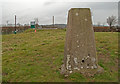
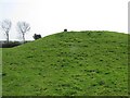
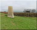
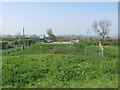
Nearby Images from Geograph Britain and Ireland:
©2011(licence)
©2011(licence)
©2017(licence)
©2011(licence)
©2017(licence)
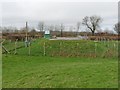
The above images may not be of the site on this page, they are loaded from Geograph.
Please Submit an Image of this site or go out and take one for us!
Click here to see more info for this site
Nearby sites
Key: Red: member's photo, Blue: 3rd party photo, Yellow: other image, Green: no photo - please go there and take one, Grey: site destroyed
Download sites to:
KML (Google Earth)
GPX (GPS waypoints)
CSV (Garmin/Navman)
CSV (Excel)
To unlock full downloads you need to sign up as a Contributory Member. Otherwise downloads are limited to 50 sites.
Turn off the page maps and other distractions
Nearby sites listing. In the following links * = Image available
1.6km WSW 243° Northay Barrow* Long Barrow (ST281115)
4.3km NNW 327° Castle Neroche* Hillfort (ST272158)
5.8km W 275° Robin Hood's Butts South* Barrow Cemetery (ST237128)
6.8km WNW 287° Robin Hood's Butts North* Barrow Cemetery (ST230143)
6.8km NNW 332° The Devilstones* Natural Stone / Erratic / Other Natural Feature (ST264183)
7.4km NNE 26° Skipperhams Well* Holy Well or Sacred Spring (ST329188)
7.6km WNW 297° Robin Hoods Butt 2 (Somerset) Round Barrow(s) (ST22801575)
9.5km S 187° Membury Castle Hillfort (ST282028)
10.8km SW 216° Stockland Little Castle Hillfort (ST22980362)
11.8km SW 215° Stockland Great Castle* Hillfort (ST22620262)
12.7km NNE 30° St. Catherine's Well (Swell)* Holy Well or Sacred Spring (ST360231)
13.0km NNW 342° Cambria Farm Ancient Village or Settlement (ST257246)
13.6km S 179° Axminster Castle* Hillfort (SY296986)
14.2km NNW 330° Museum of Somerset* Museum (ST225246)
14.4km SW 235° Dumpdon Great Camp* Hillfort (ST176040)
14.5km E 98° Pople's Well* Holy Well or Sacred Spring (ST4387909886)
15.2km SSE 149° Lambert's Castle* Hillfort (SY372991)
15.9km SE 136° Bettiscombe Stone Natural Stone / Erratic / Other Natural Feature (ST4036800561)
16.0km SE 132° Pilsdon Pen* Hillfort (ST413013)
16.6km SSE 152° Coney's Castle* Hillfort (SY372975)
16.7km ESE 124° St Dunstan's Well* Holy Well or Sacred Spring (ST433028)
17.2km NW 324° Norton Fitzwarren* Hillfort (ST196263)
17.6km WSW 247° Row Barrow (Devon)* Round Barrow(s) (ST13180561)
17.8km NNE 15° Athelney* Hillfort (ST344293)
17.9km SE 127° Lewesdon Hillfort Hillfort (ST437012)
View more nearby sites and additional images


 We would like to know more about this location. Please feel free to add a brief description and any relevant information in your own language.
 Wir möchten mehr über diese Stätte erfahren. Bitte zögern Sie nicht, eine kurze Beschreibung und relevante Informationen in Deutsch hinzuzufügen.
 Nous aimerions en savoir encore un peu sur les lieux. S'il vous plaît n'hesitez pas à ajouter une courte description et tous les renseignements pertinents dans votre propre langue.
 Quisieramos informarnos un poco más de las lugares. No dude en añadir una breve descripción y otros datos relevantes en su propio idioma.