<< Our Photo Pages >> Leven's Park ringcairn - Ring Cairn in England in Cumbria
Submitted by Bladup on Monday, 19 June 2023 Page Views: 5436
Neolithic and Bronze AgeSite Name: Leven's Park ringcairn Alternative Name: Archers HillCountry: England
NOTE: This site is 0.563 km away from the location you searched for.
County: Cumbria Type: Ring Cairn
Map Ref: SD506862
Latitude: 54.269056N Longitude: 2.760014W
Condition:
| 5 | Perfect |
| 4 | Almost Perfect |
| 3 | Reasonable but with some damage |
| 2 | Ruined but still recognisable as an ancient site |
| 1 | Pretty much destroyed, possibly visible as crop marks |
| 0 | No data. |
| -1 | Completely destroyed |
| 5 | Superb |
| 4 | Good |
| 3 | Ordinary |
| 2 | Not Good |
| 1 | Awful |
| 0 | No data. |
| 5 | Can be driven to, probably with disabled access |
| 4 | Short walk on a footpath |
| 3 | Requiring a bit more of a walk |
| 2 | A long walk |
| 1 | In the middle of nowhere, a nightmare to find |
| 0 | No data. |
| 5 | co-ordinates taken by GPS or official recorded co-ordinates |
| 4 | co-ordinates scaled from a detailed map |
| 3 | co-ordinates scaled from a bad map |
| 2 | co-ordinates of the nearest village |
| 1 | co-ordinates of the nearest town |
| 0 | no data |
Internal Links:
External Links:
I have visited· I would like to visit
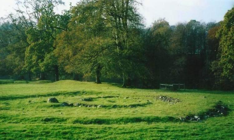
Anne T visited on 4th Jun 2015 - their rating: Cond: 2 Amb: 4 Access: 4 Leven's Park/Archer's Hill Ringcairn, Cumbria: This cairn is close to the roundabout where the A590 meets the A591 and A6 just south of Sizergh Castle. My map reading failed, as the junctions were complicated – no proper roundabouts, just adjoining roads with ‘give way’ signs to transfer from one carriageway to the other, which was fun at 5pm with traffic whizzing everywhere as everyone escaped from work to home. After a few wrong turns, eventually we made it onto the minor (brown) road which runs between Sedgwick and Hincaster, stopping at a small car park (enough room for 3-4 cars) outside a stile over a stone wall leading into Leven’s Park. By the stile, a small stream joining the River Kent tumbled over stones downhill and the trees provided welcome shade.
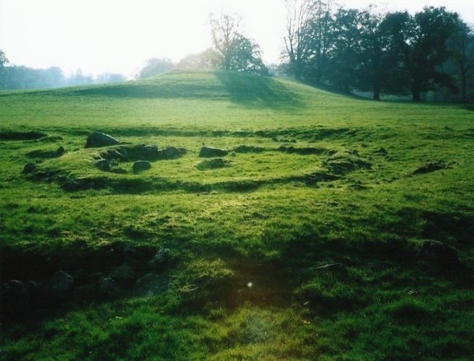
Walking along the dirt track for a couple of hundred yards, the cairn is to your right hand side, not in view from the path, but in a very pleasant spot, next to the River Kent. Between the dirt track and the actual cairn there is a series of four smaller mounds – possibly either cairns in their own right? -but I could find no mention of these anywhere on Pastcape or any other source. We did look for the mentioned field system around the ring cairn, but could find no evidence of it.
Walking round this ring cairn, there are clearly two different rings, which originally intersected, but give the appearance of now being joined into one larger cairn. Trying to capture the two different rings, we headed up the hill to the south west.

The ringcairn contained primary inhumations accompanied by pottery and flint knives or knives. A burnt plank lining to the grave was found in excavations from 1968-71 and then well reconstructed.
Source: English Heritage
Note: The oldest evidence for the plague in Britain discovered in 4,000-year-old human remains unearthed at this bronze age burial site in Cumbria, and a site in Somerset.
You may be viewing yesterday's version of this page. To see the most up to date information please register for a free account.


Do not use the above information on other web sites or publications without permission of the contributor.
Click here to see more info for this site
Nearby sites
Key: Red: member's photo, Blue: 3rd party photo, Yellow: other image, Green: no photo - please go there and take one, Grey: site destroyed
Download sites to:
KML (Google Earth)
GPX (GPS waypoints)
CSV (Garmin/Navman)
CSV (Excel)
To unlock full downloads you need to sign up as a Contributory Member. Otherwise downloads are limited to 50 sites.
Turn off the page maps and other distractions
Nearby sites listing. In the following links * = Image available
263m SSW 194° Levens Park ring cairn 2* Ring Cairn (SD5053385945)
1.3km WNW 301° Sizergh Settlement* Ancient Village or Settlement (SD49528686)
1.3km WNW 301° Sizergh Fell Round Cairn 2* Round Cairn (SD4952486868)
1.4km WNW 299° Sizergh Fell Round Cairn 1* Round Cairn (SD4938886886)
1.6km WNW 296° Sizergh Fell Stone Circle* Stone Circle (SD492869)
2.9km SSW 200° St Mary's Well (Heversham)* Holy Well or Sacred Spring (SD4958383452)
3.0km SSW 199° St Peter's Church (Heversham)* Ancient Cross (SD4960083390)
3.0km SSW 203° Heversham Ancient Wall Misc. Earthwork (SD494834)
3.5km NE 44° Helm Hill* Hillfort (SD531887)
5.8km N 7° Anchorite Well (Kendal)* Holy Well or Sacred Spring (SD5140691932)
5.8km SSW 199° Haverbrack Fell Misc. Earthwork (SD486807)
6.0km N 10° The Kendal Cross* Ancient Cross (SD5168692141)
6.2km S 190° Bela Stone Row* Stone Row / Alignment (SD495801)
6.5km SSW 203° Haverbrack Cairn Cairn (SD480802)
6.5km SSW 201° The Dog Hole Cave or Rock Shelter (SD482801)
6.6km SSW 202° Dog Hole possible dolmen/propped stone* Natural Stone / Erratic / Other Natural Feature (SD481801)
7.0km N 10° Kendal Museum* Museum (SD519931)
7.0km SSE 149° Holme Park Fell 1* Rock Outcrop (SD5419280141)
7.0km S 186° The Rent Stone* Natural Stone / Erratic / Other Natural Feature (SD498792)
7.3km SSE 148° Holme Park Fell 2* Rock Outcrop (SD5439879957)
7.4km SSW 193° The Fairy Steps* Natural Stone / Erratic / Other Natural Feature (SD488790)
8.6km SSW 202° Hazelslack Stone* Standing Stone (Menhir) (SD473783)
9.6km SSE 165° St James's Church (Burton-in-Kendal) Ancient Cross (SD5305076921)
9.6km SSW 196° Haweswater Stones* Misc. Earthwork (SD478770)
9.7km SSW 196° Haweswater Cairns and Propped Stone Cairn (SD479769)
View more nearby sites and additional images


 We would like to know more about this location. Please feel free to add a brief description and any relevant information in your own language.
 Wir möchten mehr über diese Stätte erfahren. Bitte zögern Sie nicht, eine kurze Beschreibung und relevante Informationen in Deutsch hinzuzufügen.
 Nous aimerions en savoir encore un peu sur les lieux. S'il vous plaît n'hesitez pas à ajouter une courte description et tous les renseignements pertinents dans votre propre langue.
 Quisieramos informarnos un poco más de las lugares. No dude en añadir una breve descripción y otros datos relevantes en su propio idioma.