<< Our Photo Pages >> Little Heuch Law Cairn - Cairn in Scotland in Scottish Borders
Submitted by Anne T on Tuesday, 26 May 2015 Page Views: 1762
Neolithic and Bronze AgeSite Name: Little Heuch Law CairnCountry: Scotland
NOTE: This site is 0.689 km away from the location you searched for.
County: Scottish Borders Type: Cairn
Nearest Town: Jedburgh Nearest Village: Hownam
Map Ref: NT77921705
Latitude: 55.446815N Longitude: 2.350603W
Condition:
| 5 | Perfect |
| 4 | Almost Perfect |
| 3 | Reasonable but with some damage |
| 2 | Ruined but still recognisable as an ancient site |
| 1 | Pretty much destroyed, possibly visible as crop marks |
| 0 | No data. |
| -1 | Completely destroyed |
| 5 | Superb |
| 4 | Good |
| 3 | Ordinary |
| 2 | Not Good |
| 1 | Awful |
| 0 | No data. |
| 5 | Can be driven to, probably with disabled access |
| 4 | Short walk on a footpath |
| 3 | Requiring a bit more of a walk |
| 2 | A long walk |
| 1 | In the middle of nowhere, a nightmare to find |
| 0 | No data. |
| 5 | co-ordinates taken by GPS or official recorded co-ordinates |
| 4 | co-ordinates scaled from a detailed map |
| 3 | co-ordinates scaled from a bad map |
| 2 | co-ordinates of the nearest village |
| 1 | co-ordinates of the nearest town |
| 0 | no data |
Internal Links:
External Links:
")
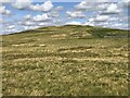
Recorded as Canmore site number 57981, this cairn is clearly visible from the Dod Law/Chatto Hill standing stones and cairns, sitting on the top of a rounded hill to the east.
The Canmore records for 1999 states that the cairn "measures 8.7 metres in diametres and stands to a height of 0.7 metres. At the centre there is a small quarry that has been dug out of the relatively flat top of the cairn."
At the time of our visit, we assumed the farmer had been using the cairn to dump stones to clear the field; on reflection it might well be the remains of this quarry.
You may be viewing yesterday's version of this page. To see the most up to date information please register for a free account.
")
Do not use the above information on other web sites or publications without permission of the contributor.
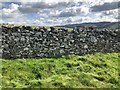
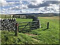
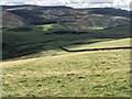
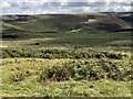
Nearby Images from Geograph Britain and Ireland:
©2023(licence)
©2023(licence)
©2023(licence)
©2023(licence)
©2023(licence)
The above images may not be of the site on this page, they are loaded from Geograph.
Please Submit an Image of this site or go out and take one for us!
Click here to see more info for this site
Nearby sites
Key: Red: member's photo, Blue: 3rd party photo, Yellow: other image, Green: no photo - please go there and take one, Grey: site destroyed
Download sites to:
KML (Google Earth)
GPX (GPS waypoints)
CSV (Garmin/Navman)
CSV (Excel)
To unlock full downloads you need to sign up as a Contributory Member. Otherwise downloads are limited to 50 sites.
Turn off the page maps and other distractions
Nearby sites listing. In the following links * = Image available
273m SSW 208° Dodlaw Burn* Standing Stone (Menhir) (NT77791681)
504m S 172° Dodlaw Cairn Round Cairn (NT77991655)
1.3km WSW 250° Chatto Craig* Hillfort (NT76701662)
1.9km NNE 17° Horseshoe Wood Settlement* Ancient Village or Settlement (NT78511891)
2.0km NNE 24° Horseshoe Wood (Hownam)* Standing Stone (Menhir) (NT78741890)
2.3km WSW 244° Dere Street stone* Standing Stone (Menhir) (NT75801604)
2.5km NNE 28° The Shearers* Stone Row / Alignment (NT79101925)
2.6km NNE 25° Hownam Rings Hill Fort* Hillfort (NT79041939)
2.7km W 266° Five Stanes A* Stone Circle (NT75261686)
2.9km WSW 251° Trestle Cairn* Stone Circle (NT75181612)
3.1km WSW 250° Five Stanes B Stone Circle (NT7516)
3.2km WSW 241° Black Knowe (Borders)* Standing Stone (Menhir) (NT75131554)
3.2km WSW 242° Dere Street Cairn* Round Cairn (NT75061552)
3.9km SW 234° Falla Knowe Cairn* Cairn (NT74711475)
4.1km S 173° Standard Knowe Cairn (NT78411300)
4.6km SSW 194° Woden Law* Hillfort (NT76771254)
5.2km NNE 19° Hownam Law Hillfort* Hillfort (NT7964022000)
5.3km ENE 66° Calroust Hillfort* Hillfort (NT828192)
5.8km S 188° Hindhope Hill Cairn* Cairn (NT7710811310)
5.8km SW 235° Dark Wood* Cairn (NT73111377)
5.9km S 191° Hindhope Hill Hillfort* Hillfort (NT76811127)
7.3km SSW 198° Upper Hindhope* Standing Stones (NT75641008)
7.4km ENE 68° Sourhope Hillfort* Hillfort (NT8475219825)
7.6km E 90° Stoney Knowe Hillfort* Hillfort (NT855170)
7.7km ENE 64° Fasset Hill (Sourhope)* Ancient Village or Settlement (NT8492520359)
View more nearby sites and additional images


 We would like to know more about this location. Please feel free to add a brief description and any relevant information in your own language.
 Wir möchten mehr über diese Stätte erfahren. Bitte zögern Sie nicht, eine kurze Beschreibung und relevante Informationen in Deutsch hinzuzufügen.
 Nous aimerions en savoir encore un peu sur les lieux. S'il vous plaît n'hesitez pas à ajouter une courte description et tous les renseignements pertinents dans votre propre langue.
 Quisieramos informarnos un poco más de las lugares. No dude en añadir una breve descripción y otros datos relevantes en su propio idioma.