


<< Text Pages >> Five Stanes B - Stone Circle in Scotland in Scottish Borders
Submitted by Tom_Bullock on Sunday, 03 November 2002 Page Views: 5690
Neolithic and Bronze AgeSite Name: Five Stanes BCountry: Scotland County: Scottish Borders Type: Stone Circle
Map Ref: NT7516 Landranger Map Number: 80
Latitude: 55.437240N Longitude: 2.396668W
Condition:
| 5 | Perfect |
| 4 | Almost Perfect |
| 3 | Reasonable but with some damage |
| 2 | Ruined but still recognisable as an ancient site |
| 1 | Pretty much destroyed, possibly visible as crop marks |
| 0 | No data. |
| -1 | Completely destroyed |
| 5 | Superb |
| 4 | Good |
| 3 | Ordinary |
| 2 | Not Good |
| 1 | Awful |
| 0 | No data. |
| 5 | Can be driven to, probably with disabled access |
| 4 | Short walk on a footpath |
| 3 | Requiring a bit more of a walk |
| 2 | A long walk |
| 1 | In the middle of nowhere, a nightmare to find |
| 0 | No data. |
| 5 | co-ordinates taken by GPS or official recorded co-ordinates |
| 4 | co-ordinates scaled from a detailed map |
| 3 | co-ordinates scaled from a bad map |
| 2 | co-ordinates of the nearest village |
| 1 | co-ordinates of the nearest town |
| 0 | no data |
Internal Links:
External Links:
Ancient site in Scottish Borders
Have you visited this site? Please add a comment below.
You may be viewing yesterday's version of this page. To see the most up to date information please register for a free account.
Do not use the above information on other web sites or publications without permission of the contributor.
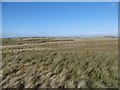
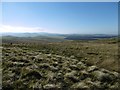
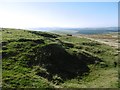
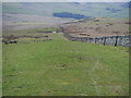
Nearby Images from Geograph Britain and Ireland:
©2016(licence)
©2016(licence)
©2016(licence)
©2023(licence)
©2016(licence)
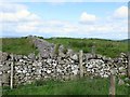
The above images may not be of the site on this page, they are loaded from Geograph.
Please Submit an Image of this site or go out and take one for us!
Click here to see more info for this site
Nearby sites
Key: Red: member's photo, Blue: 3rd party photo, Yellow: other image, Green: no photo - please go there and take one, Grey: site destroyed
Download sites to:
KML (Google Earth)
GPX (GPS waypoints)
CSV (Garmin/Navman)
CSV (Excel)
To unlock full downloads you need to sign up as a Contributory Member. Otherwise downloads are limited to 50 sites.
Turn off the page maps and other distractions
Nearby sites listing. In the following links * = Image available
216m NE 56° Trestle Cairn* Stone Circle (NT75181612)
478m SSE 164° Black Knowe (Borders)* Standing Stone (Menhir) (NT75131554)
483m S 173° Dere Street Cairn* Round Cairn (NT75061552)
799m E 87° Dere Street stone* Standing Stone (Menhir) (NT75801604)
898m NNE 16° Five Stanes A* Stone Circle (NT75261686)
1.3km SSW 193° Falla Knowe Cairn* Cairn (NT74711475)
1.8km ENE 70° Chatto Craig* Hillfort (NT76701662)
2.9km ENE 73° Dodlaw Burn* Standing Stone (Menhir) (NT77791681)
2.9km SW 220° Dark Wood* Cairn (NT73111377)
3.0km E 79° Dodlaw Cairn Round Cairn (NT77991655)
3.1km ENE 70° Little Heuch Law Cairn* Cairn (NT77921705)
3.9km SSE 153° Woden Law* Hillfort (NT76771254)
4.5km SE 131° Standard Knowe Cairn (NT78411300)
4.5km NE 50° Horseshoe Wood Settlement* Ancient Village or Settlement (NT78511891)
4.7km NE 52° Horseshoe Wood (Hownam)* Standing Stone (Menhir) (NT78741890)
5.1km SSE 159° Hindhope Hill Hillfort* Hillfort (NT76811127)
5.1km SSE 156° Hindhope Hill Cairn* Cairn (NT7710811310)
5.2km NE 51° The Shearers* Stone Row / Alignment (NT79101925)
5.3km NE 50° Hownam Rings Hill Fort* Hillfort (NT79041939)
5.5km SSW 214° Moor Head (Brundean Laws)* Standing Stones (NT7193111439)
5.9km S 174° Upper Hindhope* Standing Stones (NT75641008)
7.6km NE 37° Hownam Law Hillfort* Hillfort (NT7964022000)
7.8km WSW 243° Edgerston Hillfort (NT67981245)
8.0km SW 223° Knock Hill Cairn Cairn (NT69451016)
8.4km ENE 67° Calroust Hillfort* Hillfort (NT828192)
View more nearby sites and additional images


 We would like to know more about this location. Please feel free to add a brief description and any relevant information in your own language.
 Wir möchten mehr über diese Stätte erfahren. Bitte zögern Sie nicht, eine kurze Beschreibung und relevante Informationen in Deutsch hinzuzufügen.
 Nous aimerions en savoir encore un peu sur les lieux. S'il vous plaît n'hesitez pas à ajouter une courte description et tous les renseignements pertinents dans votre propre langue.
 Quisieramos informarnos un poco más de las lugares. No dude en añadir una breve descripción y otros datos relevantes en su propio idioma.