


<< Other Photo Pages >> Allée couverte dite de Roherman - Passage Grave in France in Bretagne:Morbihan (56)
Submitted by TheCaptain on Monday, 03 January 2005 Page Views: 3261
Neolithic and Bronze AgeSite Name: Allée couverte dite de Roherman Alternative Name: La Roche des FéesCountry: France
NOTE: This site is 2.747 km away from the location you searched for.
Département: Bretagne:Morbihan (56) Type: Passage Grave
Nearest Town: Ploërmel Nearest Village: Augan
Latitude: 47.930100N Longitude: 2.2446W
Condition:
| 5 | Perfect |
| 4 | Almost Perfect |
| 3 | Reasonable but with some damage |
| 2 | Ruined but still recognisable as an ancient site |
| 1 | Pretty much destroyed, possibly visible as crop marks |
| 0 | No data. |
| -1 | Completely destroyed |
| 5 | Superb |
| 4 | Good |
| 3 | Ordinary |
| 2 | Not Good |
| 1 | Awful |
| 0 | No data. |
| 5 | Can be driven to, probably with disabled access |
| 4 | Short walk on a footpath |
| 3 | Requiring a bit more of a walk |
| 2 | A long walk |
| 1 | In the middle of nowhere, a nightmare to find |
| 0 | No data. |
| 5 | co-ordinates taken by GPS or official recorded co-ordinates |
| 4 | co-ordinates scaled from a detailed map |
| 3 | co-ordinates scaled from a bad map |
| 2 | co-ordinates of the nearest village |
| 1 | co-ordinates of the nearest town |
| 0 | no data |
Be the first person to rate this site - see the 'Contribute!' box in the right hand menu.
Internal Links:
External Links:
")
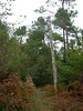
L’allée couverte de Roherman à Augan
You may be viewing yesterday's version of this page. To see the most up to date information please register for a free account.
Do not use the above information on other web sites or publications without permission of the contributor.
Nearby Images from Flickr


The above images may not be of the site on this page, but were taken nearby. They are loaded from Flickr so please click on them for image credits.
Click here to see more info for this site
Nearby sites
Click here to view sites on an interactive map of the areaKey: Red: member's photo, Blue: 3rd party photo, Yellow: other image, Green: no photo - please go there and take one, Grey: site destroyed
Download sites to:
KML (Google Earth)
GPX (GPS waypoints)
CSV (Garmin/Navman)
CSV (Excel)
To unlock full downloads you need to sign up as a Contributory Member. Otherwise downloads are limited to 50 sites.
Turn off the page maps and other distractions
Nearby sites listing. In the following links * = Image available
2.1km NW 324° Allée Couverte de Brambelay Passage Grave
5.2km ESE 120° Allée Couverte dite le Tombeau des Rochettes Passage Grave
5.2km SSW 210° Allée couverte dite la Roche des Fées* Passage Grave
5.5km SSE 156° Allée Couverte dite Château d'Eau Passage Grave
5.7km SE 145° Lande de Rousse* Standing Stones
5.9km SE 127° La Verrie menhir* Standing Stone (Menhir)
6.0km SE 142° La Loge Morinais* Passage Grave
6.2km SSE 155° Allée Couverte du Chaperon Rouge Passage Grave
6.3km N 352° Le Tombeau du Géant* Chambered Tomb
6.4km SSE 153° Megalithes de Étang du Chaperon Rouge* Passage Grave
6.9km SE 141° Pierres Droites (Monteneuf)* Stone Row / Alignment
6.9km SE 140° Centre Les Landes* Museum
7.1km SE 127° Chomet de Coëtplan* Stone Row / Alignment
7.1km NNW 345° Tombeau des Géants* Passage Grave
7.3km SSE 147° La Roche Blanche* Round Cairn
7.7km SSE 147° La Pièce Couverte* Passage Grave
7.7km ESE 123° Rocher Maheux* Passage Grave
7.7km NNE 17° Allée Couverte de l'Orgeril Passage Grave
8.0km SE 139° Les Bordouès* Passage Grave
8.0km NNW 347° L'Hotié de Viviane* Chambered Tomb
8.1km NNW 347° Sépulture mégalithique de Rauco Cist
8.1km N 353° Coffre de la Guette Burial Chamber or Dolmen
8.4km SSE 150° Sépulture de Bécihan* Passage Grave
9.0km WSW 238° Maison Neuve menhir* Standing Stone (Menhir)
9.2km WSW 238° Piprais menhir* Standing Stone (Menhir)
View more nearby sites and additional images


 We would like to know more about this location. Please feel free to add a brief description and any relevant information in your own language.
 Wir möchten mehr über diese Stätte erfahren. Bitte zögern Sie nicht, eine kurze Beschreibung und relevante Informationen in Deutsch hinzuzufügen.
 Nous aimerions en savoir encore un peu sur les lieux. S'il vous plaît n'hesitez pas à ajouter une courte description et tous les renseignements pertinents dans votre propre langue.
 Quisieramos informarnos un poco más de las lugares. No dude en añadir una breve descripción y otros datos relevantes en su propio idioma.