<< Text Pages >> Lowe Dunishbooth - Promontory Fort / Cliff Castle in England in Lancashire
Submitted by coldrum on Sunday, 30 October 2011 Page Views: 2493
Iron Age and Later PrehistorySite Name: Lowe DunishboothCountry: England
NOTE: This site is 0.413 km away from the location you searched for.
County: Lancashire Type: Promontory Fort / Cliff Castle
Map Ref: SD8756115960
Latitude: 53.640004N Longitude: 2.189615W
Condition:
| 5 | Perfect |
| 4 | Almost Perfect |
| 3 | Reasonable but with some damage |
| 2 | Ruined but still recognisable as an ancient site |
| 1 | Pretty much destroyed, possibly visible as crop marks |
| 0 | No data. |
| -1 | Completely destroyed |
| 5 | Superb |
| 4 | Good |
| 3 | Ordinary |
| 2 | Not Good |
| 1 | Awful |
| 0 | No data. |
| 5 | Can be driven to, probably with disabled access |
| 4 | Short walk on a footpath |
| 3 | Requiring a bit more of a walk |
| 2 | A long walk |
| 1 | In the middle of nowhere, a nightmare to find |
| 0 | No data. |
| 5 | co-ordinates taken by GPS or official recorded co-ordinates |
| 4 | co-ordinates scaled from a detailed map |
| 3 | co-ordinates scaled from a bad map |
| 2 | co-ordinates of the nearest village |
| 1 | co-ordinates of the nearest town |
| 0 | no data |
Be the first person to rate this site - see the 'Contribute!' box in the right hand menu.
Internal Links:
External Links:
Promontory Fort / Cliff Castle in Lancashire
Possible prehistoric or medieval triple bank and ditch cutting off a promontory, surviving as degraded earthworks and identified from GoogleEarth by a local amateur enthusias Stuart Mendelson. The earthworks have a convex curve in relation to the promontory, the banks standing up to 0.2m high and the ditch of correspondig depth. It is unclear whether all three earthworks were built in one episode.
Source: Pastscape
You may be viewing yesterday's version of this page. To see the most up to date information please register for a free account.
Do not use the above information on other web sites or publications without permission of the contributor.
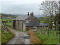
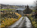
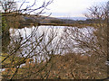
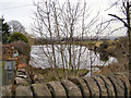
Nearby Images from Geograph Britain and Ireland:
©2013(licence)
©2011(licence)
©2010(licence)
©2010(licence)
©2010(licence)
The above images may not be of the site on this page, they are loaded from Geograph.
Please Submit an Image of this site or go out and take one for us!
Click here to see more info for this site
Nearby sites
Key: Red: member's photo, Blue: 3rd party photo, Yellow: other image, Green: no photo - please go there and take one, Grey: site destroyed
Download sites to:
KML (Google Earth)
GPX (GPS waypoints)
CSV (Garmin/Navman)
CSV (Excel)
To unlock full downloads you need to sign up as a Contributory Member. Otherwise downloads are limited to 50 sites.
Turn off the page maps and other distractions
Nearby sites listing. In the following links * = Image available
243m ENE 74° Lower Dunishbooth Promontory Fort / Cliff Castle (SD8779616025)
1.2km W 267° Hunger Hill Cairn* Cairn (SD864159)
2.7km NNW 333° Hamer Hill* Stone Circle (SD863184)
3.6km SE 145° Broadfield Park Glacial Boulder* Natural Stone / Erratic / Other Natural Feature (SD896130)
4.4km WSW 257° Wind Hill Cheesden* Round Barrow(s) (SD8326214945)
5.3km NE 37° Hades Hill Cairn (SD908202)
5.9km NW 307° Waugh's Well (Edenfield) Holy Well or Sacred Spring (SD82871957)
6.0km SW 234° Castle Hill, Heywood Hillfort (SD827125)
6.2km WSW 243° Walmersley Golf Club stone* Modern Stone Circle etc (SD82011319)
7.0km W 272° Whitelow* Cairn (SD80501626)
7.1km ESE 117° Tunshill Tolmen* Holed Stone (SD939127)
7.2km N 355° Bacup Natural History Society Museum* Museum (SD869231)
7.5km N 0° Wyrd of Stake Moss* Modern Stone Circle etc (SD876235)
7.8km ENE 72° Snoddle Hill Cairn (SD950183)
7.8km N 9° Tooter Hill (Bacup)* Ancient Village or Settlement (SD888237)
8.4km WSW 249° Castlesteads (Walmersley)* Hillfort (SD797129)
8.4km N 352° Broadclough Dykes, Bacup, Lancashire* Misc. Earthwork (SD864243)
8.9km E 83° Jacob's Well (Lydgate)* Holy Well or Sacred Spring (SD9638117068)
9.1km NNE 33° Stones monoliths, Todmorden* Standing Stones (SD92522359)
9.2km ENE 77° Cow Head End Rock Art (SD9656017991)
9.2km ENE 67° Light Hazzles Edge Rock Art (SD9605619575)
9.3km ENE 75° Cow Head (Blackstone Edge)* Rock Art (SD9651918405)
9.3km NE 50° Basin Stone* Rock Art (SD9472921990)
9.5km ENE 70° Cow Head-Light Hazzles Rock Art (SD9651619164)
9.6km E 87° Robin Hood's Bed (Blackstone Edge) Natural Stone / Erratic / Other Natural Feature (SD9720416356)
View more nearby sites and additional images


 We would like to know more about this location. Please feel free to add a brief description and any relevant information in your own language.
 Wir möchten mehr über diese Stätte erfahren. Bitte zögern Sie nicht, eine kurze Beschreibung und relevante Informationen in Deutsch hinzuzufügen.
 Nous aimerions en savoir encore un peu sur les lieux. S'il vous plaît n'hesitez pas à ajouter une courte description et tous les renseignements pertinents dans votre propre langue.
 Quisieramos informarnos un poco más de las lugares. No dude en añadir una breve descripción y otros datos relevantes en su propio idioma.