

<< Our Photo Pages >> Tooter Hill (Bacup) - Ancient Village or Settlement in England in Lancashire
Submitted by Sunny100 on Sunday, 15 May 2011 Page Views: 8411
Multi-periodSite Name: Tooter Hill (Bacup)Country: England County: Lancashire Type: Ancient Village or Settlement
Nearest Town: Bacup Nearest Village: Sharneyford
Map Ref: SD888237
Latitude: 53.709601N Longitude: 2.171157W
Condition:
| 5 | Perfect |
| 4 | Almost Perfect |
| 3 | Reasonable but with some damage |
| 2 | Ruined but still recognisable as an ancient site |
| 1 | Pretty much destroyed, possibly visible as crop marks |
| 0 | No data. |
| -1 | Completely destroyed |
| 5 | Superb |
| 4 | Good |
| 3 | Ordinary |
| 2 | Not Good |
| 1 | Awful |
| 0 | No data. |
| 5 | Can be driven to, probably with disabled access |
| 4 | Short walk on a footpath |
| 3 | Requiring a bit more of a walk |
| 2 | A long walk |
| 1 | In the middle of nowhere, a nightmare to find |
| 0 | No data. |
| 5 | co-ordinates taken by GPS or official recorded co-ordinates |
| 4 | co-ordinates scaled from a detailed map |
| 3 | co-ordinates scaled from a bad map |
| 2 | co-ordinates of the nearest village |
| 1 | co-ordinates of the nearest town |
| 0 | no data |
Internal Links:
External Links:
 (PID:141869)")
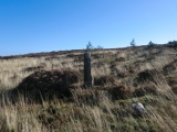
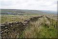
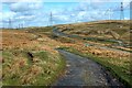
Tooter Hill in the Rossendale Valley is located on the moors about one and a half miles north-east of Bacup and 1 mile south-east of Sharneyford village and the A681 Todmorden road. Parrock farm is a few hundred yards to the north-west of the hill. There are some small mounds and earthworks on Tooter Hill, which are considered by archaeologists to be a long lost Neolithic settlement or perhaps an enclosure, but as to whether these earthworks are more recent due to quarrying, that has not, as yet, been established.
What is of interest, however, are the number of artefacts that were dug up from beneath the peat on Tooter Hill. A tanged and barbed arrow-head with serrated edges (probably an archery weapon) dating from the Neolithic period 4,500BC-2,500BC was excavated along with another arrow-head from the Bronze-Age period 2,500BC-700BC, and also a tranchet-shaped arrow-head (date unknown). These are housed in the N.A.T.S museum at Bacup. There is also a collection of small flint implements from Tooter Hill, including a flint scraper, flint adze and a flint borer.
Sadly, quarrying has taken place around the site and, although this has long since ceased, much damage has been done to the immediate area, destroying what may well have been a prehistoric site of some importance.
Update January 2018: The Northern Antiquarian (TNA) also features a page for this settlement - see their entry for Tooter Hill, Bacup, Lancashire, which gives directions for finding this site, together with a description and a photograph of some flints found at the site.
You may be viewing yesterday's version of this page. To see the most up to date information please register for a free account.
Do not use the above information on other web sites or publications without permission of the contributor.
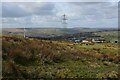
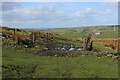
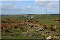
Nearby Images from Geograph Britain and Ireland:
©2023(licence)
©2023(licence)
©2023(licence)
©2011(licence)
©2023(licence)
The above images may not be of the site on this page, they are loaded from Geograph.
Please Submit an Image of this site or go out and take one for us!
Click here to see more info for this site
Nearby sites
Key: Red: member's photo, Blue: 3rd party photo, Yellow: other image, Green: no photo - please go there and take one, Grey: site destroyed
Download sites to:
KML (Google Earth)
GPX (GPS waypoints)
CSV (Garmin/Navman)
CSV (Excel)
To unlock full downloads you need to sign up as a Contributory Member. Otherwise downloads are limited to 50 sites.
Turn off the page maps and other distractions
Nearby sites listing. In the following links * = Image available
1.2km W 260° Wyrd of Stake Moss* Modern Stone Circle etc (SD876235)
2.0km WSW 252° Bacup Natural History Society Museum* Museum (SD869231)
2.5km WNW 284° Broadclough Dykes, Bacup, Lancashire* Misc. Earthwork (SD864243)
3.7km E 92° Stones monoliths, Todmorden* Standing Stones (SD92522359)
4.0km SSE 150° Hades Hill Cairn (SD908202)
4.3km NNW 339° Thieveley (Holme Chapel) Cairn (SD873277)
4.5km NE 36° Mount Cross (Todmorden)* Ancient Cross (SD9146227284)
4.6km E 81° Holy Well (Todmorden)* Holy Well or Sacred Spring (SD9339324411)
5.0km NNW 346° St John the Divine (Holme-in-Cliviger) Ancient Cross (SD8763428520)
5.0km NE 55° Golden Stones (Todmorden)* Rock Outcrop (SD9291926545)
5.1km NE 44° Hawks Stones (Stansfield Moor) Natural Stone / Erratic / Other Natural Feature (SD92332735)
5.1km ENE 58° Harley Wood Edge Rock Art (SD9312526386)
5.1km NE 50° Bridestones (above Cliviger Gorge)* Rock Art (SD9273026989)
5.2km ENE 65° Whirlaw Stones* Rock Art (SD9348125886)
5.4km NE 56° The Bridestones (Todmorden)* Natural Stone / Erratic / Other Natural Feature (SD9332926737)
5.8km ENE 73° The Frying Pan 1* Cairn (SD9433425426)
5.9km SSW 205° Hamer Hill* Stone Circle (SD863184)
5.9km ENE 72° The Frying Pan 2* Cairn (SD9445425507)
6.2km ESE 106° Basin Stone* Rock Art (SD9472921990)
6.4km N 351° Stump Cross (Mereclough)* Standing Stone (Menhir) (SD8781130029)
6.5km ESE 104° Gaddings Dam Rock Art (SD9514022123)
6.5km N 354° Mosley Height* Stone Circle (SD881302)
6.7km NNW 346° Cliviger Law (Mereclough) Cairn (SD872302)
7.2km SW 235° Waugh's Well (Edenfield) Holy Well or Sacred Spring (SD82871957)
7.4km ENE 64° Staups Moor Standing Stones (SD95452692)
View more nearby sites and additional images


 We would like to know more about this location. Please feel free to add a brief description and any relevant information in your own language.
 Wir möchten mehr über diese Stätte erfahren. Bitte zögern Sie nicht, eine kurze Beschreibung und relevante Informationen in Deutsch hinzuzufügen.
 Nous aimerions en savoir encore un peu sur les lieux. S'il vous plaît n'hesitez pas à ajouter une courte description et tous les renseignements pertinents dans votre propre langue.
 Quisieramos informarnos un poco más de las lugares. No dude en añadir una breve descripción y otros datos relevantes en su propio idioma.