<< Text Pages >> Bleara Moor Cairnfield (Earby) - Cairn in England in Lancashire
Submitted by Anne T on Tuesday, 12 February 2019 Page Views: 809
Neolithic and Bronze AgeSite Name: Bleara Moor Cairnfield (Earby)Country: England
NOTE: This site is 1.508 km away from the location you searched for.
County: Lancashire Type: Cairn
Nearest Village: Earby
Map Ref: SD919457
Latitude: 53.907393N Longitude: 2.124779W
Condition:
| 5 | Perfect |
| 4 | Almost Perfect |
| 3 | Reasonable but with some damage |
| 2 | Ruined but still recognisable as an ancient site |
| 1 | Pretty much destroyed, possibly visible as crop marks |
| 0 | No data. |
| -1 | Completely destroyed |
| 5 | Superb |
| 4 | Good |
| 3 | Ordinary |
| 2 | Not Good |
| 1 | Awful |
| 0 | No data. |
| 5 | Can be driven to, probably with disabled access |
| 4 | Short walk on a footpath |
| 3 | Requiring a bit more of a walk |
| 2 | A long walk |
| 1 | In the middle of nowhere, a nightmare to find |
| 0 | No data. |
| 5 | co-ordinates taken by GPS or official recorded co-ordinates |
| 4 | co-ordinates scaled from a detailed map |
| 3 | co-ordinates scaled from a bad map |
| 2 | co-ordinates of the nearest village |
| 1 | co-ordinates of the nearest town |
| 0 | no data |
Be the first person to rate this site - see the 'Contribute!' box in the right hand menu.
Internal Links:
External Links:
Cairn in Lancashire
This cairnfield on Bleara Moor is described as a new find (May 2010) by The Northern Antiquarian (TNA) - see their entry for Bleara Moor Cairnfield, Earby, Lancashire, which includes directions for finding this site, together with a photograph and description. TNA adds they found this scattering of a dozen or so small cairns thanks to the burning back of the heather.
The Journal of Antiquities also mentions this site as part of their entry for Bleara Lowe, Earby, Lancashire.
Note: Have you visited this site? Do you have any photographs or information to add?
You may be viewing yesterday's version of this page. To see the most up to date information please register for a free account.
Do not use the above information on other web sites or publications without permission of the contributor.
Nearby Images from Geograph Britain and Ireland:
©2022(licence)
©2018(licence)
©2006(licence)
©2011(licence)
©2011(licence)
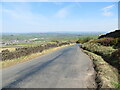
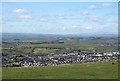
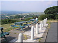
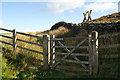
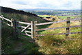
The above images may not be of the site on this page, they are loaded from Geograph.
Please Submit an Image of this site or go out and take one for us!
Click here to see more info for this site
Nearby sites
Key: Red: member's photo, Blue: 3rd party photo, Yellow: other image, Green: no photo - please go there and take one, Grey: site destroyed
Download sites to:
KML (Google Earth)
GPX (GPS waypoints)
CSV (Garmin/Navman)
CSV (Excel)
To unlock full downloads you need to sign up as a Contributory Member. Otherwise downloads are limited to 50 sites.
Turn off the page maps and other distractions
Nearby sites listing. In the following links * = Image available
607m ESE 120° Bleara Moor Cairn* Cairn (SD9242745396)
820m ESE 112° Bleara Lowe* Cairn (SD9266145388)
2.3km NNE 28° Hare Hill ring cairn* Cairn (SD9295347697)
2.9km W 264° Jinny Well, Salterforth* Holy Well or Sacred Spring (SD8898145411)
3.1km NNW 327° Church Well (Thornton-in-Craven)* Holy Well or Sacred Spring (SD902483)
3.2km NW 325° Church Well (Thornton-in-Craven)* Holy Well or Sacred Spring (SD901483)
3.6km NE 39° Standrise Earth Circle (Carleton in Craven) Misc. Earthwork (SD94194847)
4.4km S 181° Cold Well (Laneshawbridge)* Holy Well or Sacred Spring (SD91804125)
4.5km SW 220° Tallers Cross* Ancient Cross (SD890423)
4.7km SW 236° The Lark Hill Stone (Whitemoor)* Standing Stone (Menhir) (SD880431)
5.1km NNW 348° St Peter (East Marton)* Ancient Cross (SD9080750694)
5.2km SSE 165° Hullown Well* Holy Well or Sacred Spring (SD93204067)
5.3km E 84° Babyhouse Lane (Cononley) Ancient Village or Settlement (SD97194627)
6.1km SSE 152° Emmott Moor Rock Art (SD9475040285)
6.2km ESE 120° Oakworth Old Lane (Cowling) Rock Art (SD9730042625)
6.2km SW 220° Alkincoats Cross (Colne) Ancient Cross (SD87894094)
6.3km SSE 161° Ratten Clough Cross (Emmot Moor) Ancient Cross (SD9399739746)
6.4km SSE 168° Lowlands Well (Wycoller) Holy Well or Sacred Spring (SD93173944)
6.4km SSW 209° Emmott Cross (Colne) Ancient Cross (SD888401)
6.4km NNE 28° Broughton Circle Stone Circle (SD9490551404)
6.5km S 169° Wycoller Cup-marked Stones* Rock Art (SD931393)
6.7km SSW 206° St. Helen's Well (Waterside, Colne)* Holy Well or Sacred Spring (SD890397)
6.7km SSE 161° Herder's Cross (Wycoller) Ancient Cross (SD9405639367)
7.0km SSE 166° Wycoller Iron Age Bridge (Standing Stone)* Standing Stone (Menhir) (SD93583889)
7.0km SE 135° Ickornshaw Moor* Rock Art (SD9689040731)
View more nearby sites and additional images


 We would like to know more about this location. Please feel free to add a brief description and any relevant information in your own language.
 Wir möchten mehr über diese Stätte erfahren. Bitte zögern Sie nicht, eine kurze Beschreibung und relevante Informationen in Deutsch hinzuzufügen.
 Nous aimerions en savoir encore un peu sur les lieux. S'il vous plaît n'hesitez pas à ajouter une courte description et tous les renseignements pertinents dans votre propre langue.
 Quisieramos informarnos un poco más de las lugares. No dude en añadir una breve descripción y otros datos relevantes en su propio idioma.