

<< Other Photo Pages >> Eyjafjörður Fjord - Artificial Mound in Iceland
Submitted by rbatham on Wednesday, 19 July 2017 Page Views: 2550
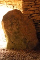
DigsSite Name: Eyjafjörður FjordCountry: Iceland
NOTE: This site is 85.566 km away from the location you searched for.
Type: Artificial Mound
Nearest Town: Skurkeyri
Latitude: 65.766000N Longitude: 18.1758W
Condition:
| 5 | Perfect |
| 4 | Almost Perfect |
| 3 | Reasonable but with some damage |
| 2 | Ruined but still recognisable as an ancient site |
| 1 | Pretty much destroyed, possibly visible as crop marks |
| 0 | No data. |
| -1 | Completely destroyed |
| 5 | Superb |
| 4 | Good |
| 3 | Ordinary |
| 2 | Not Good |
| 1 | Awful |
| 0 | No data. |
| 5 | Can be driven to, probably with disabled access |
| 4 | Short walk on a footpath |
| 3 | Requiring a bit more of a walk |
| 2 | A long walk |
| 1 | In the middle of nowhere, a nightmare to find |
| 0 | No data. |
| 5 | co-ordinates taken by GPS or official recorded co-ordinates |
| 4 | co-ordinates scaled from a detailed map |
| 3 | co-ordinates scaled from a bad map |
| 2 | co-ordinates of the nearest village |
| 1 | co-ordinates of the nearest town |
| 0 | no data |
Internal Links:
External Links:
")
Hundreds of items have been found at the site, among them two swords, three spears and three shields.
Click here for more information
Note: Pearls, Viking swords, spears and shields excavated at huge boat burials in Iceland
You may be viewing yesterday's version of this page. To see the most up to date information please register for a free account.
Do not use the above information on other web sites or publications without permission of the contributor.
Nearby Images from Flickr
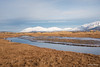
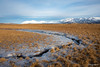
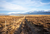
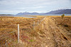
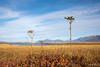
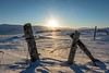
The above images may not be of the site on this page, but were taken nearby. They are loaded from Flickr so please click on them for image credits.
Click here to see more info for this site
Nearby sites
Click here to view sites on an interactive map of the areaKey: Red: member's photo, Blue: 3rd party photo, Yellow: other image, Green: no photo - please go there and take one, Grey: site destroyed
Download sites to:
KML (Google Earth)
GPX (GPS waypoints)
CSV (Garmin/Navman)
CSV (Excel)
To unlock full downloads you need to sign up as a Contributory Member. Otherwise downloads are limited to 50 sites.
Turn off the page maps and other distractions
Nearby sites listing. In the following links * = Image available
115.7km WSW 255° Borgarvirki* Promontory Fort / Cliff Castle
125.9km NE 51° Arctic Henge Modern Stone Circle etc
129.1km NE 48° Þorgeirsdys Cairn
198.7km SSW 204° Þjóðveldisbærinn Ancient Village or Settlement
207.8km ESE 111° Völvuleiði Cairn
217.0km SW 221° Althing* Natural Stone / Erratic / Other Natural Feature
219.0km S 178° Hildishaugur Cairn
221.8km SW 234° Skallagrimshaugur* Round Barrow(s)
222.2km SW 234° The Settlement Center Museum
225.4km WSW 251° Helgafell Natural Stone / Erratic / Other Natural Feature
231.6km W 266° Flókatóftir Ancient Village or Settlement
252.6km SW 226° Reykjavik Settlement Museum* Museum
258.1km SSW 196° Rútshellir Cave or Rock Shelter
262.5km S 186° Hjörleifshaugur Cairn
286.0km SW 228° Vikingaheimar* Museum
618.2km NNW 331° Danmark Ø Hut Foundations* Ancient Village or Settlement
675.7km ESE 122° Viking longhouse Kvívík, Faeröer Ancient Village or Settlement
683.0km ESE 120° Viking longhouse Leirvík, Faeröer Ancient Village or Settlement
900.4km NNW 343° Rendalen Hut Site* Ancient Village or Settlement
970.9km SE 134° North Ronan Crosses Ancient Cross (HW80913231)
1012.2km SE 146° Boreray* Stone Circle (NA15060499)
1013.1km ESE 118° Loch of Houlland* Broch or Nuraghe (HU2140079160)
1013.6km ESE 118° Sae Breck* Broch or Nuraghe (HU21057803)
1013.9km ESE 118° Loch of Breckon Burnt Mound* Artificial Mound (HU21437803)
1014.0km ESE 117° Hamnavoe Broch* Broch or Nuraghe (HU2389380641)
View more nearby sites and additional images


 We would like to know more about this location. Please feel free to add a brief description and any relevant information in your own language.
 Wir möchten mehr über diese Stätte erfahren. Bitte zögern Sie nicht, eine kurze Beschreibung und relevante Informationen in Deutsch hinzuzufügen.
 Nous aimerions en savoir encore un peu sur les lieux. S'il vous plaît n'hesitez pas à ajouter une courte description et tous les renseignements pertinents dans votre propre langue.
 Quisieramos informarnos un poco más de las lugares. No dude en añadir una breve descripción y otros datos relevantes en su propio idioma.