

<< Other Photo Pages >> Hanamiai Dune - Ancient Village or Settlement in Pacific Islands
Submitted by bat400 on Friday, 25 October 2013 Page Views: 4572
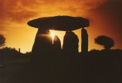
DigsSite Name: Hanamiai DuneCountry: Pacific Islands
NOTE: This site is 0.868 km away from the location you searched for.
Type: Ancient Village or Settlement
Nearest Village: Vaitahu
Latitude: 9.937S Longitude: 139.107W
Condition:
| 5 | Perfect |
| 4 | Almost Perfect |
| 3 | Reasonable but with some damage |
| 2 | Ruined but still recognisable as an ancient site |
| 1 | Pretty much destroyed, possibly visible as crop marks |
| 0 | No data. |
| -1 | Completely destroyed |
| 5 | Superb |
| 4 | Good |
| 3 | Ordinary |
| 2 | Not Good |
| 1 | Awful |
| 0 | No data. |
| 5 | Can be driven to, probably with disabled access |
| 4 | Short walk on a footpath |
| 3 | Requiring a bit more of a walk |
| 2 | A long walk |
| 1 | In the middle of nowhere, a nightmare to find |
| 0 | No data. |
| 5 | co-ordinates taken by GPS or official recorded co-ordinates |
| 4 | co-ordinates scaled from a detailed map |
| 3 | co-ordinates scaled from a bad map |
| 2 | co-ordinates of the nearest village |
| 1 | co-ordinates of the nearest town |
| 0 | no data |
Internal Links:
External Links:
")
The first European contact was by the Spanish in 1595. They described a town of timber and cane buildings and a religious site surrounded by a palisade. Archaeological finds include the nearby site of a tohua koina, a community site with stone foundation buildings and dance grounds.
Excavations by the Andover Foundation for Archaeological Research continue as field schools.
Tahuata_Museum website.
Andover Foundation for Archaeological Research's Marquesas Project website. and more images from the 2012 dig here.
Note: Archaeologists rediscover an ancient Polynesian chiefdom
You may be viewing yesterday's version of this page. To see the most up to date information please register for a free account.
Do not use the above information on other web sites or publications without permission of the contributor.
Nearby Images from Flickr


The above images may not be of the site on this page, but were taken nearby. They are loaded from Flickr so please click on them for image credits.
Click here to see more info for this site
Nearby sites
Click here to view sites on an interactive map of the areaKey: Red: member's photo, Blue: 3rd party photo, Yellow: other image, Green: no photo - please go there and take one, Grey: site destroyed
Download sites to:
KML (Google Earth)
GPX (GPS waypoints)
CSV (Garmin/Navman)
CSV (Excel)
To unlock full downloads you need to sign up as a Contributory Member. Otherwise downloads are limited to 50 sites.
Turn off the page maps and other distractions
Nearby sites listing. In the following links * = Image available
19.4km NNE 26° Tehueto Tohua* Ancient Village or Settlement
157.9km NW 316° Taetae Tupuna He'e Tai* Museum
157.9km NW 316° Temehea Tohua* Ancient Village or Settlement
1421.6km SW 232° Marae Arahurahu Ancient Temple
1488.3km WSW 238° Marae Manunu Huanhine Ancient Temple
1531.1km WSW 239° Taputapuatea* Ancient Temple
1540.8km WSW 239° Marae Tainuu* Ancient Temple
2537.0km WSW 238° Arai Te Tonga* Ancient Temple
3650.6km SE 126° Ahu Vai Uri Sculptured Stone
3650.6km SE 126° Ahu Ko Te Riku* Sculptured Stone
3650.6km SE 126° Ahu Tahai Sculptured Stone
3650.8km SE 126° Ana Kai Tangata* Rock Art
3650.8km SE 126° Tahai Kote Riku Sculptured Stone
3651.8km SE 126° Orongo* Ancient Village or Settlement
3652.4km SE 126° Rano Kau* Holy Well or Sacred Spring
3652.6km SE 126° Ahu Akivi* Sculptured Stone
3653.3km SE 126° Puna Pau Ancient Mine, Quarry or other Industry
3654.0km SE 126° Ahu Huri A Urenga* Sculptured Stone
3654.5km SE 126° Ahu Vinapu* Sculptured Stone
3657.0km SE 125° Ahu Nau Nau Anakena* Sculptured Stone
3657.5km SE 125° Ahu Ature Huke* Sculptured Stone
3658.6km SE 125° Ahu Te Pito Kura* Standing Stones
3662.4km SE 125° Easter Island* Sculptured Stone
3662.7km SE 126° Rano Raraku* Ancient Mine, Quarry or other Industry
3664.1km SE 126° Ahu Tongariki* Sculptured Stone
View more nearby sites and additional images


 We would like to know more about this location. Please feel free to add a brief description and any relevant information in your own language.
 Wir möchten mehr über diese Stätte erfahren. Bitte zögern Sie nicht, eine kurze Beschreibung und relevante Informationen in Deutsch hinzuzufügen.
 Nous aimerions en savoir encore un peu sur les lieux. S'il vous plaît n'hesitez pas à ajouter une courte description et tous les renseignements pertinents dans votre propre langue.
 Quisieramos informarnos un poco más de las lugares. No dude en añadir una breve descripción y otros datos relevantes en su propio idioma.