

<< Other Photo Pages >> Yellowstone Lake - Ancient Village or Settlement in United States in The Northwest Mountains
Submitted by Andy B on Saturday, 22 December 2018 Page Views: 8190
Multi-periodSite Name: Yellowstone LakeCountry: United States
NOTE: This site is 60.566 km away from the location you searched for.
Region: The Northwest Mountains Type: Ancient Village or Settlement
Latitude: 44.446390N Longitude: 110.36583W
Condition:
| 5 | Perfect |
| 4 | Almost Perfect |
| 3 | Reasonable but with some damage |
| 2 | Ruined but still recognisable as an ancient site |
| 1 | Pretty much destroyed, possibly visible as crop marks |
| 0 | No data. |
| -1 | Completely destroyed |
| 5 | Superb |
| 4 | Good |
| 3 | Ordinary |
| 2 | Not Good |
| 1 | Awful |
| 0 | No data. |
| 5 | Can be driven to, probably with disabled access |
| 4 | Short walk on a footpath |
| 3 | Requiring a bit more of a walk |
| 2 | A long walk |
| 1 | In the middle of nowhere, a nightmare to find |
| 0 | No data. |
| 5 | co-ordinates taken by GPS or official recorded co-ordinates |
| 4 | co-ordinates scaled from a detailed map |
| 3 | co-ordinates scaled from a bad map |
| 2 | co-ordinates of the nearest village |
| 1 | co-ordinates of the nearest town |
| 0 | no data |
Internal Links:
External Links:
I have visited· I would like to visit
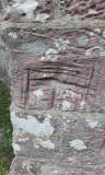
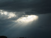
bat400 visited on 1st Jun 2002 - their rating: Cond: 4 Amb: 5 Access: 4 Strikingly beatuiful lake. No visible sign of the prehistoric occupation.
")
Thanks to archaeological digs around Yellowstone Lake last summer by University of Montana assistant archaeology professor Douglas MacDonald and 13 graduate and undergrad students, park officials are now getting a broader picture of early human use of the lake area.
“The lake may have served as a crossroads of sorts for Native Americans from multiple regions,” MacDonald said.
Why here?
The reasons are several.
Obsidian, a valued rock used to create razor-sharp points for weapons and tools, is located about 20 miles to the northwest at Obsidian Cliff. The lake area contains a variety of flora – everything from camas to wild onions – that would have created a great stew or to create medicines. And there was plenty of wildlife in the region. One archaeological site turned up blood residue from bear, wolf and deer as well as rabbit sinew.
“The lake area was clearly an important warm-weather hunting and gathering grounds for Native Americans from all over the northwestern Great Plains, northern Great Basin and northern Rocky Mountains,” MacDonald said.
His group’s explorations are part of the university’s Montana-Yellowstone Archaeological Project, which is now entering its fourth year. The partnership offers students the opportunity to perform field work while Yellowstone receives inexpensive research help.
This past summer, MacDonald’s crew made some unique finds. Along the northeast shore, the crew uncovered the park’s first Early Archaic hearth, dating to 5,800 years ago.
“The feature indicates that Native Americans used the park during the hot and dry altithermal climate period,” MacDonald said.
The Altithermal Period followed the last ice age, after large mammals like woolly mammoths had become extinct. Yellowstone Lake, during that time, would have been a huge oasis drawing people, and wildlife, from throughout the region.
Hale said analysis of campsites showed some visitors could have been small parties of male hunters, while others were families staying for longer periods.
“There are sites along the lake where there was extensive processing of hides,” Hale said. “We found sites where freshly quarried obsidian cobble had been transported to the area. This is a lithic workshop area.”
Another campsite was littered with about a dozen shaft abraders, used to smooth arrows and spears.
“That smacks of duration,” Hale said.
Another unique find was a large obsidian spear point. MacDonald theorized that the point was created for ceremonial purposes, since it’s 150 percent larger than other spear points of the same time.
The point was shaped in the style of the Hopewell Culture of about 1,500 years ago. The Hopewell Culture is known for being one of the first in North America to lead a more sedentary life that included farming, and metal working, and created burial mounds along the Mississippi and Ohio river valleys. They also traded extensively.
“It is well known that Obsidian Cliff obsidian was traded eastward to the Ohio and Mississippi river valleys,” MacDonald said. “Some archaeologists also speculate that Hopewell Native Americans themselves actually traveled to Obsidian Cliff to collect obsidian.
“Our large spear point was likely a ceremonial item, as was much of the obsidian for Hopewell people,” he said. “Most of the obsidian at sites back east is found within burial contexts.”
The UM research also indicates that “most Native Americans using the northern end of the lake traded and traveled primarily to the north, east and west, rather than to the south,” MacDonald said. “Other work at sites along the south shore of the lake indicated that Native Americans in that area were focused more southward.”
So there seemed to be some reason, possibly a cultural one, for why the people traveling from the south into the lake area didn’t move farther north.
“It just so happens that Yellowstone Lake is at the edge of multiple different tribal territories,” MacDonald said.
MacDonald and a crew of 22 graduate and undergraduate students will continue their work in the park this summer, their fourth year, surveying other parts of the lake’s shore. By identifying important cultural resource sites, park officials can plan any development to exclude and protect those areas, Hale said. Four of the five sites uncovered last summer are being considered for listing on the National Register of Historic Places.
“This is a huge benefit to the park for very little cost,” Hale said. “It’s a huge benefit to the students, too, because they have a big area to do archaeology in.”
Source: missoulian.com
Note: US National Park shutdown - many parks such as Yellowstone will remain open but without staff, however amenities and many attractions are shut. More details on our page below. Browse our resources on other National Parks and Monuments here.
You may be viewing yesterday's version of this page. To see the most up to date information please register for a free account.
")
")
")
Do not use the above information on other web sites or publications without permission of the contributor.
Nearby Images from Flickr
The above images may not be of the site on this page, but were taken nearby. They are loaded from Flickr so please click on them for image credits.
Click here to see more info for this site
Nearby sites
Click here to view sites on an interactive map of the areaKey: Red: member's photo, Blue: 3rd party photo, Yellow: other image, Green: no photo - please go there and take one, Grey: site destroyed
Download sites to:
KML (Google Earth)
GPX (GPS waypoints)
CSV (Garmin/Navman)
CSV (Excel)
To unlock full downloads you need to sign up as a Contributory Member. Otherwise downloads are limited to 50 sites.
Turn off the page maps and other distractions
Nearby sites listing. In the following links * = Image available
50.0km E 88° Mummy Cave* Cave or Rock Shelter
50.7km NW 326° Obsidian Cliff* Ancient Mine, Quarry or other Industry
127.6km SSE 152° High Rise Village Ancient Village or Settlement
151.7km NE 48° Valley of the Shields* Rock Art
158.4km ESE 116° Legend Rock* Rock Art
159.6km ENE 66° Petroglyph Canyon (Cowley)* Rock Art
197.9km ENE 77° Bighorn Medicine Wheel* Stone Circle
208.9km NE 46° Pictograph Caves* Rock Art
225.1km E 93° Medicine Lodge State Archeological Site* Rock Art
225.1km E 81° Falling Block* Natural Stone / Erratic / Other Natural Feature
263.5km NNW 333° Megaliths Of Helena* Natural Stone / Erratic / Other Natural Feature
278.2km SE 126° Castle Gardens* Rock Art
298.1km SSE 162° White Mountain Wyoming* Rock Art
348.9km NNW 346° First Peoples Buffalo Jump* Natural Stone / Erratic / Other Natural Feature
349.2km WSW 247° Shoshone Ice Caves* Cave or Rock Shelter
359.3km WSW 246° Idaho's Mammoth Cave* Cave or Rock Shelter
360.7km WSW 241° Wilson Butte Cave Cave or Rock Shelter
387.1km SSW 208° Great Salt Lake Cave* Cave or Rock Shelter
398.6km ESE 115° Glenrock Buffalo Jump* Natural Stone / Erratic / Other Natural Feature
448.3km SSE 165° Dinosaur National Monument* Rock Art
449.4km E 86° Devil's Tower National Monument* Natural Stone / Erratic / Other Natural Feature
451.2km E 90° Arch Creek Petroglyphs* Rock Art
455.3km SSW 205° Red Warrior Pictograph* Rock Art
471.1km SSW 197° Eagle Mountain Petroglyphs* Rock Art
492.5km E 87° Vore Buffalo Jump* Natural Stone / Erratic / Other Natural Feature
View more nearby sites and additional images


 We would like to know more about this location. Please feel free to add a brief description and any relevant information in your own language.
 Wir möchten mehr über diese Stätte erfahren. Bitte zögern Sie nicht, eine kurze Beschreibung und relevante Informationen in Deutsch hinzuzufügen.
 Nous aimerions en savoir encore un peu sur les lieux. S'il vous plaît n'hesitez pas à ajouter une courte description et tous les renseignements pertinents dans votre propre langue.
 Quisieramos informarnos un poco más de las lugares. No dude en añadir una breve descripción y otros datos relevantes en su propio idioma.