<< Text Pages >> Flash - Chambered Tomb in England in Staffordshire
Submitted by TimPrevett on Tuesday, 18 July 2006 Page Views: 4825
Neolithic and Bronze AgeSite Name: FlashCountry: England
NOTE: This site is 0.565 km away from the location you searched for.
County: Staffordshire Type: Chambered Tomb
Nearest Town: Buxton Nearest Village: Flash
Map Ref: SK0267
Latitude: 53.200073N Longitude: 1.971517W
Condition:
| 5 | Perfect |
| 4 | Almost Perfect |
| 3 | Reasonable but with some damage |
| 2 | Ruined but still recognisable as an ancient site |
| 1 | Pretty much destroyed, possibly visible as crop marks |
| 0 | No data. |
| -1 | Completely destroyed |
| 5 | Superb |
| 4 | Good |
| 3 | Ordinary |
| 2 | Not Good |
| 1 | Awful |
| 0 | No data. |
| 5 | Can be driven to, probably with disabled access |
| 4 | Short walk on a footpath |
| 3 | Requiring a bit more of a walk |
| 2 | A long walk |
| 1 | In the middle of nowhere, a nightmare to find |
| 0 | No data. |
| 5 | co-ordinates taken by GPS or official recorded co-ordinates |
| 4 | co-ordinates scaled from a detailed map |
| 3 | co-ordinates scaled from a bad map |
| 2 | co-ordinates of the nearest village |
| 1 | co-ordinates of the nearest town |
| 0 | no data |
Be the first person to rate this site - see the 'Contribute!' box in the right hand menu.
Internal Links:
External Links:
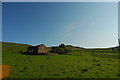
Chambered Tomb in Staffordshire
Site of alleged Neolithic Chambered Tomb, though likely a natural feature.
You may be viewing yesterday's version of this page. To see the most up to date information please register for a free account.
")
")
")
")
Do not use the above information on other web sites or publications without permission of the contributor.
Nearby Images from Geograph Britain and Ireland:
©2014(licence)
©2012(licence)
©2023(licence)
©2014(licence)
©2014(licence)
The above images may not be of the site on this page, they are loaded from Geograph.
Please Submit an Image of this site or go out and take one for us!
Click here to see more info for this site
Nearby sites
Key: Red: member's photo, Blue: 3rd party photo, Yellow: other image, Green: no photo - please go there and take one, Grey: site destroyed
Download sites to:
KML (Google Earth)
GPX (GPS waypoints)
CSV (Garmin/Navman)
CSV (Excel)
To unlock full downloads you need to sign up as a Contributory Member. Otherwise downloads are limited to 50 sites.
Turn off the page maps and other distractions
Nearby sites listing. In the following links * = Image available
2.0km WSW 252° Roaches Stone carving* Carving (SK00076637)
2.9km S 184° The Bald Stone* Natural Stone / Erratic / Other Natural Feature (SK018641)
3.2km ENE 65° Brand End standing stones* Standing Stones (SK0488868373)
3.4km N 11° Dane Head* Marker Stone (SK02657036)
3.6km WSW 247° Lud's Church* Natural Stone / Erratic / Other Natural Feature (SJ987656)
3.6km SSW 211° The Roaches Barrow Round Barrow(s) (SK001639)
3.9km SSW 209° Sainter's Dolmen* Rock Outcrop (SK00106357)
4.1km ENE 77° Hollins Hill* Cairn (SK060679)
4.2km NE 56° The Frith* Round Barrow(s) (SK055694)
4.3km ENE 71° Stoup High Edge* Cairn (SK061684)
4.3km E 99° Coatestown Barrow Round Barrow(s) (SK063663)
4.5km NE 36° Anthony Hill bowl barrow* Round Barrow(s) (SK04657066)
4.6km S 180° The Winking Man* Natural Stone / Erratic / Other Natural Feature (SK0202162362)
5.1km W 264° Allgreave* Standing Stone (Menhir) (SJ969665)
5.2km SSW 193° Bawd Stone* Natural Stone / Erratic / Other Natural Feature (SK0079561976)
5.2km SSW 193° Sainter's Circle* Stone Circle (SK008619)
5.4km SSW 195° The Roaches* Natural Stone / Erratic / Other Natural Feature (SK006618)
5.6km E 85° Etches cave* Cave or Rock Shelter (SK076675)
5.6km E 84° Dowel Cave* Cave or Rock Shelter (SK076676)
5.8km WSW 256° Bartomley Farm* Long Barrow (SJ964656)
5.8km NE 36° Grin Low* Cairn (SK05397173)
5.8km ENE 76° Upper Edge* Cairn (SK07656845)
6.1km NW 316° Macclesfield Forest Ancient Cross (SJ97767136)
6.1km E 87° Hatch-a-way* Cairn (SK081673)
6.3km NNE 29° Poole’s Cavern* Cave or Rock Shelter (SK050725)
View more nearby sites and additional images


 We would like to know more about this location. Please feel free to add a brief description and any relevant information in your own language.
 Wir möchten mehr über diese Stätte erfahren. Bitte zögern Sie nicht, eine kurze Beschreibung und relevante Informationen in Deutsch hinzuzufügen.
 Nous aimerions en savoir encore un peu sur les lieux. S'il vous plaît n'hesitez pas à ajouter une courte description et tous les renseignements pertinents dans votre propre langue.
 Quisieramos informarnos un poco más de las lugares. No dude en añadir una breve descripción y otros datos relevantes en su propio idioma.