<< Our Photo Pages >> Crawley Edge - Barrow Cemetery in England in County Durham
Submitted by Triumphrider on Wednesday, 06 November 2019 Page Views: 1585
Neolithic and Bronze AgeSite Name: Crawley EdgeCountry: England
NOTE: This site is 4.238 km away from the location you searched for.
County: County Durham Type: Barrow Cemetery
Nearest Town: Stanhope
Map Ref: NZ0007139875
Latitude: 54.753823N Longitude: 2.000419W
Condition:
| 5 | Perfect |
| 4 | Almost Perfect |
| 3 | Reasonable but with some damage |
| 2 | Ruined but still recognisable as an ancient site |
| 1 | Pretty much destroyed, possibly visible as crop marks |
| 0 | No data. |
| -1 | Completely destroyed |
| 5 | Superb |
| 4 | Good |
| 3 | Ordinary |
| 2 | Not Good |
| 1 | Awful |
| 0 | No data. |
| 5 | Can be driven to, probably with disabled access |
| 4 | Short walk on a footpath |
| 3 | Requiring a bit more of a walk |
| 2 | A long walk |
| 1 | In the middle of nowhere, a nightmare to find |
| 0 | No data. |
| 5 | co-ordinates taken by GPS or official recorded co-ordinates |
| 4 | co-ordinates scaled from a detailed map |
| 3 | co-ordinates scaled from a bad map |
| 2 | co-ordinates of the nearest village |
| 1 | co-ordinates of the nearest town |
| 0 | no data |
Internal Links:
External Links:
")
At Crawley Edge to the immediate North above Stanhope in Weardale lies a large Cairnfield of Bronze Age date. Cairnfields are concentrations of cairns sited in close proximity to one another. They often consist largely of clearance cairns, built with stone cleared from the surrounding land to improve its use for agriculture, and on occasion their distribution pattern can be seen to define field plots. Funerary cairns are also frequently incorporated, although without excavation it may be impossible to determine which cairns contain burials.
Clearance cairns were constructed from the Neolithic period (from c.3400 BC), although the majority of examples appear to be the result of field clearance which began during the earlier Bronze Age and continued into the later Bronze Age (2000-700 BC).
Cairnfields are uncommon in County Durham and this one is a good example of its type with significant archaeological deposits remaining. At least forty-one earth and stone cairns have been recognised. A stone curb surrounds many, which suggest that they are burial mounds dating to the period 2600BC to 700BC
This is a Scheduled Ancient Monument protected by law: see Historic England List ID 1016816 (Cairnfield on Crawley Edge, 500m north west of Hill Crest) and Pastscape Monument No. 20163.
In the southern part of the Cairnfield, the cairns lie in four distinct small groupings around an area in which there are no visible cairns and which is also relatively stone free.
The cairns which lie in the northern part of the cairnfield display a more dispersed pattern.
Most of the cairns are oval or oblong in shape and many have traces of a surrounding kerb. They range in size from 1.8m to 8.5m in diameter, the majority being between 3m and 7m across, and vary in height from 0.2m to 1m.
Two of the cairns situated in one of the groups in the southern part of the cairnfield were excavated in 1976 and 1977. The first and largest cairn contained a large Bronze Age pot, which had been placed within a pit dug into the subsoil beneath the cairn material. The pot was of a type known as a collared urn, and contained the remains of cremated bone. Three jet beads, several fragments of bone and charcoal were also recovered from the excavation. Dates were obtained by radio-carbon dating which indicate that the main period of activity occurred in the Early Bronze Age.
On excavation, the structure of the second cairn was revealed, suggesting that this cairn, of a similar date to the first, was formed by field clearance.
Reference number: D1382
National Heritage List for England Entry Number: 1016816
Reference Sources
Young, R 1984 PhD thesis: Aspects of the Prehistoric Archaeology of the Wear Valley, Co. Durham
Clack, P 1980 The Archaeology of the Durham Dales, Prehistoric List Site 11 - Durham Archaeology Committee,
CBA North Newsbulletin No15 Jan-77 - Council for British Archaeology
You may be viewing yesterday's version of this page. To see the most up to date information please register for a free account.
")
")
")
Do not use the above information on other web sites or publications without permission of the contributor.
Nearby Images from Geograph Britain and Ireland:
©2014(licence)
©2014(licence)
©2020(licence)
©2022(licence)

©2018(licence)
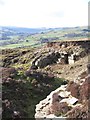
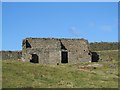
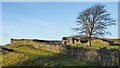
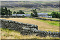
The above images may not be of the site on this page, they are loaded from Geograph.
Please Submit an Image of this site or go out and take one for us!
Click here to see more info for this site
Nearby sites
Key: Red: member's photo, Blue: 3rd party photo, Yellow: other image, Green: no photo - please go there and take one, Grey: site destroyed
Download sites to:
KML (Google Earth)
GPX (GPS waypoints)
CSV (Garmin/Navman)
CSV (Excel)
To unlock full downloads you need to sign up as a Contributory Member. Otherwise downloads are limited to 50 sites.
Turn off the page maps and other distractions
Nearby sites listing. In the following links * = Image available
1.8km NW 315° Heathery Burn Cave* Cave or Rock Shelter (NY98764118)
3.9km N 357° Feldon Plain (Muggleswick)* Marker Stone (NY9988843816)
4.9km N 4° Edmundbyers Cross (Muggleswick)* Ancient Cross (NZ0040244761)
5.7km E 85° Tunstall Reservoir Rock Art (NZ0573040360)
6.0km NNW 332° Dead Friar's Stone (Stanhope)* Marker Stone (NY9721545194)
7.8km ESE 105° Holy Well (Wolsingham)* Holy Well or Sacred Spring (NZ0766637882)
8.5km NNW 335° Old Man's Grave (Edmunbyers)* Marker Stone (NY96464763)
8.7km NW 314° Hunstanworth Moor south* Standing Stone (Menhir) (NY9377745971)
9.0km NW 317° Hunstanworth Moor north* Standing Stone (Menhir) (NY9398546500)
11.1km NNW 342° St Mary the Virgin (Blanchland)* Ancient Cross (NY9659850408)
11.4km SW 225° Carr Crags 18 Rock Art (NY9192231825)
11.5km SW 225° Carr Crags 16 Rock Art (NY9187831833)
11.5km SW 225° Carr Crags 7 Rock Art (NY9191431763)
11.5km SW 225° Carr Crags 5 Rock Art (NY9191331759)
11.5km SW 225° Carr Crags 6 Rock Art (NY9191231759)
11.5km SW 225° Carr Crags 4 Rock Art (NY9192231747)
11.5km SW 225° Carr Crags 3 Rock Art (NY9192731742)
11.5km SW 225° Carr Crags 4a Rock Art (NY9192931735)
11.5km SW 225° Carr Crags 8 Rock Art (NY9190631754)
11.5km SW 225° Carr Crags 1, 12 & 13 Rock Art (NY9192131736)
11.5km SW 225° Carr Crags 2, 9 & 10 Rock Art (NY9191931733)
11.5km SW 225° Carr Crags 15 Rock Art (NY9190831726)
11.5km SW 225° Carr Crags 14 Rock Art (NY9189831730)
11.5km SW 225° Carr Crags 17 Rock Art (NY9183731785)
11.5km SW 225° Carr Crags 11 Rock Art (NY9190731708)
View more nearby sites and additional images


 We would like to know more about this location. Please feel free to add a brief description and any relevant information in your own language.
 Wir möchten mehr über diese Stätte erfahren. Bitte zögern Sie nicht, eine kurze Beschreibung und relevante Informationen in Deutsch hinzuzufügen.
 Nous aimerions en savoir encore un peu sur les lieux. S'il vous plaît n'hesitez pas à ajouter une courte description et tous les renseignements pertinents dans votre propre langue.
 Quisieramos informarnos un poco más de las lugares. No dude en añadir una breve descripción y otros datos relevantes en su propio idioma.