<< Text Pages >> Robin Hood's Penny Stone (Wainstalls) - Standing Stone (Menhir) in England in Yorkshire (West)
Submitted by coldrum on Monday, 05 December 2011 Page Views: 3601
Neolithic and Bronze AgeSite Name: Robin Hood's Penny Stone (Wainstalls)Country: England
NOTE: This site is 1.49 km away from the location you searched for.
County: Yorkshire (West) Type: Standing Stone (Menhir)
Nearest Town: Wainstalls
Map Ref: SE04632870
Latitude: 53.754644N Longitude: 1.93126W
Condition:
| 5 | Perfect |
| 4 | Almost Perfect |
| 3 | Reasonable but with some damage |
| 2 | Ruined but still recognisable as an ancient site |
| 1 | Pretty much destroyed, possibly visible as crop marks |
| 0 | No data. |
| -1 | Completely destroyed |
| 5 | Superb |
| 4 | Good |
| 3 | Ordinary |
| 2 | Not Good |
| 1 | Awful |
| 0 | No data. |
| 5 | Can be driven to, probably with disabled access |
| 4 | Short walk on a footpath |
| 3 | Requiring a bit more of a walk |
| 2 | A long walk |
| 1 | In the middle of nowhere, a nightmare to find |
| 0 | No data. |
| 5 | co-ordinates taken by GPS or official recorded co-ordinates |
| 4 | co-ordinates scaled from a detailed map |
| 3 | co-ordinates scaled from a bad map |
| 2 | co-ordinates of the nearest village |
| 1 | co-ordinates of the nearest town |
| 0 | no data |
Internal Links:
External Links:
Standing Stone (Menhir) in Yorkshire (West)
"Robin Hood's Penny Stone, said to have been surrounded by a stone circle, was broken up for building purposes. It was situated by the road to Luddenden. Today, no vestige of stone or circle survives.
Listed by Barnatt, in his gazetteer of stone circles, as a site about which too little is known to be certain whether a genuine stone circle existed. " For more information read: Pastscape Monument 47704.
The Northern Antiquarian (TNA) also features a page for this now destroyed stone circle - see their entry for Robin Hood’s Penny Stone, Wainstalls, West Yorkshire, which features a drawing from 1775, an image of the 1852 showing the location of the stone circle, a brief description and local folklore.
TNA adds: "All remains of this site, first mentioned as a stone circle in 1836, have gone. The place could be found by the appropriately named Stone Farm at the top end of Wainstalls and was first mentioned by John Watson (1775), who strangely said nothing about any circle here. However, this changed when John Crabtree (1836) arrived and described a ring of stones surrounding a large boulder in the centre (illustrated here). The boulder itself was actually called the Robin Hood Penny Stone."
Note: Have you visited this site where this stone circle was located? Do you have any photographs, historical information, images or drawings to contribute?
You may be viewing yesterday's version of this page. To see the most up to date information please register for a free account.
Do not use the above information on other web sites or publications without permission of the contributor.
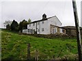
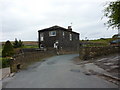
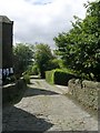
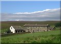
Nearby Images from Geograph Britain and Ireland:
©2009(licence)

©2007(licence)
©2010(licence)
©2010(licence)
©2010(licence)
The above images may not be of the site on this page, they are loaded from Geograph.
Please Submit an Image of this site or go out and take one for us!
Click here to see more info for this site
Nearby sites
Key: Red: member's photo, Blue: 3rd party photo, Yellow: other image, Green: no photo - please go there and take one, Grey: site destroyed
Download sites to:
KML (Google Earth)
GPX (GPS waypoints)
CSV (Garmin/Navman)
CSV (Excel)
To unlock full downloads you need to sign up as a Contributory Member. Otherwise downloads are limited to 50 sites.
Turn off the page maps and other distractions
Nearby sites listing. In the following links * = Image available
608m WSW 240° The White Stones Natural Stone / Erratic / Other Natural Feature (SE041284)
1.2km WNW 303° Sleepy Lowe Cairn (SE03612936)
1.5km NE 37° The Carrs (Ovenden) Ancient Village or Settlement (SE0554729937)
1.9km SSE 163° Tower Hill Enclosure Misc. Earthwork (SE05192689)
1.9km NW 321° Rocking Stone (Warley Moor) Natural Stone / Erratic / Other Natural Feature (SE0339930199)
2.3km SW 231° Midgley Moor Ring Cairn (SE0284227259)
2.4km ENE 65° Mount Zion (Illingworth) Cist (SE068297)
2.6km SW 232° Crow Hill Cairn Circle* Stone Circle (SE026271)
2.7km W 263° Miller's Grave* Cairn (SE0191328369)
2.8km SSE 163° Tower Hill (Warley) Cairn (SE05472604)
2.8km SW 235° Foster Clough* Misc. Earthwork (SE02352708)
2.8km WSW 249° Churn Milk Joan (Midgley Moor)* Standing Stone (Menhir) (SE0197327691)
2.9km NW 317° Dean Head Stony Edge* Rock Art (SE0267730808)
3.0km W 266° Greenwood Stone (Midgley Moor)* Marker Stone (SE0165228514)
3.0km NNE 23° The Boggarts Grave Holy Well or Sacred Spring (SE058315)
3.1km NNE 24° The Giants Tooth Modern Stone Circle etc (SE059315)
3.2km NNE 16° The Nab Round Cairn (SE0549831755)
3.4km WNW 293° Shore End Top Standing Stone (Menhir) (SE01533002)
3.5km WSW 248° Wicken Hill* Misc. Earthwork (SE0133527390)
3.8km SSE 157° Warley Edge (Halifax)* Rock Art (SE061252)
3.9km WSW 252° Mount Skip (Hebden Bridge) Cairn (SE00952748)
4.1km WNW 295° High Brown Knoll* Rock Art (SE0089930463)
4.6km WNW 302° White Hill (Yorkshire West) Rock Art (SE0077031129)
4.8km SSW 207° Sowerby Lad (Mytholmroyd) Standing Stone (Menhir) (SE02442443)
4.9km WNW 300° Clattering Edge* Rock Art (SE0036731145)
View more nearby sites and additional images


 We would like to know more about this location. Please feel free to add a brief description and any relevant information in your own language.
 Wir möchten mehr über diese Stätte erfahren. Bitte zögern Sie nicht, eine kurze Beschreibung und relevante Informationen in Deutsch hinzuzufügen.
 Nous aimerions en savoir encore un peu sur les lieux. S'il vous plaît n'hesitez pas à ajouter une courte description et tous les renseignements pertinents dans votre propre langue.
 Quisieramos informarnos un poco más de las lugares. No dude en añadir una breve descripción y otros datos relevantes en su propio idioma.