<< Our Photo Pages >> Hiscocks Hill barrow - Round Barrow(s) in England in Hampshire
Submitted by TheCaptain on Tuesday, 08 February 2022 Page Views: 354
Neolithic and Bronze AgeSite Name: Hiscocks Hill barrowCountry: England
NOTE: This site is 0.853 km away from the location you searched for.
County: Hampshire Type: Round Barrow(s)
Nearest Village: Fritham
Map Ref: SU22481371
Latitude: 50.922414N Longitude: 1.681547W
Condition:
| 5 | Perfect |
| 4 | Almost Perfect |
| 3 | Reasonable but with some damage |
| 2 | Ruined but still recognisable as an ancient site |
| 1 | Pretty much destroyed, possibly visible as crop marks |
| 0 | No data. |
| -1 | Completely destroyed |
| 5 | Superb |
| 4 | Good |
| 3 | Ordinary |
| 2 | Not Good |
| 1 | Awful |
| 0 | No data. |
| 5 | Can be driven to, probably with disabled access |
| 4 | Short walk on a footpath |
| 3 | Requiring a bit more of a walk |
| 2 | A long walk |
| 1 | In the middle of nowhere, a nightmare to find |
| 0 | No data. |
| 5 | co-ordinates taken by GPS or official recorded co-ordinates |
| 4 | co-ordinates scaled from a detailed map |
| 3 | co-ordinates scaled from a bad map |
| 2 | co-ordinates of the nearest village |
| 1 | co-ordinates of the nearest town |
| 0 | no data |
Internal Links:
External Links:
I have visited· I would like to visit
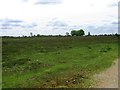
TheCaptain visited on 2nd Feb 2022 - their rating: Cond: 2 Amb: 3 Access: 3 Walk with friends in the New Forest over heathland through an old bombing range, hunting down a few tumuli. Before we got to the (closed) pub at Fritham, I took a small detour to hunt down what is marked as tumulus on my map.
")
See Historic England listing
You may be viewing yesterday's version of this page. To see the most up to date information please register for a free account.
")
")
Do not use the above information on other web sites or publications without permission of the contributor.
Nearby Images from Geograph Britain and Ireland:
©2022(licence)
©2008(licence)
©2014(licence)
©2008(licence)
©2014(licence)
The above images may not be of the site on this page, they are loaded from Geograph.
Please Submit an Image of this site or go out and take one for us!
Click here to see more info for this site
Nearby sites
Key: Red: member's photo, Blue: 3rd party photo, Yellow: other image, Green: no photo - please go there and take one, Grey: site destroyed
Download sites to:
KML (Google Earth)
GPX (GPS waypoints)
CSV (Garmin/Navman)
CSV (Excel)
To unlock full downloads you need to sign up as a Contributory Member. Otherwise downloads are limited to 50 sites.
Turn off the page maps and other distractions
Nearby sites listing. In the following links * = Image available
1.1km NNE 23° Irons Well (Eyeworth)* Holy Well or Sacred Spring (SU22931476)
1.9km E 88° Fritham Butt* Round Barrow(s) (SU244138)
1.9km WNW 288° Ashley Cross tumuli* Round Barrow(s) (SU20641431)
2.2km NNW 331° The Butts (Godshill)* Round Barrow(s) (SU21391565)
2.5km W 280° Ashley Walk mound* Artificial Mound (SU20041413)
3.1km NE 50° Black Bush Plain* Barrow Cemetery (SU248157)
4.4km NNW 345° Jacob's Barrow* Round Barrow(s) (SU21321793)
5.1km NNE 28° Hamptworth Common Tumulus* Round Barrow(s) (SU248182)
5.5km SSW 208° Castle Piece* Hillfort (SU199089)
5.5km ESE 107° Malwood Castle Hillfort (SU278121)
6.0km WNW 285° Frankenbury* Hillfort (SU167152)
6.1km NE 35° Landford Common Tumulus* Round Barrow(s) (SU260187)
6.1km WSW 240° Ibsley Common barrows* Barrow Cemetery (SU172106)
6.4km ENE 69° Stagbury Hill* Barrow Cemetery (SU285160)
6.5km WSW 249° Gorley Hill* Hillfort (SU164113)
6.9km WSW 238° South Gorley Bowl Barrow Round Barrow(s) (SU16640997)
7.2km NE 49° Plaitford Barrow* Round Barrow(s) (SU27901852)
8.0km SW 228° Moyles Court bowl barrow* Round Barrow(s) (SU16510833)
8.5km NNW 345° Templeman's Tumulus* Artificial Mound (SU202219)
9.2km S 187° Collins Grave Round Barrow(s) (SU21350461)
9.4km E 82° Money Hills Barrow Cemetery (SU31771505)
9.4km SE 127° New Forest Museum* Museum (SU30020813)
9.7km SSW 192° St Mary's Well (Hampshire)* Holy Well or Sacred Spring (SU2056304175)
10.1km SSW 195° Castle Hill (Hampshire)* Hillfort (SU199039)
10.5km E 86° Tatchbury Mount Hillfort (SU330144)
View more nearby sites and additional images


 We would like to know more about this location. Please feel free to add a brief description and any relevant information in your own language.
 Wir möchten mehr über diese Stätte erfahren. Bitte zögern Sie nicht, eine kurze Beschreibung und relevante Informationen in Deutsch hinzuzufügen.
 Nous aimerions en savoir encore un peu sur les lieux. S'il vous plaît n'hesitez pas à ajouter une courte description et tous les renseignements pertinents dans votre propre langue.
 Quisieramos informarnos un poco más de las lugares. No dude en añadir una breve descripción y otros datos relevantes en su propio idioma.