<< Our Photo Pages >> St Helen's Well (Kirkby Overblow) - Holy Well or Sacred Spring in England in Yorkshire (North)
Submitted by rogerkread on Wednesday, 10 February 2016 Page Views: 3384
Springs and Holy WellsSite Name: St Helen's Well (Kirkby Overblow)Country: England
NOTE: This site is 2.854 km away from the location you searched for.
County: Yorkshire (North) Type: Holy Well or Sacred Spring
Nearest Town: Harrogate Nearest Village: Kirkby Overblow
Map Ref: SE32354920
Latitude: 53.937912N Longitude: 1.508713W
Condition:
| 5 | Perfect |
| 4 | Almost Perfect |
| 3 | Reasonable but with some damage |
| 2 | Ruined but still recognisable as an ancient site |
| 1 | Pretty much destroyed, possibly visible as crop marks |
| 0 | No data. |
| -1 | Completely destroyed |
| 5 | Superb |
| 4 | Good |
| 3 | Ordinary |
| 2 | Not Good |
| 1 | Awful |
| 0 | No data. |
| 5 | Can be driven to, probably with disabled access |
| 4 | Short walk on a footpath |
| 3 | Requiring a bit more of a walk |
| 2 | A long walk |
| 1 | In the middle of nowhere, a nightmare to find |
| 0 | No data. |
| 5 | co-ordinates taken by GPS or official recorded co-ordinates |
| 4 | co-ordinates scaled from a detailed map |
| 3 | co-ordinates scaled from a bad map |
| 2 | co-ordinates of the nearest village |
| 1 | co-ordinates of the nearest town |
| 0 | no data |
Internal Links:
External Links:
 (PID:144997)")
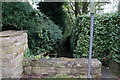
The well is near the church in the corner of a recess a few yards back from the road (the one leading towards Dunkeswick, on the North side) and next to St Helen's cottage. Two steps lead down into an outer chamber and well house containing an inner stone trough full of clear water. The well is kept reasonably clear by the owner of the cottage, although it is actually on council land.
You may be viewing yesterday's version of this page. To see the most up to date information please register for a free account.
 (PID:144999)")
 (PID:144998)")
 (PID:144996)")
Do not use the above information on other web sites or publications without permission of the contributor.
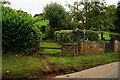
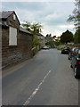
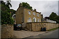
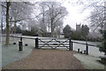
Nearby Images from Geograph Britain and Ireland:
©2014(licence)
©2010(licence)
©2014(licence)
©2012(licence)
©2014(licence)
The above images may not be of the site on this page, they are loaded from Geograph.
Please Submit an Image of this site or go out and take one for us!
Click here to see more info for this site
Nearby sites
Key: Red: member's photo, Blue: 3rd party photo, Yellow: other image, Green: no photo - please go there and take one, Grey: site destroyed
Download sites to:
KML (Google Earth)
GPX (GPS waypoints)
CSV (Garmin/Navman)
CSV (Excel)
To unlock full downloads you need to sign up as a Contributory Member. Otherwise downloads are limited to 50 sites.
Turn off the page maps and other distractions
Nearby sites listing. In the following links * = Image available
3.9km NNE 29° Follifoot cross* Ancient Cross (SE342526)
4.8km N 2° Great Yorkshire Showground (Harrogate) Rock Art (SE3245353990)
5.5km W 268° Almscliffe Crags* Natural Stone / Erratic / Other Natural Feature (SE26814900)
6.2km S 189° Grey Stone (Harewood)* Rock Art (SE31474308)
6.8km ENE 73° Green Howe (North Deighton) Round Barrow(s) (SE38865124)
7.3km ESE 115° Collingham Crosses* Ancient Cross (SE3901546096)
7.4km SE 146° All Hallows (Bardsey)* Ancient Cross (SE3656143122)
7.8km NNE 29° St Robert's Cave* Cave or Rock Shelter (SE3610556089)
8.1km NNE 16° Mother Shipton's Cave and Petrifying Well * Holy Well or Sacred Spring (SE345570)
8.3km NNE 29° St Robert's Holy Well (Knaresborough) Holy Well or Sacred Spring (SE36315649)
9.6km WNW 289° Little Almscliff* Rock Outcrop (SE232523)
10.3km SSW 209° Adel Cupstone* Rock Art (SE274402)
10.8km SW 223° Long Stone (Adel) Standing Stone (Menhir) (SE25014119)
11.7km SSE 163° Grim's Dyke* Misc. Earthwork (SE358380)
12.0km NNW 341° Weeping Cross* Ancient Cross (SE283605)
12.0km WNW 296° Bank Slack* Misc. Earthwork (SE215545)
12.2km N 349° Yarmer Head (Nidd) Standing Stone (Menhir) (SE299612)
12.4km W 271° Farnley/Clifton boundary stone Marker Stone (SE19924933)
12.6km S 179° Gipton Wood Ancient Village or Settlement (SE32653664)
12.6km WSW 247° Knotties Stone (Otley Chevin)* Rock Art (SE2077144182)
12.8km WSW 253° All Saints (Otley)* Ancient Cross (SE20154536)
12.8km WSW 253° Otley Cup and Ring Rock Art (SE20084531)
12.9km WNW 298° Long Stoop* Standing Stones (SE209552)
13.0km WSW 244° Bull Stone (Guiseley) Standing Stone (Menhir) (SE2067043481)
13.0km WSW 244° Bull Stone* Standing Stone (Menhir) (SE206435)
View more nearby sites and additional images


 We would like to know more about this location. Please feel free to add a brief description and any relevant information in your own language.
 Wir möchten mehr über diese Stätte erfahren. Bitte zögern Sie nicht, eine kurze Beschreibung und relevante Informationen in Deutsch hinzuzufügen.
 Nous aimerions en savoir encore un peu sur les lieux. S'il vous plaît n'hesitez pas à ajouter une courte description et tous les renseignements pertinents dans votre propre langue.
 Quisieramos informarnos un poco más de las lugares. No dude en añadir una breve descripción y otros datos relevantes en su propio idioma.