<< Our Photo Pages >> Fawler Modern Stone Circle - Modern Stone Circle etc in England in Oxfordshire
Submitted by hoya105 on Thursday, 30 August 2018 Page Views: 4036
Modern SitesSite Name: Fawler Modern Stone CircleCountry: England County: Oxfordshire Type: Modern Stone Circle etc
Nearest Town: Wantage Nearest Village: Kingston Lisle
Map Ref: SU323880
Latitude: 51.589932N Longitude: 1.535157W
Condition:
| 5 | Perfect |
| 4 | Almost Perfect |
| 3 | Reasonable but with some damage |
| 2 | Ruined but still recognisable as an ancient site |
| 1 | Pretty much destroyed, possibly visible as crop marks |
| 0 | No data. |
| -1 | Completely destroyed |
| 5 | Superb |
| 4 | Good |
| 3 | Ordinary |
| 2 | Not Good |
| 1 | Awful |
| 0 | No data. |
| 5 | Can be driven to, probably with disabled access |
| 4 | Short walk on a footpath |
| 3 | Requiring a bit more of a walk |
| 2 | A long walk |
| 1 | In the middle of nowhere, a nightmare to find |
| 0 | No data. |
| 5 | co-ordinates taken by GPS or official recorded co-ordinates |
| 4 | co-ordinates scaled from a detailed map |
| 3 | co-ordinates scaled from a bad map |
| 2 | co-ordinates of the nearest village |
| 1 | co-ordinates of the nearest town |
| 0 | no data |
Internal Links:
External Links:
")
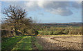
Between the hamlet of Fawler, to the right of the Manor, and Kingston Lisle village - a stone circle of 7 visible stones. Access via a stile at edge of lane, visible from lane. Installed, we are told in 2017/18 as a focal point for Fawler Manor gardens.
You may be viewing yesterday's version of this page. To see the most up to date information please register for a free account.
Do not use the above information on other web sites or publications without permission of the contributor.
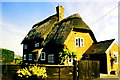
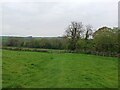
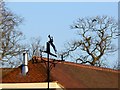
Nearby Images from Geograph Britain and Ireland:
©2019(licence)
©2019(licence)
©2023(licence)

©2008(licence)
©2008(licence)
The above images may not be of the site on this page, they are loaded from Geograph.
Please Submit an Image of this site or go out and take one for us!
Click here to see more info for this site
Nearby sites
Key: Red: member's photo, Blue: 3rd party photo, Yellow: other image, Green: no photo - please go there and take one, Grey: site destroyed
Download sites to:
KML (Google Earth)
GPX (GPS waypoints)
CSV (Garmin/Navman)
CSV (Excel)
To unlock full downloads you need to sign up as a Contributory Member. Otherwise downloads are limited to 50 sites.
Turn off the page maps and other distractions
Nearby sites listing. In the following links * = Image available
905m S 174° The Blowing Stone* Holed Stone (SU324871)
1.9km SSW 208° Rams Hill* Causewayed Enclosure (SU314863)
2.5km WSW 243° Dragon Hill* Natural Stone / Erratic / Other Natural Feature (SU30078687)
2.6km WSW 238° Uffington White Horse* Hill Figure or Geoglyph (SU30128662)
2.7km WSW 238° Uffington Castle Neolithic long barrow* Long Barrow (SU30008652)
2.9km WSW 237° Uffington Castle* Hillfort (SU299864)
3.5km SE 144° Sincombe Farm Bowl Barrow* Round Barrow(s) (SU34368521)
3.8km WSW 250° Hardwell Camp* Hillfort (SU2876686671)
3.8km SSW 214° Idlebush Barrow* Ancient Village or Settlement (SU302848)
4.6km S 180° Lambourn Long Barrow* Long Barrow (SU32328338)
4.8km WSW 238° Odstone Barrow Round Barrow(s) (SU28248545)
4.9km WSW 239° Wayland's Smithy* Long Barrow (SU28098539)
5.2km S 174° Lambourn Seven Barrows* Barrow Cemetery (SU32898288)
5.5km SSW 205° Knighton Bushes* Ancient Village or Settlement (SU300830)
5.9km NW 325° Lower Coxwell Camp* Hillfort (SU289928)
6.1km SW 236° Ashbury Folly Barrows Round Barrow(s) (SU27238454)
6.3km SW 228° Hailey Wood Barrows Round Barrow(s) (SU27638378)
6.8km S 183° Hangman's Stone - Upper Lambourn* Standing Stone (Menhir) (SU320812)
7.1km SSW 202° Park Farm Barrow Round Barrow(s) (SU29638143)
7.1km ESE 120° Segsbury Camp* Hillfort (SU385845)
7.4km SW 219° Alfred's Castle* Hillfort (SU27738223)
7.6km E 92° King Alfred's Well* Holy Well or Sacred Spring (SU399878)
7.6km SW 232° Idstone Hill Barrow Round Barrow(s) (SU26348327)
7.7km S 188° St Luke's Church Barrow Round Barrow(s) (SU31228042)
7.9km SW 215° Ashdown Barrow Round Barrow(s) (SU27748153)
View more nearby sites and additional images


 We would like to know more about this location. Please feel free to add a brief description and any relevant information in your own language.
 Wir möchten mehr über diese Stätte erfahren. Bitte zögern Sie nicht, eine kurze Beschreibung und relevante Informationen in Deutsch hinzuzufügen.
 Nous aimerions en savoir encore un peu sur les lieux. S'il vous plaît n'hesitez pas à ajouter une courte description et tous les renseignements pertinents dans votre propre langue.
 Quisieramos informarnos un poco más de las lugares. No dude en añadir una breve descripción y otros datos relevantes en su propio idioma.