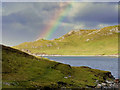
<< Our Photo Pages >> Islesburgh - Chambered Cairn in Scotland in Shetland
Submitted by Andy B on Wednesday, 13 July 2011 Page Views: 7417
Neolithic and Bronze AgeSite Name: IslesburghCountry: Scotland
NOTE: This site is 3.819 km away from the location you searched for.
County: Shetland Type: Chambered Cairn
Nearest Village: Mavis Grind
Map Ref: HU33456845
Latitude: 60.398576N Longitude: 1.394815W
Condition:
| 5 | Perfect |
| 4 | Almost Perfect |
| 3 | Reasonable but with some damage |
| 2 | Ruined but still recognisable as an ancient site |
| 1 | Pretty much destroyed, possibly visible as crop marks |
| 0 | No data. |
| -1 | Completely destroyed |
| 5 | Superb |
| 4 | Good |
| 3 | Ordinary |
| 2 | Not Good |
| 1 | Awful |
| 0 | No data. |
| 5 | Can be driven to, probably with disabled access |
| 4 | Short walk on a footpath |
| 3 | Requiring a bit more of a walk |
| 2 | A long walk |
| 1 | In the middle of nowhere, a nightmare to find |
| 0 | No data. |
| 5 | co-ordinates taken by GPS or official recorded co-ordinates |
| 4 | co-ordinates scaled from a detailed map |
| 3 | co-ordinates scaled from a bad map |
| 2 | co-ordinates of the nearest village |
| 1 | co-ordinates of the nearest town |
| 0 | no data |
Internal Links:
External Links:
I have visited· I would like to visit
Andy B has visited here
")
The location also probably had symbolic significance for journeys of a different kind between the realms of the living and the dead and it is these that the walk will be exploring.
Parking on the A970 roadside at Mavis Grind
More details at Simon Clarke's pages
Note: Guided Walk to Islesburgh Neolithic Tomb and Enclosures, Sat 16 July
You may be viewing yesterday's version of this page. To see the most up to date information please register for a free account.
")
")
")
")
Do not use the above information on other web sites or publications without permission of the contributor.
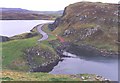
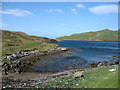
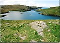
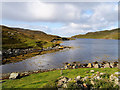
Nearby Images from Geograph Britain and Ireland:
©2005(licence)
©2016(licence)
©2006(licence)
©2018(licence)
©2018(licence)
The above images may not be of the site on this page, they are loaded from Geograph.
Please Submit an Image of this site or go out and take one for us!
Click here to see more info for this site
Nearby sites
Key: Red: member's photo, Blue: 3rd party photo, Yellow: other image, Green: no photo - please go there and take one, Grey: site destroyed
Download sites to:
KML (Google Earth)
GPX (GPS waypoints)
CSV (Garmin/Navman)
CSV (Excel)
To unlock full downloads you need to sign up as a Contributory Member. Otherwise downloads are limited to 50 sites.
Turn off the page maps and other distractions
Nearby sites listing. In the following links * = Image available
1.8km SE 127° Busta Brae* Standing Stones (HU34886739)
3.0km NNW 341° Pund's Water* Chambered Cairn (HU32457124)
8.5km SSW 208° Vementry* Chambered Cairn (HU296609)
10.6km NNW 336° Gateside Chambered Cairn* Chambered Cairn (HU29137811)
10.7km SSE 168° East Burra Firth Broch* Broch or Nuraghe (HU358580)
11.1km NE 51° Crooksetter Hill - two Chambered Cairns* Chambered Cairn (HU420756)
11.1km SSE 165° East Burra Firth Chambered Cairn* Chambered Cairn (HU364577)
11.3km NNW 332° Burnside Burnt Mound* Artificial Mound (HU28057842)
12.3km SSW 205° Brindister Voe Broch* Broch or Nuraghe (HU284572)
12.7km S 185° Gravlaba* Standing Stones (HU325558)
13.0km ESE 106° Lunnasting Standing Stone* Standing Stone (Menhir) (HU4665)
13.6km SW 214° Giant's Stone (West Burrafirth)* Standing Stone (Menhir) (HU2583157157)
13.7km SW 215° West Burrafirth broch* Broch or Nuraghe (HU256572)
15.1km E 88° Chapel Knowe Broch or Nuraghe (HU48556910)
15.1km NW 323° Giant's Stones Row (Shetland)* Multiple Stone Rows / Avenue (HU243805)
15.1km NW 324° Giant's Stones (Shetland)* Standing Stones (HU2431280555)
15.3km NW 309° Loch of Breckon Burnt Mound* Artificial Mound (HU21437803)
15.5km NW 322° Hamnavoe Broch* Broch or Nuraghe (HU2389380641)
15.6km SW 230° Ness of Garth* Promontory Fort / Cliff Castle (HU216583)
15.6km SW 226° Broch of Brousta Broch or Nuraghe (HU223575)
15.6km SW 230° Bay of Garth Broch or Nuraghe (HU216582)
15.6km NW 308° Sae Breck* Broch or Nuraghe (HU21057803)
16.0km SW 227° Rinns of Shurdimires* Stone Row / Alignment (HU2171057489)
16.1km NW 312° Loch of Houlland* Broch or Nuraghe (HU2140079160)
17.2km N 10° Beorgs of Housetter* Standing Stones (HU36178546)
View more nearby sites and additional images


 We would like to know more about this location. Please feel free to add a brief description and any relevant information in your own language.
 Wir möchten mehr über diese Stätte erfahren. Bitte zögern Sie nicht, eine kurze Beschreibung und relevante Informationen in Deutsch hinzuzufügen.
 Nous aimerions en savoir encore un peu sur les lieux. S'il vous plaît n'hesitez pas à ajouter une courte description et tous les renseignements pertinents dans votre propre langue.
 Quisieramos informarnos un poco más de las lugares. No dude en añadir una breve descripción y otros datos relevantes en su propio idioma.